U.S. Forest Service · Wilderness Area · Montana
Selway-Bitterroot Wilderness
1 federal campground, 1 of them with first-come, first-served sites, and 1 free to camp.
1Campgrounds
1With first-come sites
1Free to camp
8,060 ftElevation
Where they are
1 of 1 mappedDrawing the map
© OpenFreeMap · OpenStreetMap · Esri hillshadeSource: RIDB · NPS · USFS EDW · BLM, unified by CAMPANAC · Sep 8, 2026
The campgrounds · 1
1 campground
Source: RIDB · NPS · USFS EDW · BLM, unified by CAMPANAC · Sep 8, 2026
This land
measured from the nearest campground in the unitdeveloping
Camping here is a stake in what happens to it. More Than Just Parks tracks the threats and the comment windows.
Source: MTJP Threatened Lands map · Aug 12, 2026
Heads up
Wildfire
Cooper fire · 5.0 mi from the nearest campground here · 310 acres · 0% contained
Wildfire
Scimitar fire · 13 mi from the nearest campground here · 334 acres · 0% contained
Wildfire
North Fork Lost Horse fire · 22 mi from the nearest campground here · 118 acres · 70% contained
Wildfire
Nature Grove fire · 33 mi from the nearest campground here · 1,422 acres · 0% contained
Wildfire
Black Bear fire · 35 mi from the nearest campground here · 2,126 acres · 30% contained
Wildfire
Wolf Creek fire · 36 mi from the nearest campground here · 2,643 acres · 25% contained
Source: NIFC/IRWIN via MTJP wildfire tracker · Sep 8, 2026
Who answers for this land
Selway-Bitterroot Wilderness’s campgrounds sit in one congressional district. These members vote on the laws that decide what happens to this land.
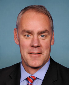
Ryan Zinke (R)
SRC · RIDB · NPS · USFS EDW · BLM · unified by CAMPANAC · refreshed nightly