AhDiNa Campground
- Right now
- Listed not openA database flag with no reason and no date
- A night
- $10From, per site
- Sites
- 41 on recreation.gov
The place
the agency’s own description · what’s there · 2 notices
In the agency’s own words
This location is available on a first-come, first-served basis only. Visitors are required to physically arrive at the campground to purchase and claim a site. Once on-site, you may be able to pay for your campsite(s) by scanning a QR code using the Recreation.gov mobile app, and the Scan and Pay feature. If this option is available, you will need to first download the free Recreation.gov mobile app https://www.recreation.gov/mobile-app prior to your arrival as some remote areas have limited or no cellular service. Keep reading
Recreation
Current Conditions Please stay safe while near the McCloud River.
Facilities
Description: Located on the Lower McCloud River at an elevation of 2300 feet, this remote campground has 16 sites with tables and fire rings, flush toilets, and drinking water. The dirt access road from Lake McCloud is very rough and rocky. Low clearance vehicles, trailers, and RVs are not advised. 14 day limit. $10 per night. No reservations. Generally open May 01- November 1st. According to local lore the site's name is derived from the first two initials of the first names of the three daughters of one of the previous owners. It is pronounced "Uhdeenuh". One word, soft 'A' hard 'E'.
Natural Features
Features: This campground is situated on an historic site used by Native American tribes and various land owners over the years, including the families of Whittier, Fitzhugh, and William Randolph Hearst. Visitors can explore and identify the remains of several buildings, foundations, rock walls, and an orchard that still produces fruit. The Lower McCloud River is a world renown native trout fishery which makes this camp a favorite for anglers. California Fish and Game regulations for this section of river allow only the use of artificial lures with barbless hooks. Contact Info This location is unstaffed. To speak with our main office for general information, please call: (530) 926-4511.
Nearby Attractions
AH-DI-NA (2,200' elevation) The PCT, running east from AH-DI-NA campground, parallels the McCloud River but remains well above it with only infrequent views of the river. The river has carved a steep, impressive canyon along this stretch of the trail. It is an enjoyable 2.5 mile hike to Ash Camp. Bald Mountain ridge is a 4.5 mile uphill climb to the west of AH-DI-NA Campground. The trail passes through an oak and Douglas fir forest and a variety of wildlife may be observed. Directions: Follow the road signs to AH-DI-NA Campground 16 miles south of the town of McCloud. The trail crosses the road 0.5 miles north of the campground. Ash Camp (2,400' elevation) AH-DI-NA Campground is a 2.5 mile hike to the west of Ash Camp. To the east, Grizzly Peak is a steady 10 mile uphill climb. This section passes through the Butcherknife Creek and Deer Creek drainages before it tops out along the Grizzly Peak ridge system at 6,000'.
What the agency tells you
Please stay safe while near the McCloud River. The river may have high level surges due to flow releases from the McCloud Reservoir Dam. The cold temperature of McCloud River could be concern for Hypothermia.
Road is very rough. Trailers and motorhomes are not advised. High clearance vehicles are recommended. Drive slow.
Tents and rigs
- Sites
- 4
- Hookups
- None
- Accessible sites
- None listed
Facilities
- Toilets
- Flush Toilets
- “…has 16 sites with tables and fire rings, flush toilets, and drinking water. The dirt access road from Lake…”
- Drinking water
- Yes
- “…and fire rings, flush toilets, and drinking water. The dirt access road from Lake McCloud is very…”
Around the campground
- On the water
- Lake, River, Creek
- Cultural Activities
- Fishing
- Hiking
- Historic site
- Hunting
Nothing on the booking system for the next 30 nightsread 15:39 UTC
recreation.gov lists 1 of the 4 campsites the agency files here. The rest aren’t on its booking system, so a reservation won’t get you one.
Every one of the next thirty nights is in recreation.gov’s record and not one site is being offered on any of them. That’s a campground closed or not yet released for booking, not a sold-out one.
Watch for a cancellation
Full? Watch it.
One email when a night opens, plus More Than Just Parks dispatches. Unsubscribe any time.
We read recreation.gov once an hour, at 40 minutes past, and write the first time a site in your window is free for the nights you asked for.
Scanners that check every few minutes exist, and most of them charge. This one is free, it reads the same calendar, and it won’t always be first.
Tell me when the season opens
Watch for the season to open
One email when the season goes on sale, plus More Than Just Parks dispatches. Unsubscribe any time.
We check once an hour, at 40 minutes past, and write the first time the agency has that season on sale.
Scanners that check every few minutes exist, and most of them charge. This one is free, it reads the same calendar, and it won’t always be first.
We make nothing when you book. The link goes straight to the government.
Every line of the receipt · 12
What you actually pay
Derived by CAMPANAC: the agency’s published rate for this season, $10 a night, plus one $8 recreation.gov reservation fee for the booking. A weekend here means Friday and Saturday night, booked once. Optional charges (an extra vehicle, a second tent, a dump-station fee) are listed separately and aren’t in this total.
Who keeps the booking fee
The agency’s own policy text says the reservation fee and the cancellation processing fee are “retained by the reservation service contractor”, and that a campground concessionaire will decline to refund them because “they did not receive these fees”. Recreation.gov is run under contract by Booz Allen Hamilton. What share of your booking fee the contractor keeps isn’t published in any federal dataset we can read, so we print no number for it. Our reporting on the contract →
How we know this receipt · 5
recreation.gov availability, read 15:39 UTC · rules read Sep 9, 2026 · rates Sep 10, 2026 · How we know all this
The sites
4 sites
All 4 sites
The price is derived by CAMPANAC, not published per site: the per-night rate this campground publishes for each site’s own site type. 1 of the 4 sites listed carry one, and a site whose type has no published rate sits out of the price rather than being called free.
Getting there
the map and the coordinate · the agency’s directions · the phone number
Where it is
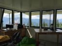 Girard Ridge LookoutShasta National Forest · 9.5 mi
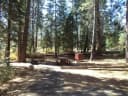 Fowlers CampgroundShasta National Forest · 10 miCamp 4 Group Campsite and Day Use AreaShasta National Forest · 10 mi
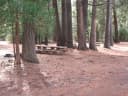 Camp 4 Group CampgroundShasta National Forest · 10 miMadrone CampgroundShasta National Forest · 13 mi
From the McCloud Ranger Station, turn right on SR 89. Go approximately 1/4 mile to the left turn lane. Turn left and go approximately 10 miles to Lake McCloud. Stay on the paved road the goes around the lake. In 3 miles there will be a sign for AH-DI-NA. Turn right onto the dirt road (distance of 4 miles) and drive uphill to the top and continue down the other side. AH-DI-NA is on the left. Road is very rough. Trailers and motorhomes are not advised.
The weather
the next four days · the thirty-year normal
Next four days, and the thirty-year normal
Forecast
NWS forecast for McCloud, CA
Typical weather
Typical October night 39°F, day 71°F.
Coldest month of the year: typical January night 30°F, below freezing. Bring a bag rated colder than that, and expect ice in the water bottle.
Daily high and lowDays with 0.10 in or more
A normal is the 1991-2020 average for the month, not a forecast: about half of all Julys are colder than the July line. The seven-day forecast above answers the other question.
The land, and who answers for it
what threatens it · who answers for it
What threatens this place
You’re camping on ground somebody wants. We track the threats and the comment deadlines.
Who answers for this land
AhDiNa Campground is in California’s 1st congressional district. Whoever holds it votes on the laws that decide what happens to this land. See how its representative votes on public lands →
Our roster still carries Doug LaMalfa for this district and the current federal record doesn’t list them as sitting, so we’re not naming a representative here until the two agree.