Bogan Flats Campground and Group
- Right now
- Closedrecreation.gov lists every site closed this weekend, read 15:55 UTC
- A night
- $32When it reopens, per site
- Sites
- 37In the agency’s record
The place
the agency’s own description · what’s there · 15 notices
In the agency’s own words
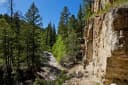
Bogan Flats Campground stretches along the Crystal River in a valley of aspen groves, towering Ponderosa Pine, spruce, and willow. The setting is ideal for larger groups seeking recreation and relaxation in White River National Forest. Sites in the campground are widely spaced and offer a nice mixture of open and shaded spots, with several sites at the river's edge. The group site is located away from the main campground, offering a more private location. Keep reading
Recreation
Crystal River, a tributary of Roaring Fork River, is renowned for its fly fishing. Rainbow, cutthroat and brown trout are plentiful in this waterway. A hike up Mt. Sopris offers spectacular panoramic views. This 12,953-foot mountain dominates the surrounding landscape. The hike is 14.8 miles with a 4,600-foot. elevation gain. In summer, wildflowers carpet the trail through aspen groves and mixed conifer forest, climbing up to talus slopes. Other popular activities in the area include jeep tours, biking, and historic sightseeing.
Facilities
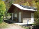
Bogan Flats Group site has one site available for reservation. There is no electric hook ups and no water is available at the group site. Group Site users must go to the main Bogan Flats Campground to fill containers. Group site facilities include: hardened parking for approximately 10 campers/RV's depending on the size. This gravel area must accommodate passenger vehicles as well. The site has 3 regular fire rings, and 1 group size fire ring. 1 pedestal grill, 5 food lockers, 8 picnic tables, a double vault toilet, and a horseshoe pit.
Natural Features
In the heart of the Rocky Mountains, the 2.3 million acre White River National Forest is a place of serenity and adventure, boasting 8 wilderness areas, 4 defined seasons, and 10 peaks surpassing 14,000 feet in elevation. The Crystal River flows near the campground and drains the Valley of the Coal Miners, a glacial valley that was once a center of coal mining in southwestern Colorado. Wildlife in the area abounds. Bighorn sheep navigate rocky ridges and bull elk bugle at dusk. Scenic rivers sustain populations of cutthroat, rainbow, and brown trout. Alpine regions provide habitat for pika and ptarmigan. These species, along with many others, depend on surrounding undeveloped wilderness, clean streams, and diverse forests to live.
Nearby Attractions
The quaint mountain town of Redstone is a hidden gem, located south of Carbondale. In addition to shops, galleries, and restaurants, the town boasts a castle that was built by industrialist John Osgood at the turn of the 20th century. Contact Info For facility specific information, please call (801) 226-3564.
Charges & Cancellations
Once your reservation start date has begun, neither the Recreation.gov Contact Center nor the campground manager will be able to modify your reservation.
What the agency tells you
Dogs must be always on leash within the two sites and anywhere in this area. Campers must occupy the site the first night at a campsite. This prevents booking the site for Fri-Sun and showing up on Saturday. Campers may leave the site for 24 hours and must occupy the site otherwise. This allows a camper to say go for an overnight backpack trip in the woods for one night and come back to their campsite the next day.
Gate entering the Group Site must ALWAYS remain closed. Tell all your guests and vendors- this is very important!
ALL garbage shall be removed from the site and deposited in the appropriate receptacle by check out time.
Everything else this campground posts · 12
Check in time is 2:00pm and Check out time is 11:00am. It is imperative that you are clear from the site at ELEVEN on your check out day so the host can come prepare the site for the next event. Please don't be that group that makes the incoming group have to wait! Customer Service Contact 801-226-3564 or Help.WhiteRiver.Sopris@AmericanLL.com
Off Highway Vehicle Use is NOT allowed at the group or other campground sites.
All food, beverage and trash must be always attended by an adult, this requires someone within 100 feet of the attractants. Otherwise, all attractants shall be stored in a locked vehicle or food lockers. Campers must adhere to the food storage rules as well and store all attractants in a locked vehicle unless attending the food, garbage, etc.
Tent camping is allowed on flat, gravel areas shown inside the designated area. Tents are allowed the small area along the river.
RV's and campers must be parked on the hardened gravel surface.
Tables must stay in the site, do not move them out of their designated area.
Fires are restricted to the metal fire rings or pedestal grill, no other opening burning is allowed.
Check with the Ranger District or American Land & Leisure prior to your event to investigate fire restrictions. In the event of fire restrictions, you may only be able to use propane cooking facilities.
There is no dump station onsite; closest facility is in Glenwood Springs.
VENDOR AND EVENT REQUIREMENTS Renters of these sites may hire vendors to support their use such as catering, flowers, music, ceremony efficient, photography, chair rental, etc. These vendors are not required to obtain a separate permit to provide these services. However, the party who rented Windy Point via Recreation.gov is responsible for all actions and/or damage taken by the vendors. The vendor must follow all site rules. All vendors shall adhere to check-in/out times for set up and especially retrieval of their equipment. In event the vendor does not retrieve their equipment, the renter is responsible to remove the equipment by noon on checkout day.
Vendor Requirements -Commercial Filming and Still Photography: purpose is for a pre-paid film/photography service to document the event only. The products are only available to the client who reserved the group site and their guests. No re-sale is allowed. -Food and Drink Catering: purpose is for a prep-paid food/beverage service provided by the client who booked the group site for the sole service to their guests of the event. No other service shall be offered to other recreation visitors. -Music: Music shall be 80 decibels or less as to not disturb other forest users. Music and the overall event shall adhere to the posted quite hours of 10pm to 6am, the event must shut down between those hours. -Chair and Seating: Additional pre-paid seating may be provided by the client who booked the event site. All seating shall be placed on hardened surfaces. Even numbers shall meet posted site limitations. -Event Tents: Appropriately sized tents shall only be placed on/over gravel, hardened areas such as the parking area, concrete pad, or gravel gathering area at Forest Loop. No tents allowed on grass, in the woods etc. -Flowers and other decorations: A pre-paid vendor hired by the client who booked the group site is allowable. All decorations shall be removed immediately post event and not be allowed to bow away or be strewn about the site. Decorations shall bot be affixed to natural features such as trees, rocks, or other vegetation. -Release or throwing of animals, vegetation, or any other materials: Ariel release of any/all items such as but not limited to doves, other birds, butterflies, balloons, rice, petals, flowers, fireworks, reveal features, or any other item is prohibited. These users are not considered nominal and are prohibited. This is a natural environment, and all celebratory its shall reflect the setting.
Event use is NOT allowed below highwater line of the Crystal River, protect the riparian area please! All vehicles shall stay on the road system, no vehicles are allowed to drive into the grassy area. All supplies must be hand carried if needed.
Tents and rigs
- Sites
- 37 · 1 group
- Hookups
- None
- Longest rig
- 80 ft
- Accessible sites
- None listed
- Pets
- Allowed
- Campfires
- Allowed, barring fire bans
- Shade
- Every site
Facilities
- Toilets
- Vault Toilets
- “…food lockers, 8 picnic tables, a double vault toilet, and a horseshoe pit. Natural Features In the heart…”
- Drinking water
- None, bring your own
- “There is no electric hook ups and no water is available at the group site.”
- Camp host
- On site
- recreation.gov lists “Host”
- Stay limit
- 14 nights
- recreation.gov facility rule maxStay
Around the campground
- On the water
- River, Creek
- Biking
- Fishing
- Hiking
- Historic site
- Horseback riding
- Wildlife viewing
- Night sky · 164th darkest of 522 in CO
- Bortle 2
- Fall color · reported 14 days ago, 30 km away
- Peak color
Nothing to book until it reopensread 15:55 UTC
recreation.gov lists every site closed this weekend
Every one of the next thirty nights is in recreation.gov’s record and not one site is being offered on any of them. That’s a campground closed or not yet released for booking, not a sold-out one.
Tell me when it reopens
Watch for it to come back
One email when the agency reopens it, plus More Than Just Parks dispatches. Unsubscribe any time.
We check the agency’s own record once an hour, at 40 minutes past, and write the first time it stops saying closed.
Scanners that check every few minutes exist, and most of them charge. This one is free, it reads the same calendar, and it won’t always be first.
Every line of the receipt · 12
What you actually pay
“Once your reservation start date has begun, neither the Recreation.gov Contact Center nor the campground manager will be able to modify your reservation.” · this campground’s own terms
Who keeps the booking fee
The agency’s own policy text says the reservation fee and the cancellation processing fee are “retained by the reservation service contractor”, and that a campground concessionaire will decline to refund them because “they did not receive these fees”. Recreation.gov is run under contract by Booz Allen Hamilton. What share of your booking fee the contractor keeps isn’t published in any federal dataset we can read, so we print no number for it. Our reporting on the contract →
How we know this receipt · 5
Why this page can’t say why
recreation.gov lists every site at Bogan Flats Campground and Group closed this Friday and Saturday night. The U.S. Forest Service has published no closure notice we hold, so this page can’t say why, and it won’t fill the gap with a guess. A closed night isn’t a sold-out one: the reservations its record still carries were taken before the sites were closed.
There’s no notice to quote and no reason to argue with, so this page offers you the watch and the list below, and no letter.
Open within 60 miles · 1
The agency’s own word that these are open, not our reading of a season.
- DexterSan Isabel National Forest · 50 mi · 4 sites
recreation.gov availability, read 15:55 UTC · rules read Sep 9, 2026 · rates Oct 1, 2026 · How we know all this
The sites
37 sites · which ones have room · the site map
The sites, ranked
from 36 mapped sitesAll 37 sites
The price is derived by CAMPANAC, not published per site: the per-night rate this campground publishes for each site’s own site type. 36 of the 37 sites listed carry one, and a site whose type has no published rate sits out of the price rather than being called free.
Measured shade is NLCD Tree Canopy Cover 2024 (USDA Forest Service / MRLC) read at the site’s own coordinate, 27% canopy or more, and only for the sites the agency gave no Shade value. It never changes the agency’s own shaded count beside it.
| BOGA | 002 | standard nonelectric | 45 ft | 130 ft | 175 ft | $32 |
| BOGA | 003 | standard nonelectric | 45 ft | 87 ft | 169 ft | $32 |
| BOGA | 004 | standard nonelectric | 25 ft | 58 ft | 151 ft | $32 |
| BOGA | 005 | standard nonelectric | 35 ft | 58 ft | 151 ft | $32 |
| BOGA | 006 | rv nonelectric | 50 ft | 82 ft | 130 ft | $32 |
| BOGA | 007 | standard nonelectric | 50 ft | 86 ft | 131 ft | $32 |
| BOGA | 008 | standard nonelectric | 35 ft | 96 ft | 82 ft | $32 |
| BOGA | 009 | standard nonelectric | 30 ft | 36 ft | 70 ft | $32 |
| BOGA | 010 | standard nonelectric | 20 ft | 36 ft | 92 ft | $32 |
| BOGA | 011 | standard nonelectric | 20 ft | 19 ft | 105 ft | $32 |
| BOGA | 012 | standard nonelectric | 35 ft | 19 ft | 89 ft | $32 |
| BOGA | 013 | standard nonelectric | 40 ft | 57 ft | 99 ft | $32 |
| BOGA | 014 | standard nonelectric | 35 ft | 57 ft | 99 ft | $32 |
| BOGA | 015 | standard nonelectric | 80 ft | 116 ft | 57 ft | $32 |
| BOGA | 016 | rv nonelectric | 55 ft | 50 ft | 55 ft | $32 |
| BOGA | 017 | standard nonelectric | 40 ft | 50 ft | 62 ft | $32 |
| BOGA | 018 | standard nonelectric | 25 ft | 47 ft | 67 ft | $32 |
| BOGA | 019 | standard nonelectric | 55 ft | 47 ft | 36 ft | $32 |
| BOGA | 020 | standard nonelectric | 40 ft | 27 ft | under 10 ft | $32 |
| BOGA | 021 | rv nonelectric | 46 ft | 27 ft | under 10 ft | $32 |
| BOGA | 022 | standard nonelectric | 40 ft | 63 ft | under 10 ft | $32 |
| BOGA | 023 | standard nonelectric | 40 ft | 63 ft | 19 ft | $32 |
| BOGA | 024 | standard nonelectric | 31 ft | 16 ft | under 10 ft | $32 |
| BOGA | 025 | standard nonelectric | 55 ft | 21 ft | 22 ft | $32 |
| BOGA | 026 | standard nonelectric | 32 ft | 50 ft | under 10 ft | $32 |
| BOGA | 027 | standard nonelectric | 40 ft | 50 ft | under 10 ft | $32 |
| BOGA | 028 | standard nonelectric | 44 ft | 21 ft | under 10 ft | $32 |
| BOGA | 029 | standard nonelectric | 45 ft | 16 ft | under 10 ft | $32 |
| BOGA | 030 | standard nonelectric | 30 ft | 75 ft | under 10 ft | $32 |
| BOGA | 031 | standard nonelectric | 55 ft | 115 ft | 63 ft | $32 |
| BOGA | 032 | type not stated | 40 ft | 91 ft | ||
| BOGA | 033 | standard nonelectric | 40 ft | 62 ft | 95 ft | $32 |
| BOGA | 034 | standard nonelectric | 45 ft | 53 ft | 103 ft | $32 |
| BOGA | 035 | standard nonelectric | 40 ft | 80 ft | 169 ft | $32 |
| BOGA | 036 | standard nonelectric | 40 ft | 27 ft | 194 ft | $32 |
| BOGA | 037 | standard nonelectric | 45 ft | 27 ft | 188 ft | $32 |
| GRP | 001 | group standard nonelectric | 30 ft | 2065 ft | 188 ft | $166 |
OpenStreetMap has no toilet mapped within 1 km of this campground, so no site here carries a toilet distance. That’s a gap in the map, not a finding about the campground.
25 of 37 listed
Getting there
the map and the coordinate · the agency’s directions · the phone number
Where it is
 RedstoneWhite River National Forest · 6.7 miErickson SpringsGunnison National Forest · 9.9 miAvalanche CampgroundWhite River National Forest · 9.9 mi
 Thompson Creek CampgroundColorado River Valley Field Office · 16 miGothic Campground - Gunnison RDGunnison National Forest · 16 mi
Take I-70 west of Denver, Colorado, to Glenwood Spring exit 116, Highway 82, south to Carbondale. Take Highway 133 south for 20 miles. Turn left on Gunnison County Road 3 toward Marble. Campground located another 1.5 miles near the river.
The weather
the next four days · the thirty-year normal
Next four days, and the thirty-year normal
Forecast
NWS forecast for Marble, CO
Typical weather
Typical October night 29°F, day 60°F.
Coldest month of the year: typical January night 9°F, below freezing. Bring a bag rated colder than that, and expect ice in the water bottle.
Daily high and lowDays with 0.10 in or more
A normal is the 1991-2020 average for the month, not a forecast: about half of all Julys are colder than the July line. The seven-day forecast above answers the other question.
The land, and who answers for it
what threatens it · who answers for it
What threatens this place
You’re camping on ground somebody wants. We track the threats and the comment deadlines.
Who answers for this land

Bogan Flats Campground and Group is in Colorado’s 3rd congressional district. Its representative, Jeff Hurd (R), votes on the laws that decide what happens to this land. Public-lands grade so far: F. See every public-lands vote →