Bridge
- Right now
- ClosedThe agency’s own sentence, quoted below
- A night
- $28When it reopens, per site
- Sites
- 18In the agency’s record
- Season
- May 1Opens May 1. No closing date published.
The place
the agency’s own description · what’s there
In the agency’s own words
This location is available on a first-come, first-served basis only. Visitors are required to physically arrive at the campground to purchase and claim a site. Once on-site, you may be able to pay for your campsite(s) by scanning a QR code using the Recreation.gov mobile app, and the Scan and Pay feature. If this option is available, you will need to first download the free Recreation.gov mobile app https://www.recreation.gov/mobile-app prior to your arrival as some remote areas have limited or no cellular service. Keep reading
Recreation
Streams offer fishing, and the area is popular for hunting. Several trails a few miles away access the Weminuche Wilderness and Piedra Area.
Facilities
Bridge Campground offers 19 campsites in a flat, open area all on a first-come, first-serve basis. Plenty of large sites offer views of the high peaks to the north. Horses are not allowed inside the campground. Contact Info For facility specific information, please call (661) 702-1420.
Tents and rigs
- Sites
- 18
- Hookups
- None
- Accessible sites
- None listed
Around the campground
- On the water
- Creek
- Fall color · reported 8 days ago, 32 km away
- Patchy color
Nothing to book until it reopens
West Fork Road and Bridge Closure Order.
The closure above is the reading. We hold no availability snapshot for this campground, so there’s no thirty-night strip to draw under it.
Tell me when it reopens
Watch for it to come back
One email when the agency reopens it, plus More Than Just Parks dispatches. Unsubscribe any time.
We check the agency’s own record once an hour, at 40 minutes past, and write the first time it stops saying closed.
Scanners that check every few minutes exist, and most of them charge. This one is free, it reads the same calendar, and it won’t always be first.
Every line of the receipt · 10
What you actually pay
Who keeps the booking fee
The agency’s own policy text says the reservation fee and the cancellation processing fee are “retained by the reservation service contractor”, and that a campground concessionaire will decline to refund them because “they did not receive these fees”. Recreation.gov is run under contract by Booz Allen Hamilton. What share of your booking fee the contractor keeps isn’t published in any federal dataset we can read, so we print no number for it. Our reporting on the contract →
How we know this receipt · 4
What the agency said · 1
West Fork Road and Bridge Closure Order. The Pagosa Ranger District's West Fork Bridge is closed by Forest Order due to damage during the October 2025 flood events.
U.S. Forest Service · posted Oct 24, 2025
Filed as emergency from the agency’s own words “flood”. That reading is ours.
Open within 60 miles · 1
The agency’s own word that these are open, not our reading of a season.
- Rio Grande CampgroundRio Grande National Forest · 23 mi · walk-up
rules read Sep 9, 2026 · rates Oct 1, 2026 · How we know all this
The sites
19 records · which ones have room · the site map
The sites, ranked
from 18 mapped sitesAll 19 records
The price is derived by CAMPANAC, not published per site: the per-night rate this campground publishes for each site’s own site type. 18 of the 19 sites listed carry one, and a site whose type has no published rate sits out of the price rather than being called free.
| Bridge | 01 | standard nonelectric | 302 ft | 91 ft | $28 |
| Bridge | 02 | standard nonelectric | 206 ft | 128 ft | $28 |
| Bridge | 03 | standard nonelectric | 204 ft | 107 ft | $28 |
| Bridge | 04 | standard nonelectric | 146 ft | 122 ft | $28 |
| Bridge | 05 | standard nonelectric | 146 ft | 96 ft | $28 |
| Bridge | 06 - Host | host pad | 85 ft | ||
| Bridge | 07 | standard nonelectric | 114 ft | 89 ft | $28 |
| Bridge | 08 | standard nonelectric | 113 ft | 39 ft | $28 |
| Bridge | 10 | standard nonelectric | 113 ft | 86 ft | $28 |
| Bridge | 11 | standard nonelectric | 114 ft | 210 ft | $28 |
| Bridge | 12 | standard nonelectric | 114 ft | 145 ft | $28 |
| Bridge | 13 | standard nonelectric | 117 ft | 179 ft | $28 |
| Bridge | 14 | standard nonelectric | 117 ft | 96 ft | $28 |
| Bridge | 15 | standard nonelectric | 100 ft | 99 ft | $28 |
| Bridge | 16 | standard nonelectric | 100 ft | 116 ft | $28 |
| Bridge | 17 | standard nonelectric | 92 ft | 83 ft | $28 |
| Bridge | 18 | standard nonelectric | 92 ft | 130 ft | $28 |
| Bridge | 19 | standard nonelectric | 147 ft | 110 ft | $28 |
| Scan and Pay | Standard | standard nonelectric | 217 ft | 330 ft | $28 |
The agency files 1 more record here that isn’t a site for the night. It names it a host pad. It’s in the table above, marked for what it is, and it isn’t counted as a site.
OpenStreetMap has no toilet mapped within 1 km of this campground, so no site here carries a toilet distance. That’s a gap in the map, not a finding about the campground.
Getting there
the map and the coordinate · the agency’s directions · the phone number
Where it is
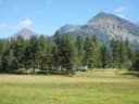 Williams Creek CampgroundSan Juan National Forest · 2.6 mi
 TealSan Juan National Forest · 3.5 mi
 Cimarrona (CO)San Juan National Forest · 5.1 mi
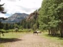 Palisades Horse CampSan Juan National Forest · 5.6 mi
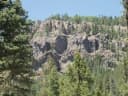 West Fork CampgroundSan Juan National Forest · 16 mi
 Pine RiverSan Juan National Forest · 17 mi
From Pagosa Springs, CO: Travel 2.0 miles west on U.S. Hwy 160, then turn northwest on Piedra Road, FR #631 for 18.0 miles. The Piedra Road is open year-round and suitable for most vehicles.
The weather
the next four days · the thirty-year normal
Next four days, and the thirty-year normal
Forecast
NWS forecast for Piedra, CO
Typical weather
Typical May night 35°F, day 66°F.
Coldest night of the open season: typical May night 35°F. Bring the bag rated for it.
Daily high and lowDays with 0.10 in or moreOutside the published season
A normal is the 1991-2020 average for the month, not a forecast: about half of all Julys are colder than the July line. The seven-day forecast above answers the other question.
The land, and who answers for it
what threatens it · who answers for it
Roadless country, and what’s coming for it
You’re camping on ground somebody wants. We track the threats and the comment deadlines.
Who answers for this land

Bridge is in Colorado’s 3rd congressional district. Its representative, Jeff Hurd (R), votes on the laws that decide what happens to this land. Public-lands grade so far: F. See every public-lands vote →