Buckhorn Ranger Station
- Right now
- Closedrecreation.gov lists every site closed this weekend, read 15:39 UTC
- Sites
- 3In the agency’s record
The place
the agency’s own description · what’s there · 7 notices
In the agency’s own words
The Buckhorn Ranger Station has three cabins, an office and large garage. In August 2022, the Buckhorn Ranger Station was listed in the National Register of Historic Places. The Buckhorn Ranger Cabin was built in 1933 by the Civilian Conservation Corps. Guests need to bring bedding, including pillows, blankets and/or sleeping bags, as well as towels, toiletry items, and food and beverages. Cooking pots, table and chairs, dishes, and utensils are provided. The Ranger Cabin is a fully-furnished two-bedroom cabin with indoor plumbing and electricity. Keep reading
It can accommodate up to six people and has two single beds in one bedroom, a queen bed in the second bedroom and a futon in the living room. The cabin is also equipped with a woodstove. The kitchen has running water, a stove and oven, refrigerator, microwave, and toaster. The Assistant Ranger Cabin is a one-bedroom cabin with two twin beds and a futon in the living room. The cabin has a propane heater, a full kitchen with gas stove and refrigerator, and a bathroom with shower. The Bunkhouse is an efficiency cabin that is planned to be wheelchair accessible. It has a kitchen with eating area and a small living room/bedroom area.
Recreation
Danner Hill Trail (AKA Donner Pass Trail) is located just north of the site and heads to the south towards Lookout Mountain. Forest Road 100 (West White Pine Road) heads north of the site to the original location of the West White Pine Fire Lookout that was relocated by helicopter to Fort Collins, Colorado. The area is popular for biking, hiking, OHV and motorized riding, hunting, and scenic drives.
Facilities
Beyond the specific cabin details above, the overall facility has a two fire pits, a horseshoe court and charcoal grills.
Natural Features
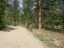
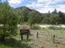
The Buckhorn Ranger Station is located on a large broad open terrace in the narrow Buckhorn Canyon just off Box Elder Creek, a tributary of Buckhorn Creek. West and East White Pine Mountains are located to the north, Lookout Mountain and Crystal Mountain are located to the south and Pingree Pass and the Mummy Range are located to the west.
Nearby Attractions
The Golden Eagle Disc Golf Course is locate just across Larimer County Road 44H. The Danner Trail is located just west of the site Pennock pass is located three miles west of the site.
What the agency tells you
The cabins remain locked, and a combination will be provided upon booking. You can also call the Forest Service office at 970-295-6600, 8:30 a.m. to 4:30 p.m. MST, Monday through Friday, to obtain a combination code.
Elevation can pose a hazard; learn more about altitude illness
The nearest services are an hour or more away in Fort Collins or Loveland
Everything else this campground posts · 4
Pets (including dogs) and livestock are not allowed at the cabins.
The number of guests is limited; additional camping on-site is prohibited.
Click here to learn more about the Arapaho and Roosevelt National Forests and Pawnee National Grassland.
This is black bear country. Dispose of waste properly in a bear proof dumpster outside and provided trash cans inside the cabin.
Tents and rigs
- Sites
- 3 · 3 cabin
- Hookups
- 3 electric
- Accessible sites
- 1
- Pets
- Not allowed
- Campfires
- Allowed, barring fire bans
- Shade
- Every site
Facilities
- Toilets
- Flush Toilets
- FLUSH TOILETS on 1 of 3 campsite records, ACCESSIBLE FLUSH TOILETS on 1 of 3 campsite records
- Showers
- Accessible Showers
- ACCESSIBLE SHOWERS on 1 of 3 campsite records
- Drinking water
- Yes
- DRINKING WATER on 3 of 3 campsite records, ACCESSIBLE DRINKING WATER on 1 of 3 campsite records, WATER SPIGOT on 1 of 3 campsite records, WATER (SEASONAL) on 1 of 3 campsite records
Around the campground
- On the water
- Creek
- Backpacking
- Biking
- Climbing
- Disc Golf
- Fire Lookouts/Cabins Overnight
- Hiking
- Historic site
- Hunting
- Information Site
- Off Highway Vehicle Trails
- Picnicking
- Scenic drives
- Fall color · reported 2 days ago, 21 km away
- No change
Nothing to book until it reopensread 15:39 UTC
recreation.gov lists every site closed this weekend
OpenBookedClosed
Tell me when it reopens
Watch for it to come back
One email when the agency reopens it, plus More Than Just Parks dispatches. Unsubscribe any time.
We check the agency’s own record once an hour, at 40 minutes past, and write the first time it stops saying closed.
Scanners that check every few minutes exist, and most of them charge. This one is free, it reads the same calendar, and it won’t always be first.
Every line of the receipt · 11
What you actually pay
Who keeps the booking fee
The agency’s own policy text says the reservation fee and the cancellation processing fee are “retained by the reservation service contractor”, and that a campground concessionaire will decline to refund them because “they did not receive these fees”. Recreation.gov is run under contract by Booz Allen Hamilton. What share of your booking fee the contractor keeps isn’t published in any federal dataset we can read, so we print no number for it. Our reporting on the contract →
How we know this receipt · 4
Why this page can’t say why
recreation.gov lists every site at Buckhorn Ranger Station closed this Friday and Saturday night. The U.S. Forest Service has published no closure notice we hold, so this page can’t say why, and it won’t fill the gap with a guess. A closed night isn’t a sold-out one: the reservations its record still carries were taken before the sites were closed.
There’s no notice to quote and no reason to argue with, so this page offers you the watch and the list below, and no letter.
Open within 150 miles · 4
The agency’s own word that these are open, not our reading of a season.
- Deer Creek CampgroundPike National Forest · 74 mi · 4 sites
- Osprey (CO)Pike National Forest · 86 mi · 13 sites
- OuzelPike National Forest · 88 mi · 13 sites
- Platte RiverPike National Forest · 90 mi · 4 sites
recreation.gov availability, read 15:39 UTC · rules read Sep 9, 2026 · rates Oct 1, 2026 · How we know all this
The sites
3 sites · which ones have room · the site map
The sites, ranked
from 3 mapped sitesAll 3 sites
The price is derived by CAMPANAC, not published per site: the per-night rate this campground publishes for each site’s own site type. 3 of the 3 sites listed carry one, and a site whose type has no published rate sits out of the price rather than being called free.
| Buckhorn | Buckhorn Assistant Ranger Cabin (0502) | cabin electric | 266 ft | 779 ft | $150–$175 | |
| Buckhorn | Buckhorn Bunkhouse (0503) | cabin electric | yes | 266 ft | 525 ft | $150–$175 |
| Buckhorn | Buckhorn Ranger Cabin (Fullen Kamp) | cabin electric | 286 ft | 615 ft | $150–$175 |
OpenStreetMap has no toilet mapped within 1 km of this campground, so no site here carries a toilet distance. That’s a gap in the map, not a finding about the campground.
Getting there
the map and the coordinate · the agency’s directions · the phone number
Where it is
 Jacks GulchRoosevelt National Forest · 4.9 mi
 Tom Bennett CampgroundRoosevelt National Forest · 6.0 mi
 Kelly Flats CampgroundRoosevelt National Forest · 6.9 mi
 Mountain ParkRoosevelt National Forest · 7.0 mi
 Narrows (CO)Roosevelt National Forest · 7.9 miNarrows Campground: Upper and LowerRoosevelt National Forest · 7.9 mi
The site is located on the south and north sides of Larimer County Road 44H (Buckhorn Road) 22 miles west of Masonville, Colorado, in the Roosevelt National Forest. The site is 165’ east of the intersection of Forest Service Road 100, 11.6 miles west of the intersection of Buckhorn Road and Stove Prairie Road (just past mile marker 32 if driving from the east), and 1 mile east of the junction of Buckhorn Road and Monument Gulch Road.
The weather
the next four days · the thirty-year normal
Next four days, and the thirty-year normal
Forecast
NWS forecast for Estes Park, CO
Typical weather
Typical October night 36°F, day 57°F.
Coldest month of the year: typical February night 20°F, below freezing. Bring a bag rated colder than that, and expect ice in the water bottle.
Daily high and lowDays with 0.10 in or more
A normal is the 1991-2020 average for the month, not a forecast: about half of all Julys are colder than the July line. The seven-day forecast above answers the other question.
The land, and who answers for it
what threatens it · who answers for it
Roadless country, and what’s coming for it
You’re camping on ground somebody wants. We track the threats and the comment deadlines.
Who answers for this land

Buckhorn Ranger Station is in Colorado’s 2nd congressional district. Its representative, Joe Neguse (D), votes on the laws that decide what happens to this land. Public-lands grade so far: A. See every public-lands vote →