Chilkoot Trail Camping Permits
- Right now
- Nobody has saidNo season, no closure, no bookings to read
- Sites
- 55All of them booked ahead
The place
the agency’s own description · what’s there · 15 notices
In the agency’s own words
The Chilkoot National Historic Trail is not open for crossing the Canadian border. When you apply for your Chilkoot Trail permit you will need to select the campgrounds you wish to use, select which nights you will be there, and how many members are in your party. Each campsite includes one 10ftx10ft space which may be used for up to two small tents. If additional spaces are needed, select additional camp sites. April 1-May 31 camping permits are not required. Campsites are listed as Walk up - First Come, First Served to indicate the campgrounds are open. Keep reading
You do not need to check in at the park upon arrival during this time period. June 1 - September 12 camping permits must be reserved, printed out beforehand, and validated at the Trail Center in Skagway prior to heading out on the trail. There is a $20.00 nonrefundable permit fee per trip. Guide to Planning Your Chilkoot Trail Hike . Finnegan's Point Campground Finnegan's Point is the first campground on the Chilkoot Trail. It is located near the Taiya River. Warming shelter and bear boxes are located close to the trail. Outhouse and tent platforms are up the hill from the warming shelter. Finnegan's Point is a good choice for hikers starting late in the day. Location: Mile Marker 5 Site Elevation: 249 ft. Campsites: 6 sites, with wooden 10ftx10ft tent platforms Warming Shelter: 1 Canvas, walled tent with wood burning stove Food Storage: bear boxes and one bear pole Toilet: 1composting outhouse Water Source: Taiya river located close to the warming shelter, all water must be purified Grey Water Disposal: Pack out all food scraps, dispose of grey water into fast moving water to follow Leave No Trace principles. Canyon City Campground The Canyon City campground provides a nice place to take a break from hiking, with several tables and two warming shelters. Canyon City is a common first night stop. Spending the night here makes it easy to explore the Canyon City Loop Trail. Location: Mile marker 7.7 Site elevation: 463 ft Campsites : 16 sites, with wooden 10ftx10ft tent platforms. Warming shelter : 1 canvas walled tent, 1 log cabin with wood burning stoves Food storage : bear boxes Toilet : 2 composting outhouses Water source : Taiya River located a short distance from the campground, a small stream runs behind the wall tent, all water must be purified. Grey water disposal : pack out all food scraps, dispose of grey water into fast moving water to practice Leave No Trace Pleasant Camp Campground Pleasant Camp is located near the Taiya River. It is just after a relatively large elevation gain coming from Canyon City. It is a good place to stay for experienced hikers accustomed to long days who want a quieter campground than Sheep Camp. Location: Mile marker10.7 Site elevation: 750 ft Campsites : 11 bare ground sites Warming shelter : 1 canvas walled tent with wood burning stove Food storage : bear boxes Toilet : 1 composting outhouse Water source : Taiya River located a short distance from the campground, all water must be purified Grey water disposal : pack out all food scraps, dispose of grey water into fast moving water to practice Leave No Trace Sheep Camp Campground Sheep Camp is the last campground on the U.S. side of the trail before the trail summit. Sheep Camp is the location of the NPS backcountry ranger station, a quarter mile from the campground. Location Mile marker: 13 Site elevation: 1,058 ft Campsites : 25 sites, with wooden 10ftx10ft tent platforms, have places to tie securing lines. Warming shelter : A large covered, but open air picnic shelter for meals. A restored 1960s era log cabin, also with wood stove. Note: sleeping in shelters is not permitted. Food storage : bear boxes Toilet : 3 composting outhouses Water source : Taiya River located a short distance from the campground, all water must be purified Grey water disposal : pack out all food scraps, dispose of grey water into fast moving water to practice Leave No Trace Facilities You are required to stop by the Trail Center in Skagway to validate your permit and receive a safety briefing prior to starting your hike. Contact Info This location is unstaffed. To speak with our main office for general information, please call: (907) 983-9234.
What the agency tells you
From April 1-May 31 permits are not required. Campsites are listed as Walk up - First Come, First Served to indicate the campgrounds are open. You do not need to check in at the park upon arrival during this time period, but we highly recommend checking in on the trail head register. As always, make sure there are people who know when you are going, how long you'll be gone, and when you'll be back. Expect to encounter significant snow and ice, especially at higher elevations.
From June 1-September 12 you are required to stop by the Trail Center in Skagway to validate your permit and receive a safety briefing prior to starting your hike.
Your permit guarantees you a site within the campground you have chosen. Individual sites are first come, first served. When you arrive in the campground you may set up camp at any unused site.
Everything else this campground posts · 12
There is a $20.00 nonrefundable permit fee per trip. The permit covers all Chilkoot Trail campsites that you reserve for your trip.
The Chilkoot Trailhead is located north of the Dyea townsite, about 10 miles (16 km) from Skagway, and is accessible by road.
The Taiya river and all tributaries are non-potable. Due to high sediment levels and potential bacterial and viral contamination all water must be filtered before drinking or using. You must bring your own water filtration system.
This is a backcountry wilderness trail. You are responsible for your own safety. Experience in route-finding and navigation are required. You must pack in and pack out everything.
There is no cell service anywhere along the Chilkoot Trail. Satellite-enabled phone users may seek 24-hour emergency assistance through the ARCC dispatch at 1-907-683-9555 or their emergency line at 907-683-2276. Hikers using a personal Garmin InReach must use the SOS button. Bad weather conditions may delay medical or rescue assistance for several days. Helicopter medical evacuations from the trail can be extremely expensive. Trail hikers are advised to consult their medical insurance policies before starting their hike. You are responsible for your own safety.
Weather conditions can be severe and unpredictable. Conditions above tree line change quickly and can be especially severe. High winds, driving snow, and poor visibility may prevent travel through this alpine terrain. Whiteout conditions are common and can prevent detection of hazardous avalanche terrain, cliffs, open water and overflow. Temperatures vary from 30F/-1C to -50F/-46C. It snows up to 200inches/508cm. per year at the Pass. Be prepared for rain, sleet, snow, ice and winds in excess of 50mph/80kmph. Come dressed and prepared for cold weather environmental conditions.
Remain bear aware at all times. All food and scented items must be stored in the provided bear boxes at each campsite.
Camping in shelters is not allowed. Tent pads must be used at Finnegan's Point, Canyon City, and Sheep Camp. Designated bare ground campsites must be used as Pleasant Camp. Do not use stones or cobbles to secure tents as they may belong to historic building foundations.
Only those experienced in winter backcountry travel, prepared with essential avalanche safety and winter camping gear, and travelling with partners should attempt the Chilkoot Trail in early Spring.
Pets: Although pets are allowed on trail, they must be leashed at all times. Please note that many sections of the trail may be extremely challenging to navigate with your pet on a leash and having your pets present may also increase the potential for aggressive encounters with bears. Because of this we do not recommend bringing them. If you do choose to bring your pet please note that they are not allowed in cooking shelters, their food must also be stored in a bear box, and all feces must be cleaned up and disposed of in the outhouses.
Fires: Open fires are prohibited on the Chilkoot Trail. You must bring your own backpacking stove and fuel for cooking. There are wood stoves in many of the shelters and you may collect down and dead wood but please note that the wood is often too wet to use.
Fishing: With an Alaska State fishing license, you can fish along the US portions of the trail.
Tents and rigs
- Sites
- 55 · 55 walk-in
- Hookups
- None
- Accessible sites
- None listed
- Pets
- Allowed
- Campfires
- Not allowed
Facilities
- Toilets
- Yes, the record doesn't say what kind
- OUTHOUSE on 49 of 55 campsite records
- Bear boxes
- Yes
- Stay limit
- 14 nights
- recreation.gov facility rule maxStay
Around the campground
- On the water
- River, Creek
No reading yet, book on recreation.gov
Every site here is reservable, and the record lists none held back for anyone who drives up.
No availability snapshot inside the last 36 hours, so this page draws nothing rather than ageing a reading into fiction.
Watch for a cancellation
Full? Watch it.
One email when a night opens, plus More Than Just Parks dispatches. Unsubscribe any time.
We read recreation.gov once an hour, at 40 minutes past, and write the first time a site in your window is free for the nights you asked for.
Scanners that check every few minutes exist, and most of them charge. This one is free, it reads the same calendar, and it won’t always be first.
We make nothing when you book. The link goes straight to the government.
Every line of the receipt · 11
What you actually pay
Who keeps the booking fee
The agency’s own policy text says the reservation fee and the cancellation processing fee are “retained by the reservation service contractor”, and that a campground concessionaire will decline to refund them because “they did not receive these fees”. Recreation.gov is run under contract by Booz Allen Hamilton. What share of your booking fee the contractor keeps isn’t published in any federal dataset we can read, so we print no number for it. Our reporting on the contract →
How we know this receipt · 4
rules read Sep 9, 2026 · record Aug 23, 2026 · How we know all this
The sites
55 sites · which ones have room · the site map
The sites, ranked
from 55 mapped sites55 sites share one published coordinate and are left out of the rankings.
All 55 sites
Toilet distances are OpenStreetMap’s, measured for 31 of the 55 sites listed. A site with no reading is unknown, never far.
Measured shade is NLCD Tree Canopy Cover 2024 (USDA Forest Service / MRLC) read at the site’s own coordinate, 27% canopy or more, and only for the sites the agency gave no Shade value. It never changes the agency’s own shaded count beside it.
| Canyon City Campground | Site 1 Canyon City | hike to | 163 ft | Outhouse listed |
| Canyon City Campground | Site 10 Canyon City | hike to | 163 ft | Outhouse listed |
| Canyon City Campground | Site 11 Canyon City | hike to | 163 ft | Outhouse listed |
| Canyon City Campground | Site 12 Canyon Point | hike to | 163 ft | Outhouse listed |
| Canyon City Campground | Site 13 Canyon City | hike to | 163 ft | Outhouse listed |
| Canyon City Campground | Site 14 Canyon City | hike to | 163 ft | Outhouse listed |
| Canyon City Campground | Site 15 Canyon City | hike to | 163 ft | Outhouse listed |
| Canyon City Campground | Site 16 Canyon City | hike to | 163 ft | Outhouse listed |
| Canyon City Campground | Site 2 Canyon City | hike to | 163 ft | Outhouse listed |
| Canyon City Campground | Site 3 Canyon City | hike to | 163 ft | Outhouse listed |
| Canyon City Campground | Site 4 Canyon City | hike to | 163 ft | Outhouse listed |
| Canyon City Campground | Site 5 Canyon City | hike to | 163 ft | Outhouse listed |
| Canyon City Campground | Site 6 Canyon City | hike to | 163 ft | Outhouse listed |
| Canyon City Campground | Site 7 Canyon City | hike to | 163 ft | Outhouse listed |
| Canyon City Campground | Site 8 Canyon City | hike to | 163 ft | Outhouse listed |
| Canyon City Campground | Site 9 Canyon City | hike to | 163 ft | Outhouse listed |
| Finnegan's Point Campground | Site 1 Finnegan's Point | hike to | 81 ftTaiya River | 11 ft |
| Finnegan's Point Campground | Site 2 Finnegan's Point | hike to | 81 ftTaiya River | 11 ft |
| Finnegan's Point Campground | Site 3 Finnegan's Point | hike to | 81 ftTaiya River | 11 ft |
| Finnegan's Point Campground | Site 4 Finnegan's Point | hike to | 81 ftTaiya River | 11 ft |
| Finnegan's Point Campground | Site 5 Finnegan's Point | hike to | 81 ftTaiya River | 11 ft |
| Finnegan's Point Campground | Site 6 Finnegan's Point | hike to | 81 ftTaiya River | 11 ft |
| Pleasant Camp Campground | Site 1 Pleasant Camp | hike to | 64 ftTaiya River | Outhouse listed |
| Pleasant Camp Campground | Site 2 Pleasant Camp | hike to | 64 ftTaiya River | Outhouse listed |
| Pleasant Camp Campground | Site 3 Pleasant Camp | hike to | 64 ftTaiya River | Outhouse listed |
| Pleasant Camp Campground | Site 4 Pleasant Camp | hike to | 64 ftTaiya River | Outhouse listed |
| Pleasant Camp Campground | Site 5 Pleasant Camp | hike to | 64 ftTaiya River | Outhouse listed |
| Pleasant Camp Campground | Site 6 Pleasant Camp | hike to | 64 ftTaiya River | Outhouse listed |
| Pleasant Camp Campground | Site 7 Pleasant Camp | hike to | 64 ftTaiya River | Outhouse listed |
| Pleasant Camp Campground | Site 8 Pleasant Camp | hike to | 64 ftTaiya River | Outhouse listed |
| Sheep Camp Campground | Site 1 Sheep Camp | hike to | 257 ft | 47 ft |
| Sheep Camp Campground | Site 10 Sheep Camp | hike to | 257 ft | 47 ft |
| Sheep Camp Campground | Site 11 Sheep Camp | hike to | 257 ft | 47 ft |
| Sheep Camp Campground | Site 12 Sheep Camp | hike to | 257 ft | 47 ft |
| Sheep Camp Campground | Site 13 Sheep Camp | hike to | 257 ft | 47 ft |
| Sheep Camp Campground | Site 14 Sheep Camp | hike to | 257 ft | 47 ft |
| Sheep Camp Campground | Site 15 Sheep Camp | hike to | 257 ft | 47 ft |
| Sheep Camp Campground | Site 16 Sheep Camp | hike to | 257 ft | 47 ft |
| Sheep Camp Campground | Site 17 Sheep Camp | hike to | 257 ft | 47 ft |
| Sheep Camp Campground | Site 18 Sheep Camp | hike to | 257 ft | 47 ft |
| Sheep Camp Campground | Site 19 Sheep Camp | hike to | 257 ft | 47 ft |
| Sheep Camp Campground | Site 2 Sheep Camp | hike to | 257 ft | 47 ft |
| Sheep Camp Campground | Site 20 Sheep Camp | hike to | 257 ft | 47 ft |
| Sheep Camp Campground | Site 21 Sheep Camp | hike to | 257 ft | 47 ft |
| Sheep Camp Campground | Site 22 Sheep Camp | hike to | 257 ft | 47 ft |
| Sheep Camp Campground | Site 23 Sheep Camp | hike to | 257 ft | 47 ft |
| Sheep Camp Campground | Site 24 Sheep Camp | hike to | 257 ft | 47 ft |
| Sheep Camp Campground | Site 25 Sheep Camp | hike to | 257 ft | 47 ft |
| Sheep Camp Campground | Site 3 Sheep Camp | hike to | 257 ft | 47 ft |
| Sheep Camp Campground | Site 4 Sheep Camp | hike to | 257 ft | 47 ft |
| Sheep Camp Campground | Site 5 Sheep Camp | hike to | 257 ft | 47 ft |
| Sheep Camp Campground | Site 6 Sheep Camp | hike to | 257 ft | 47 ft |
| Sheep Camp Campground | Site 7 Sheep Camp | hike to | 257 ft | 47 ft |
| Sheep Camp Campground | Site 8 Sheep Camp | hike to | 257 ft | 47 ft |
| Sheep Camp Campground | Site 9 Sheep Camp | hike to | 257 ft | 47 ft |
25 of 55 listed
Getting there
the map and the coordinate · the agency’s directions · the phone number
Where it is
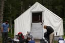 Pleasant CampKlondike Gold Rush National Historical Park · 0.1 mi
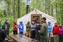 Sheep CampKlondike Gold Rush National Historical Park · 1.6 mi
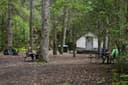 Canyon CityKlondike Gold Rush National Historical Park · 2.5 mi
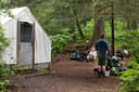 Finnegan's PointKlondike Gold Rush National Historical Park · 4.7 mi
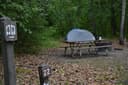 Dyea CampgroundKlondike Gold Rush National Historical Park · 9.4 mi
 Laughton Glacier CabinTongass National Forest · 9.6 mi
- Start by checking in at the Chilkoot Trail Center at 520 Broadway, Skagway, AK. The Chilkoot Trail Center is located on the east side of Broadway between 5th and 6th Avenues.
- Once your permit has been validated you can head to the Chilkoot Trailhead. Head North out of town towards the Klondike Highway. Turn left onto Dyea road, and follow the road for approximately 7 miles.
- The parking lot will be on your left, and the trailhead will be on your right, across the road from the parking lot.
The weather
the next four days · the thirty-year normal
Next four days, and the thirty-year normal
Forecast
NWS forecast for Skagway, AK
Typical weather
Typical October night 39°F, day 48°F.
Coldest month of the year: typical January night 22°F, below freezing. Bring a bag rated colder than that, and expect ice in the water bottle.
Daily high and lowDays with 0.10 in or more
A normal is the 1991-2020 average for the month, not a forecast: about half of all Julys are colder than the July line. The seven-day forecast above answers the other question.
The land, and who answers for it
who answers for it
Who answers for this land

Chilkoot Trail Camping Permits is in Alaska’s at-large congressional district. Its representative, Nick Begich (R), votes on the laws that decide what happens to this land. Public-lands grade so far: F. See every public-lands vote →