Cowpuncher Guard Station
- Right now
- Nobody has saidNo season, no closure, no bookings to read
- Sites
- 1All of them booked ahead
The place
the agency’s own description · what’s there · 3 notices
In the agency’s own words
Cowpuncher Guard Station is located in the Dixie National Forest, 20 miles northeast of the town of Escalante in southern Utah. The cabin is situated just off the Hells Backbone Road and is accessed by road during summer and fall. Roads are usually closed by snow 5.5 miles from the cabin from late November to mid-April. Check the ranger station for winter conditions. Keep reading
Recreation
The cabin is surrounded by trails, including the Great Western Trail which offer abundant opportunities for hiking, mountain biking and horseback riding. Pine Creek flows through the site offering excellent trout fishing. The scenic Hells Backbone Road is minutes away and is a popular scenic drive for both cars and OHVs. Posey Lake is 7 miles away.
Facilities
The cabin is comfortably furnished with bunk beds and one full size bed, table and chairs, wood cook stove, propane stovetop, kitchen sink with cold running water (summer and early fall), battery operated lanterns, pots and pans, dishes and utensils. A covered porch extends the space outside with a picnic table and fire ring below. A vault toilet is located 150 ft. from the cabin and firewood is provided.
Natural Features
Cowpuncher sits in a secluded meadow surrounded by pine and aspen groves next to a small trout stream. The elevation at the cabin is 8,000 feet and the adjacent pine and aspen covered slopes quickly rise up to 8,900 feet. Summer days are warm and nights are cool.
Nearby Attractions
Cowpuncher offers a cool escape from the surrounding desert landscape and is often used as a base to explore the surrounding area. The Escalante area of southern Utah offers breathtaking scenery nearly everywhere you look. Sightseeing along Road 153, Hells Backbone Road, and Utah Highway 12, a National All American Highway, are very popular. The Grand Staircase-Escalante National Monument, Anasazi State Park, and the Escalante Petrified Forest State Park are all located in the area.
What the agency tells you
No garbage service is provided. Pack-it-in. Pack-it-out.
Access can be difficult during wet weather and requires driving 14 miles of dirt road with some steep sections.
During winter months the last 5.5 miles require a snowmobile or skis.
Tents and rigs
- Sites
- 1 · 1 cabin
- Hookups
- None
- Longest rig
- 30 ft
- Accessible sites
- 1
- Pets
- Allowed
- Campfires
- Allowed, barring fire bans
- Shade
- Every site
Facilities
- Toilets
- Vault Toilets
- “…a picnic table and fire ring below. A vault toilet is located 150 ft. from the cabin and firewood is…”
- Firewood
- Mentioned
- Stay limit
- 10 nights
- recreation.gov facility rule maxStay
Around the campground
- On the water
- Lake, Creek, Meadow
- Fishing
- Hiking
- Night sky · 19th darkest of 458 in UT
- Bortle 1
No reading yet, book on recreation.gov
Every site here is reservable, and the record lists none held back for anyone who drives up.
No availability snapshot inside the last 36 hours, so this page draws nothing rather than ageing a reading into fiction.
Watch for a cancellation
Full? Watch it.
One email when a night opens, plus More Than Just Parks dispatches. Unsubscribe any time.
We read recreation.gov once an hour, at 40 minutes past, and write the first time a site in your window is free for the nights you asked for.
Scanners that check every few minutes exist, and most of them charge. This one is free, it reads the same calendar, and it won’t always be first.
Tell me when the season opens
Watch for the season to open
One email when the season goes on sale, plus More Than Just Parks dispatches. Unsubscribe any time.
We check once an hour, at 40 minutes past, and write the first time the agency has that season on sale.
Scanners that check every few minutes exist, and most of them charge. This one is free, it reads the same calendar, and it won’t always be first.
We make nothing when you book. The link goes straight to the government.
Every line of the receipt · 12
What you actually pay
Who keeps the booking fee
The agency’s own policy text says the reservation fee and the cancellation processing fee are “retained by the reservation service contractor”, and that a campground concessionaire will decline to refund them because “they did not receive these fees”. Recreation.gov is run under contract by Booz Allen Hamilton. What share of your booking fee the contractor keeps isn’t published in any federal dataset we can read, so we print no number for it. Our reporting on the contract →
How we know this receipt · 4
rules read Sep 9, 2026 · rates Oct 1, 2026 · How we know all this
The sites
1 sites · the site map
All 1 sites
Toilet distances are OpenStreetMap’s, measured for 1 of the 1 sites listed. A site with no reading is unknown, never far.
| COWPUNCHER | Cowpuncher | cabin nonelectric | 30 ft | yes | 121 ft | 2,386 ft |
Getting there
the map and the coordinate · the agency’s directions · the phone number
Where it is
 Posey Lake CampgroundDixie National Forest · 4.4 mi
 Barker Recreation AreaDixie National Forest · 10 mi
 Aquarius Ranger StationDixie National Forest · 14 miOak Creek CampgroundDixie National Forest · 18 miOak Creek Rec Site (Boulder, UT)Dixie National Forest · 18 mi
From Highway 12 in Escalante, turn north on 300E. Drive 14 miles to the junction of Forest Roads 154 and 153. Continue on FR153 for 4.5 miles. Turn left on FR145 towards Cowpuncher and Blue Spruce Campground. Travel 0.7 miles to Cowpuncher Gate. The cabin is 0.2 miles past the gate.
The weather
the next four days · the thirty-year normal
Next four days, and the thirty-year normal
Forecast
NWS forecast for Boulder, UT
Typical weather
Typical October night 26°F, day 59°F.
Coldest month of the year: typical December night 6°F, below freezing. Bring a bag rated colder than that, and expect ice in the water bottle.
Daily high and lowDays with 0.10 in or more
A normal is the 1991-2020 average for the month, not a forecast: about half of all Julys are colder than the July line. The seven-day forecast above answers the other question.
The land, and who answers for it
what threatens it · who answers for it
Roadless country, and what’s coming for it
You’re camping on ground somebody wants. We track the threats and the comment deadlines.
Who answers for this land
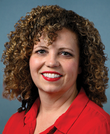
Cowpuncher Guard Station is in Utah’s 2nd congressional district. Its representative, Celeste Maloy (R), votes on the laws that decide what happens to this land. Public-lands grade so far: F. See every public-lands vote →