Dana Peak
- Right now
- Closedrecreation.gov lists every site closed this weekend, read 14:47 UTC
- A night
- $20–$60When it reopens, per site
- Sites
- 33In the agency’s record
The place
the agency’s own description · what’s there · 7 notices
In the agency’s own words
Dana Peak Campground is located on a peninsula on the shoreline of Stillhouse Hollow Lake in central Texas. The lake offers a wide variety of recreation opportunities, including water sports, hiking, biking, horseback riding, picnicking, large group pavilions, hunting, fishing and more. The facility is one of only two reservable campgrounds on the lake and often fills up on weekends during summer. Stillhouse Hollow Lake was created by the U.S. Army Corps of Engineers with the construction of Stillhouse Hollow Dam in 1968. The 6,430-acre lake is located 16 miles upstream of the confluence of the Lampasas and Leon Rivers, which flow into the Little River. Keep reading
Recreation
With 58 miles of shoreline, Stillhouse Hollow Lake is an often uncrowded haven for boaters and fishermen. The campground has a four-lane boat ramp, and visitors who do not have motor boats, canoes or kayaks can rent them nearby. Families can enjoy soaking up the sun, swimming at the beach or exploring the Dana Peak Trails (located just outside the main entrance to the park) by foot, bike or horseback. Birding is a favorite pastime for many visitors with hawks, Great Blue herons, ducks, geese, many species of songbirds, bobwhite quail, Rio Grande turkey and even an occasional bald eagle, yielding year-round opportunities for bird sightings.
Facilities
The campground has more than 30 campsites, including RV and tent sites with electric hookups and eight primitive tent sites. The park offers restrooms with flush toilets and showers, a swimming beach, several picnic sites and a boat ramp. Primitive campsites include a picnic table and a campfire ring with a grill. A group shelter is available by reservation for up to 80 people at a time.
Natural Features
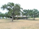
Aside from two campgrounds and a nearby day-use park, very little of the lakeshore is developed. The edges consist of rocky beaches and sandy bluffs. Much of the lake area is forested, though the campground is mostly grassy, flat and open with little to no shade. Most campsites are right along the water's edge; others are within a short walk. The lake has noticeably clear and deep water inhabited by largemouth bass, smallmouth bass and channel catfish. A man-made wetland was constructed on the south shore of the lake, providing an additional 10 acres of wildlife habitat in the area. Contact Info This location is unstaffed. To speak with our main office for general information, please call: (254) 939-2461.
Nearby Attractions
Within a short drive, the Village of Salado offers golf, art galleries and shopping, among other pastimes. Chalk Ridge Falls Environmental Learning Center is below the Stillhouse Hollow Lake Dam. The center has about five miles of hiking trails, including a one-mile nature trail along the Lampasas River, a spring-fed creek, a waterfall, bridges and several wildlife viewing points. Stillhouse Hollow Lake is located near the Fort Hood Army Base, which has several points of interest for the military buff.
What the agency tells you
Park hours are 6 a.m. to 8 p.m. daily
CAMPERS: There is no gate attendant at this park. Please check your confirmation email from Recreation.gov for the camper gate code to enter the campground.
There are QR code signs posted throughout the park that can be used to pay the $5.00 day use fee. The sign has instructions listed on how to pay.
Everything else this campground posts · 4
Temporary inflatable structures i.e. bounce houses, moon bounces, water slides etc. are NOT allowed.
This park is closed Oct. 1 through March 1 every year.
For more information, contact 254-939-2461 Monday - Friday between 8:00am and 4:30pm or visit the lake website
Don't Move Firewood: Protect your forests from tree-killing pests by buying your firewood locally and burning it on-site. Visit Dontmovefirewood.org for further information.
Tents and rigs
- Sites
- 33 · 13 tent-only
- Hookups
- 22 electric, 25 water
- Longest rig
- 91 ft
- Paved pads
- All
- Accessible sites
- 1
- Pets
- Allowed
- Campfires
- Allowed, barring fire bans
Facilities
- Toilets
- Flush Toilets
- “…primitive tent sites. The park offers restrooms with flush toilets and showers, a swimming beach, several picnic sites…”
- Showers
- Yes, the record doesn’t say what kind
- “The park offers restrooms with flush toilets and showers, a swimming beach, several picnic sites and a boat ramp.”
- Dump station
- Yes
- recreation.gov lists “Dump Station”
- Boat ramp
- Yes
- Camp host
- On site
- recreation.gov lists “Host”
- Stay limit
- 14 nights
- recreation.gov facility rule maxStay
Around the campground
- On the water
- Waterfall, Lake, River, Creek, Beach
- Biking
- Fishing
- Horseback riding
- Swimming
- Night sky · 132nd darkest of 154 in TX
- Bortle 5
Nothing to book until it reopensread 14:47 UTC
recreation.gov lists every site closed this weekend
Every one of the next thirty nights is in recreation.gov’s record and not one site is being offered on any of them. That’s a campground closed or not yet released for booking, not a sold-out one.
Tell me when it reopens
Watch for it to come back
One email when the agency reopens it, plus More Than Just Parks dispatches. Unsubscribe any time.
We check the agency’s own record once an hour, at 40 minutes past, and write the first time it stops saying closed.
Scanners that check every few minutes exist, and most of them charge. This one is free, it reads the same calendar, and it won’t always be first.
Every line of the receipt · 14
What you actually pay
Who keeps the booking fee
The agency’s own policy text says the reservation fee and the cancellation processing fee are “retained by the reservation service contractor”, and that a campground concessionaire will decline to refund them because “they did not receive these fees”. Recreation.gov is run under contract by Booz Allen Hamilton. What share of your booking fee the contractor keeps isn’t published in any federal dataset we can read, so we print no number for it. Our reporting on the contract →
How we know this receipt · 4
Why this page can’t say why
recreation.gov lists every site at Dana Peak closed this Friday and Saturday night. The U.S. Army Corps of Engineers has published no closure notice we hold, so this page can’t say why, and it won’t fill the gap with a guess. A closed night isn’t a sold-out one: the reservations its record still carries were taken before the sites were closed.
There’s no notice to quote and no reason to argue with, so this page offers you the watch and the list below, and no letter.
recreation.gov availability, read 14:47 UTC · rules read Sep 9, 2026 · rates Oct 1, 2026 · How we know all this
The sites
34 records · which ones have room · the site map
The sites, ranked
from 31 mapped sitesAll 34 records
Toilet distances are OpenStreetMap’s, measured for 34 of the 34 sites listed. A site with no reading is unknown, never far.
The price is derived by CAMPANAC, not published per site: the per-night rate this campground publishes for each site’s own site type. 30 of the 34 sites listed carry one, and a site whose type has no published rate sits out of the price rather than being called free.
| COMANCHE GAP | Comanche Gap Pavilion | day use | 15 amp | 486 ft | 172 ft | 310 ft | $120 | ||
| DANA PEAK | 01T | tent only nonelectric | 72 ft | 60 ft | 1,541 ft | $20 | |||
| DANA PEAK | 02T | tent only nonelectric | 60 ft | 51 ft | 1,482 ft | $20 | |||
| DANA PEAK | 03T | tent only nonelectric | 60 ft | 53 ft | 1,428 ft | $20 | |||
| DANA PEAK | 04T | tent only nonelectric | 65 ft | 49 ft | 1,374 ft | $20 | |||
| DANA PEAK | 05T | tent only nonelectric | 113 ft | 45 ft | 1,269 ft | $20 | |||
| DANA PEAK | 06T | tent only nonelectric | 80 ft | 46 ft | 1,172 ft | $20 | |||
| DANA PEAK | 07T | tent only nonelectric | 80 ft | 58 ft | 1,100 ft | $20 | |||
| DANA PEAK | 08T | tent only nonelectric | 86 ft | 60 ft | 1,026 ft | $20 | |||
| DANA PEAK | 09 | type not stated | 62 ft | 50 amp | 54 ft | 761 ft | |||
| DANA PEAK | 10 | standard electric | 64 ft | 50 amp | 97 ft | 65 ft | 695 ft | $30–$60 | |
| DANA PEAK | 11 | standard electric | 64 ft | 50 amp | 92 ft | 77 ft | 606 ft | $30–$60 | |
| DANA PEAK | 12 | standard electric | 59 ft | 50 amp | 83 ft | 74 ft | 525 ft | $30–$60 | |
| DANA PEAK | 13 | standard electric | 60 ft | 50 amp | 83 ft | 72 ft | 455 ft | $30–$60 | |
| DANA PEAK | 14 | standard electric | 91 ft | 50 amp | 96 ft | 54 ft | 383 ft | $30–$60 | |
| DANA PEAK | 15 | standard electric | 57 ft | 50 amp | 96 ft | 88 ft | 300 ft | $30–$60 | |
| DANA PEAK | 16 | standard electric | 64 ft | 50 amp | yes | 95 ft | 88 ft | 384 ft | $30–$60 |
| DANA PEAK | 17 | standard electric | 75 ft | 50 amp | 50 ft | 71 ft | 466 ft | $30–$60 | |
| DANA PEAK | 18 | standard electric | 78 ft | 50 amp | 50 ft | 59 ft | 512 ft | $30–$60 | |
| DANA PEAK | 19 | standard electric | 86 ft | 50 amp | 75 ft | 59 ft | 612 ft | $30–$60 | |
| DANA PEAK | 20 | standard electric | 68 ft | 50 amp | 63 ft | 52 ft | 676 ft | $30–$60 | |
| DANA PEAK | 21 | standard electric | 85 ft | 50 amp | 63 ft | 38 ft | 729 ft | $30–$60 | |
| DANA PEAK | 22 | standard electric | 63 ft | 50 amp | 87 ft | 25 ft | 797 ft | $30–$60 | |
| DANA PEAK | 23 | standard electric | 61 ft | 50 amp | 72 ft | 34 ft | 867 ft | $30–$60 | |
| DANA PEAK | 24 | standard electric | 78 ft | 50 amp | 72 ft | 69 ft | 901 ft | $30–$60 | |
| DANA PEAK | 25 | standard electric | 88 ft | 50 amp | 107 ft | 44 ft | 969 ft | $30–$60 | |
| DANA PEAK | 26 | standard electric | 77 ft | 50 amp | 107 ft | 78 ft | 954 ft | $30–$60 | |
| DANA PEAK | 27T | tent only electric | 56 ft | 92 ft | 951 ft | $24 | |||
| DANA PEAK | 28T | tent only electric | 56 ft | 89 ft | 938 ft | $24 | |||
| DANA PEAK | 29T | tent only electric | 58 ft | 83 ft | 920 ft | $24 | |||
| DANA PEAK | 30T | tent only electric | 48 ft | 102 ft | 839 ft | $24 | |||
| DANA PEAK | 31T | tent only electric | 48 ft | 103 ft | 792 ft | $24 | |||
| DANA PEAK | Host1 | type not stated | 66 ft | 50 amp | 139 ft | 239 ft | |||
| DANA PEAK | Host2 | type not stated | 70 ft | 50 amp | 148 ft | 300 ft |
The agency files 1 more record here that isn’t a site for the night. It files it as day use. It’s in the table above, marked for what it is, and it isn’t counted as a site.
25 of 34 listed
Getting there
the map and the coordinate · the agency’s directions · the phone number
Where it is
 Union Grove1.5 mi
 Stillhouse4.3 mi
 Westcliff7.9 mi
 Belton Lakeview Park8.9 mi
 Temples Lake9.7 mi
 Live Oak Ridge9.9 mi
From Interstate 35 in Belton, Texas take Highway 190 west to the Simmons Road exit. Cross under the highway and turn west on Farm-to-Market Road 2410. Turn left (south) on Commanche Gap Road and drive for five miles to reach the park.
The weather
the next four days · the thirty-year normal
Next four days, and the thirty-year normal
Forecast
NWS forecast for Harker Heights, TX
Typical weather
Typical October night 56°F, day 81°F.
Coldest month of the year: typical January night 36°F. Bring the bag rated for it.
Daily high and lowDays with 0.10 in or more
A normal is the 1991-2020 average for the month, not a forecast: about half of all Augusts are colder than the August line. The seven-day forecast above answers the other question.
The land, and who answers for it
who answers for it
Who answers for this land

Dana Peak is in Texas’s 31st congressional district. Its representative, John Carter (R), votes on the laws that decide what happens to this land. Public-lands grade so far: F. See every public-lands vote →