Davenport Landing
1Heads up1 fire 21 mi away
- Right now
- Listed not openA database flag with no reason and no date
The place
the agency’s own description · what’s there
In the agency’s own words
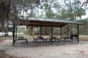
Deep in the floodplain forest along the Ocklawaha River, Davenport Landing is a former steamboat stop along this twisting, winding waterway. Three primitive campsites provide a stop for paddlers working their way along the river. Boating Paddle your canoe or kayak across the beautiful waters of Davenport Lading in search of a quiet spot along the shoreline. Fishing Sitting along the Ocklawaha River, this is the perfect location to cast a line from the shallows for a chance to catch that big one. Just keep an eye out for any alligators that may be roaming the area. Hiking The Davenport Landing Trail is a 0. Keep reading
6-mile interpretive walk to a former steamboat landing along the Ocklawaha River (1.2 mile round-trip). Since it is within the river's floodplain area, expect a high concentration of mosquitoes and dress / prepare accordingly. Interpretive Area In addition to leading you to the site of a historic steamboat landing, interpretive information along the Davenport Landing Trail includes middens along the Ocklawaha River from the Timucuan period as well as a Civil War-era gravesite. Primitive Camping Three primitive sites, maximum 15 people total (five per campsite). Four-day stay limit. Primitive campsites can be used by individuals camping with tents or any motorized vehicle. These specific areas in the forest offer no facilities. While any motorized vehicle is permitted in these primitive campsites, not all areas are accessible by all types of vehicles. Sandy and narrow woods roads may make navigation difficult or impossible for some vehicles. Visitors should treat these roads with cautious respect.
Facilities
- Toilets
- None. Pack out what you bring in
- “…These specific areas in the forest offer no facilities. While any motorized vehicle is permitted in these…”
Around the campground
- On the water
- River, Beach
Phone before you drive
recreation.gov publishes no availability for a campground you can’t reserve, so there’s no thirty-night reading to draw here. The season bar above is what the agency does publish.
Every line of the receipt · 4
What you actually pay
How we know this receipt · 4
record Aug 24, 2026 · How we know all this
Getting there
the map and the coordinate
Where it is
 Lake Delancy West CampgroundOcala National Forest · 3.2 mi
 Salt Springs Recreation AreaOcala National Forest · 8.3 mi
 Hopkins Prairie CampgroundOcala National Forest · 15 mi
 Lake Eaton CampgroundOcala National Forest · 16 mi
 Lake Shore Group CampOcala National Forest · 16 mi
 Fore Lake CampgroundOcala National Forest · 16 mi
The weather
the next four days · the thirty-year normal
Next four days, and the thirty-year normal
Forecast
NWS forecast for Lake Kerr, FL
Typical weather
Typical October night 60°F, day 83°F.
Coldest month of the year: typical January night 41°F. Bring the bag rated for it.
Daily high and lowDays with 0.10 in or more
A normal is the 1991-2020 average for the month, not a forecast: about half of all Augusts are colder than the August line. The seven-day forecast above answers the other question.
The land, and who answers for it
who answers for it
Who answers for this land

Davenport Landing is in Florida’s 6th congressional district. Its representative, Randy Fine (R), votes on the laws that decide what happens to this land. Public-lands grade so far: D-. See every public-lands vote →