Deer Flat Group Campground
2Heads up2 fires, nearest 14 mi
- Right now
- Listed not openA database flag with no reason and no date
The place
the agency’s own description · what’s there
In the agency’s own words
Located on the North Umpqua Wild and Scenic River adjacent to the Horseshoe Bend Campground with its own loop of camping spurs and restrooms. Keep reading
Facilities
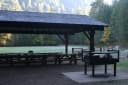
1 group campsite with picnic tables, fire pit and grills 70 people maximum Drinking water Flush toilet Garbage disposal
Facilities
- Toilets
- Flush Toilets
- “…grills 70 people maximum Drinking water Flush toilet Garbage disposal”
- Drinking water
- Yes
- “…fire pit and grills 70 people maximum Drinking water Flush toilet Garbage disposal”
Around the campground
- On the water
- River
Phone before you drive
recreation.gov publishes no availability for a campground you can’t reserve, so there’s no thirty-night reading to draw here. The season bar above is what the agency does publish.
Every line of the receipt · 4
What you actually pay
How we know this receipt · 4
record Aug 24, 2026 · How we know all this
Getting there
the map and the coordinate
Where it is
 Deer Flat Group Site (Horseshoe Bend Campground)Umpqua National Forest · 3.0 mi
 Horseshoe Bend Campground (OR)Umpqua National Forest · 3.0 mi
 Island CampgroundUmpqua National Forest · 3.7 mi
 Steamboat Ball Field Group SiteUmpqua National Forest · 3.9 mi
 Canton Creek CampgroundUmpqua National Forest · 4.4 mi
The weather
the next four days · the thirty-year normal
Next four days, and the thirty-year normal
Forecast
NWS forecast for Glide, OR
Typical weather
Typical October night 39°F, day 60°F.
Coldest month of the year: typical December night 31°F, below freezing. Bring a bag rated colder than that, and expect ice in the water bottle.
Daily high and lowDays with 0.10 in or more
A normal is the 1991-2020 average for the month, not a forecast: about half of all Julys are colder than the July line. The seven-day forecast above answers the other question.
The land, and who answers for it
what threatens it · who answers for it
What threatens this place
You’re camping on ground somebody wants. We track the threats and the comment deadlines.
Who answers for this land

Deer Flat Group Campground is in Oregon’s 2nd congressional district. Its representative, Cliff Bentz (R), votes on the laws that decide what happens to this land. Public-lands grade so far: F. See every public-lands vote →
How we know
every fact on this page, and where it came from
Inside the Jack Fire perimeter, 2021, 24,167 acres. Tree cover here read 0% in the 2021 product and 35% in the 2024 one.