Deer Ridge Lookout
3Heads up3 fires, nearest 24 mi
- Right now
- Nobody has saidNo season, no closure, no bookings to read
- Sites
- 1All of them booked ahead
The place
the agency’s own description · what’s there · 9 notices
In the agency’s own words
Deer Ridge Lookout, perched on a 40 foot timber frame, boasts excellent views of the Purcell mountain ranges of Northern Idaho, Canada and Montana. Located 24 miles northeast of Bonners Ferry, guests can enjoy magnificent scenery, hiking and wildlife watching. The lookout can be accessed by car and the gravel road to the lookout is well maintained. Keep reading
Recreation
Hiking and viewing the scenery are two well-loved activities at the facility. Hiking trails from the lookout follow along the Deer Ridge and Ruby Ridge. Huckleberry picking is enjoyed from August to September. Fly fishing is available in the Moyie River, where anglers can cast for rainbow and brook trout. Make sure to check all regulations and secure all permits with the local Fish and Wildlife department before heading out.
Facilities
The 14' X 14' cabin has a wraparound catwalk, with a trap door that lifts for access to the tower's entrance staircase. The staircase is steep and is not recommended for small children. Furnishings include two twin beds, two chairs, a dresser and a table. A pit toilet is located 50 yards away. No water is available. Guests should bring plenty of water for drinking, cooking and washing. Cooking is not permitted in the lookout. All cooking should be done outside and at ground level. Guests should bring a tarp to block the rain. Other items to bring include bedding, a first aid kit, towels and flashlights.
Natural Features
The Lower Kootenai River Area (Bonners Ferry District) is bordered by the Purcell and Cabinet Ranges and the Montana Line on the east, the rugged Selkirk Range on the west, and the Canadian border to the north. The Kootenai River meanders north and west through the District, and the Moyie River joins it from the north. Peaks are moderate in elevation (6000 - 7000 ft.) but are rugged due to heavy glaciation. They are renowned for their mountaineering challenge. The lookout is perched atop Deer Ridge at an elevation of 4,755 feet. The view from the facility includes the rugged Purcell mountain peaks and the beautiful Moyie River Valley and Moyie Springs. Elk, deer and black bears are among the wildlife in the area. Please be aware of and practice bear safety.
Nearby Attractions
The nearest town for groceries is Bonners Ferry, about 24 miles from the lookout.
What the agency tells you
Entry is by combination lock; contact the ranger district at (208) 267-5561 for combination 10-14 days prior to arrival
Children are discouraged from staying at this facility due to the height of the lookout
No candles, open flames, or smoking inside
Everything else this campground posts · 6
Please bring garbage bags; this is a 'pack it in-pack it out' facility
Bring bedding, cooking supplies, flashlights, etc.
Use extreme caution when climbing stairs
Upon arrival, read lightning safety instructions located in cabin
Click here for more information on the Idaho Panhandle National Forests
Don't Move Firewood: Prevent the spread of tree-killing pests by obtaining firewood near your destination and burning it on-site. For more information visit dontmovefirewood.org.
Tents and rigs
- Sites
- 1 · 1 cabin
- Hookups
- None
- Accessible sites
- None listed
Facilities
- Toilets
- Pit Toilets
- “…two chairs, a dresser and a table. A pit toilet is located 50 yards away. No water is available.…”
- Drinking water
- None, bring your own
- “…A pit toilet is located 50 yards away. No water is available. Guests should bring plenty of water…”
Around the campground
- On the water
- River
- Hiking
- Wildlife viewing
No reading yet, book on recreation.gov
Every site here is reservable, and the record lists none held back for anyone who drives up.
No availability snapshot inside the last 36 hours, so this page draws nothing rather than ageing a reading into fiction.
Watch for a cancellation
Full? Watch it.
One email when a night opens, plus More Than Just Parks dispatches. Unsubscribe any time.
We read recreation.gov once an hour, at 40 minutes past, and write the first time a site in your window is free for the nights you asked for.
Scanners that check every few minutes exist, and most of them charge. This one is free, it reads the same calendar, and it won’t always be first.
Tell me when the season opens
Watch for the season to open
One email when the season goes on sale, plus More Than Just Parks dispatches. Unsubscribe any time.
We check once an hour, at 40 minutes past, and write the first time the agency has that season on sale.
Scanners that check every few minutes exist, and most of them charge. This one is free, it reads the same calendar, and it won’t always be first.
We make nothing when you book. The link goes straight to the government.
Every line of the receipt · 12
What you actually pay
Who keeps the booking fee
The agency’s own policy text says the reservation fee and the cancellation processing fee are “retained by the reservation service contractor”, and that a campground concessionaire will decline to refund them because “they did not receive these fees”. Recreation.gov is run under contract by Booz Allen Hamilton. What share of your booking fee the contractor keeps isn’t published in any federal dataset we can read, so we print no number for it. Our reporting on the contract →
How we know this receipt · 5
rules read Sep 9, 2026 · rates Sep 10, 2026 · How we know all this
The sites
1 sites · the site map
All 1 sites
The price is derived by CAMPANAC, not published per site: the per-night rate this campground publishes for each site’s own site type. 1 of the 1 sites listed carry one, and a site whose type has no published rate sits out of the price rather than being called free.
Measured shade is NLCD Tree Canopy Cover 2024 (USDA Forest Service / MRLC) read at the site’s own coordinate, 27% canopy or more, and only for the sites the agency gave no Shade value. It never changes the agency’s own shaded count beside it.
| AREA DEER RIDGE LOOKOUT | 001 | cabin nonelectric | 450 ftMill Creek | $45 |
OpenStreetMap has no toilet mapped within 1 km of this campground, so no site here carries a toilet distance. That’s a gap in the map, not a finding about the campground.
Getting there
the map and the coordinate · the agency’s directions · the phone number
Where it is
 Snyder Guard Station (ID)Kaniksu National Forest · 4.1 mi
 Mt. Baldy-Buckhorn RidgeKootenai National Forest · 7.9 miSmith Lake CampgroundKaniksu National Forest · 8.7 miCopper Creek CampgroundKaniksu National Forest · 10 mi
Take Highway 95/2 north from the Bonners Ferry Ranger Station for 5 miles. Turn right onto Highway 2 and head east for 2 miles. Turn left onto Meadow Creek Road and head north and east for 10 miles to the bridge over the Moyie River. Turn right onto Road 2541 (Placer Creek Road) and go east 1.5 miles. Next, drive north on Road 2540 for 6 miles until the road ends at Deer Ridge Lookout.
The weather
the next four days
Next four days, and the thirty-year normal
Forecast
NWS forecast for Moyie Springs, ID
The land, and who answers for it
what threatens it · who answers for it
Roadless country, and what’s coming for it
You’re camping on ground somebody wants. We track the threats and the comment deadlines.
Who answers for this land
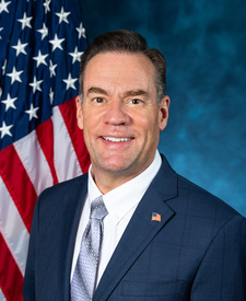
Deer Ridge Lookout is in Idaho’s 1st congressional district. Its representative, Russ Fulcher (R), votes on the laws that decide what happens to this land. Public-lands grade so far: F. See every public-lands vote →