Excelsior Group Camp
3Heads up3 fires, nearest 25 mi
- Right now
- Nobody has saidNo season, no closure, no bookings to read
- Sites
- 2All of them booked ahead
The place
the agency’s own description · what’s there · 7 notices
In the agency’s own words
Located near the rushing Nooksack River in Mt. Baker-Snoqualmie National Forest, Excelsior Group Camp offers access to numerous recreational activities popular in the north Cascades Mountains in Washington state. Keep reading
Recreation
The area surrounding the campground is prime location for hiking, fishing and picnicking in summer and early fall. Hikers and backpackers are especially fortunate to have access to a variety of trails near the campground and in the surrounding areas. Horseshoe Bend Trail is an easy forest hike along the Mt. Baker Scenic Byway, highlighting old-growth forests, gushing whitewater rapids and forest wildflowers. The trail follows the North Fork of the Nooksack River upstream to a stunning view of East Church Mountain. The trailhead can be accessed from the nearby Douglas Fir campground. Another popular hike in the Mt. Baker Ranger District is the Skyline Divide Trail. This trail climbs steadily for two miles through forest into lush, open, flower-filled meadows with stellar views of glacier-draped Mt. Baker. The trail then wanders along Skyline Divide for another 1.5 miles, offering views of rivers, forests and countless peaks.
Facilities
There are two large group sites in the campground. Site A will sleep 50 people and has a group fire ring along with picnic tables ant fire pits at the tent sites. Site B accommodates 50 people and has picnic tables and fire pits. Vault toilets are also provided.
Natural Features
The Mt. Baker-Snoqualmie National Forest showcases rugged peaks, sparkling alpine lakes and old-growth forests. Mt. Baker, the most prominent feature of the nearby Mt. Baker Wilderness, rises to an elevation of 10,781 feet. This active volcano is perpetually snow-capped and mantled with an extensive network of creeping glaciers. Mt. Baker's summit, Grant Peak, is actually a 1,300-foot-deep mound of ice, which hides a massive volcanic crater. Fed by the high snowfields and glaciers of Mt. Baker, Mt.Shuksan and the Twin Sisters range, the Nooksack River system provides habitat for many species. Wildlife in the area includes five native salmon species, elk, bald eagles and black tailed deer. Migratory birds and black bears find ample habitat in the surrounding ecosystems. Contact Info For facility specific information, please call (360) 386-8214.
Nearby Attractions
Visitors enjoy hiking, picnicking and photography in the Heather Meadows area located along the upper reaches of the Mt. Baker Scenic Byway, SR 542. Many popular hikes and climbing routes are located in the surrounding Mt. Baker Wilderness and backpackers enjoy visiting the northern reaches of North Cascades National Park.
What the agency tells you
Please store food properly, so not to attract wildlife
Gate keys are available from the Douglas Fir Campground host
Groceries, firewood and other conveniences are available in the nearby community of Glacier
Everything else this campground posts · 4
Fire Restrictions: Fire restrictions may be imposed at any time due to hot, dry weather conditions, at which time campfires and charcoal fires may not be allowed.
Refunds: Refund requests made through www.recreation.gov will be charged a $10 processing fee. This fee is retained by the reservation service contractor along with the non-refundable reservation fee. All requests for the return of the non-refundable reservation fee and the cancellation fee will be declined by the campground concessionaire as they did not receive these fees (these are the fees retained by the reservation contractor, a different entity).
Don't Move Firewood: Please protect Pacific Northwest forests by preventing the spread of invasive species. Firewood can carry insects and diseases that can threaten the health of our western forests. You can make a difference by obtaining and burning your firewood near your camping destination. Visit Dontmovefirewood.org for further information.
Click here for more information about Mt. Baker-Snoqualmie National Forest
Tents and rigs
- Sites
- 2 · 2 group
- Hookups
- None
- Longest rig
- 30 ft
- Accessible sites
- None listed
- Pets
- Allowed
- Campfires
- Allowed, barring fire bans
- Shade
- Every site
Facilities
- Toilets
- Vault Toilets
- “…and has picnic tables and fire pits. Vault toilets are also provided. Natural Features The Mt.…”
- Stay limit
- 14 nights
- recreation.gov facility rule maxStay
Around the campground
- On the water
- Lake, River, Meadow
- Fishing
- Hiking
- Night sky · 367th darkest of 400 in WA
- Bortle 4
No reading yet, book on recreation.gov
Every site here is reservable, and the record lists none held back for anyone who drives up.
No availability snapshot inside the last 36 hours, so this page draws nothing rather than ageing a reading into fiction.
Watch for a cancellation
Full? Watch it.
One email when a night opens, plus More Than Just Parks dispatches. Unsubscribe any time.
We read recreation.gov once an hour, at 40 minutes past, and write the first time a site in your window is free for the nights you asked for.
Scanners that check every few minutes exist, and most of them charge. This one is free, it reads the same calendar, and it won’t always be first.
We make nothing when you book. The link goes straight to the government.
Every line of the receipt · 9
What you actually pay
Who keeps the booking fee
The agency’s own policy text says the reservation fee and the cancellation processing fee are “retained by the reservation service contractor”, and that a campground concessionaire will decline to refund them because “they did not receive these fees”. Recreation.gov is run under contract by Booz Allen Hamilton. What share of your booking fee the contractor keeps isn’t published in any federal dataset we can read, so we print no number for it. Our reporting on the contract →
How we know this receipt · 4
rules read Sep 9, 2026 · record Aug 23, 2026 · How we know all this
The sites
2 sites · the site map
All 2 sites
Getting there
the map and the coordinate · the agency’s directions · the phone number
Where it is
 Douglas Fir CampgroundMt. Baker National Forest · 4.1 mi
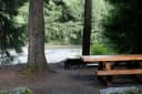 Silver Fir CampgroundMt. Baker National Forest · 5.7 mi
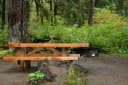 Park Creek CampgroundMt. Baker National Forest · 14 mi
 Swift Creek CampgroundMt. Baker National Forest · 15 mi
 Panorama Point CampgroundMt. Baker National Forest · 15 mi
 Boulder Creek CampgroundMt. Baker National Forest · 15 mi
From Seattle, Washington, go north on I-5 to Bellingham. Take exit 255 onto Sunset Drive/Mt. Baker Highway SR 542. Turn right (east) on SR 542 and continue past the town of Glacier near mile 33. Continue past Glacier approximately 7 miles to the campground. The sign for the campground is located on the left (north) side of the highway. The campground access road is on the right (south) side of the highway, just before mile post 40. Turn right on the access road and then take the first right through the gated entrance of the campground. Site B is the first site on the left. Site A is the loop at the end of the driveway.
The weather
the next four days · the thirty-year normal
Next four days, and the thirty-year normal
Forecast
NWS forecast for Glacier, WA
Typical weather
Typical October night 41°F, day 56°F.
Coldest month of the year: typical January night 29°F, below freezing. Bring a bag rated colder than that, and expect ice in the water bottle.
Daily high and lowDays with 0.10 in or more
A normal is the 1991-2020 average for the month, not a forecast: about half of all Augusts are colder than the August line. The seven-day forecast above answers the other question.
The land, and who answers for it
what threatens it · who answers for it
Roadless country, and what’s coming for it
You’re camping on ground somebody wants. We track the threats and the comment deadlines.
Who answers for this land
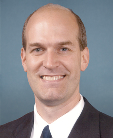
Excelsior Group Camp is in Washington’s 2nd congressional district. Its representative, Rick Larsen (D), votes on the laws that decide what happens to this land. Public-lands grade so far: A+. See every public-lands vote →