Frying Pan
- Right now
- Closed for the seasonOut of the season the agency publishes
- A night
- $25From, per site
- Sites
- 1211 on recreation.gov
- Season
- May 1 – September 30Open May 1 through September 30
The place
the agency’s own description · what’s there · 8 notices
In the agency’s own words
Frying Pan Campground is located on the Fishlake Scenic Byway in central Utah, just 3 miles north of Fish Lake, at an elevation of 9,000 feet. Visitors enjoy boating, fishing and exploring local trails. View Frying Pan Campground Map Recreation Fish Lake is Utah's largest natural mountain lake and covers 2,500 acres. It is famous for its 20-40 pound Mackinaw lake trout. Anglers also enjoy fishing for rainbow trout and splake. Boating, canoeing, swimming and scuba diving are popular activities. The scenic Lakeshore National Recreation Trail extends around the eastern side of the lake. Hikers are rewarded with stunning lake views after climbing 900 feet in elevation. Keep reading
Facilities
The campground contains one group site that can accommodate up to 100 people, with picnic tables, a campfire ring and large parking area. Several single-family sites are available as well. Flush toilets and drinking water are provided. Roads and parking spurs are paved. Three resorts are located in the Fish Lake Basin, offering camping and fishing supplies, RV parks with hookups, cabin and boat rentals, marinas, gas, restaurants, groceries, laundry facilities and showers. The resorts are open from Memorial Day to Labor Day.
Natural Features
The campground sits on a sagebrush-covered hillside above the valley floor and offers views of the north end of Fish Lake Basin. Aspen trees forest the site, providing limited shade.
Nearby Attractions
Johnson Valley Reservoir is just north of Fish Lake, offering additional fishing and boating opportunities. The 5-mile Pelican Canyon Trail begins nearby at Bowery Creek Campground. It leads through meadows and dense forests of spruce, pine and aspen as it climbs to the 11,633-foot Fish Lake Hightop.
What the agency tells you
This is a high elevation facility; use caution when traveling from lower elevations and be prepared for inclement weather.
There are no electricity, water or sewer hookups at the campground.
This is a 'pack it in-pack it out' facility. Please bring your own garbage bags. Dumpsters are available within Fishlake Basin.
Everything else this campground posts · 5
Camping is limited to 16 days.
Street legal and non-stree legal vehicles are allowed for access and egress only.
Any vehicles or trailers that can not fit in the designated site must be relocated to another site purchased at full site price. Check area map for available free parking.
Don't Move Firewood: Help prevent the spread of tree-killing pests in our national forests by obtaining firewood near your destination and burning it on-site. For more information visit dontmovefirewood.org.
Discharging a firearm of any kind is prohibited: this includes BB guns, slingshots, paintball guns etc. Take these activities outside of the campground please.
Tents and rigs
- Sites
- 12 · 1 group
- Hookups
- None
- Longest rig
- 99 ft
- Paved pads
- All
- Accessible sites
- None listed
- Campfires
- Allowed, barring fire bans
Facilities
- Toilets
- Flush Toilets
- “…sites are available as well. Flush toilets and drinking water are provided. Roads and parking…”
- Drinking water
- Yes
- “…are available as well. Flush toilets and drinking water are provided. Roads and parking spurs are paved.…”
Around the campground
- On the water
- Reservoir, Lake, Creek, Meadow
- Biking
- Boating
- Fishing
- Hiking
- Wildlife viewing
- Night sky · 75th darkest of 458 in UT
- Bortle 2
- Fall color · reported 14 days ago, 11 km away
- Patchy color
No reading yet, book on recreation.gov
recreation.gov lists 11 of the 12 campsites the agency files here. The rest aren’t on its booking system, so a reservation won’t get you one.
No availability snapshot inside the last 36 hours, so this page draws nothing rather than ageing a reading into fiction.
Watch for a cancellation
Full? Watch it.
One email when a night opens, plus More Than Just Parks dispatches. Unsubscribe any time.
We read recreation.gov once an hour, at 40 minutes past, and write the first time a site in your window is free for the nights you asked for.
Scanners that check every few minutes exist, and most of them charge. This one is free, it reads the same calendar, and it won’t always be first.
Tell me when the season opens
Watch for the season to open
One email when the season goes on sale, plus More Than Just Parks dispatches. Unsubscribe any time.
We check once an hour, at 40 minutes past, and write the first time the agency has that season on sale.
Scanners that check every few minutes exist, and most of them charge. This one is free, it reads the same calendar, and it won’t always be first.
We make nothing when you book. The link goes straight to the government.
Every line of the receipt · 13
What you actually pay
Derived by CAMPANAC: the agency’s published rate for this season, $25 a night, plus one $8 recreation.gov reservation fee for the booking. A weekend here means Friday and Saturday night, booked once. Optional charges (an extra vehicle, a second tent, a dump-station fee) are listed separately and aren’t in this total.
Who keeps the booking fee
The agency’s own policy text says the reservation fee and the cancellation processing fee are “retained by the reservation service contractor”, and that a campground concessionaire will decline to refund them because “they did not receive these fees”. Recreation.gov is run under contract by Booz Allen Hamilton. What share of your booking fee the contractor keeps isn’t published in any federal dataset we can read, so we print no number for it. Our reporting on the contract →
How we know this receipt · 5
rules read Sep 9, 2026 · rates Oct 1, 2026 · How we know all this
The sites
12 sites · which ones have room · the site map
The sites, ranked
from 11 mapped sitesAll 12 sites
Toilet distances are OpenStreetMap’s, measured for 12 of the 12 sites listed. A site with no reading is unknown, never far.
The price is derived by CAMPANAC, not published per site: the per-night rate this campground publishes for each site’s own site type. 11 of the 12 sites listed carry one, and a site whose type has no published rate sits out of the price rather than being called free.
Measured shade is NLCD Tree Canopy Cover 2024 (USDA Forest Service / MRLC) read at the site’s own coordinate, 27% canopy or more, and only for the sites the agency gave no Shade value. It never changes the agency’s own shaded count beside it.
| GRP | G1 | group standard nonelectric | 99 ft | 284 ft | 2,936 ft | 123 ft | $110 |
| SINGLE | 001 | type not stated | 3,116 ft | 101 ft | |||
| SINGLE | 002 | standard nonelectric | 34 ft | 194 ft | 3,182 ft | 76 ft | $25 |
| SINGLE | 003 | standard nonelectric | 53 ft | 103 ft | 3,372 ft | 192 ft | $25 |
| SINGLE | 004 | standard nonelectric | 40 ft | 103 ft | 3,443 ft | 293 ft | $25 |
| SINGLE | 005 | standard nonelectric | 30 ft | 71 ft | 3,637 ft | 444 ft | $25 |
| SINGLE | 006 | standard nonelectric | 37 ft | 71 ft | 3,621 ft | 412 ft | $25 |
| SINGLE | 007 | standard nonelectric | 37 ft | 103 ft | 3,506 ft | 310 ft | $25 |
| SINGLE | 008 | standard nonelectric | 40 ft | 106 ft | 3,556 ft | 343 ft | $25 |
| SINGLE | 009 | standard nonelectric | 36 ft | 100 ft | 3,425 ft | 212 ft | $25 |
| SINGLE | 010 | standard nonelectric | 35 ft | 100 ft | 3,481 ft | 284 ft | $25 |
| SINGLE | 011 | standard nonelectric | 41 ft | 237 ft | 3,149 ft | 179 ft | $25 |
Getting there
the map and the coordinate · the agency’s directions · the phone number
Where it is
 Tasha EquestrianFishlake National Forest · 1.4 mi
 Paiute CampgroundFishlake National Forest · 1.5 mi
 Bowery CreekFishlake National Forest · 3.0 mi
 Bowery Creek CampgroundFishlake National Forest · 3.7 mi
 MackinawFishlake National Forest · 4.2 mi
 Twin Creeks PicnicFishlake National Forest · 4.7 mi
From Highway 24 northwest of Loa, Utah, take Highway 25 northeast approximately 15 miles to the campground.
The weather
the next four days
Next four days, and the thirty-year normal
Forecast
NWS forecast for Fremont, UT
The land, and who answers for it
what threatens it · who answers for it
Roadless country, and what’s coming for it
You’re camping on ground somebody wants. We track the threats and the comment deadlines.
Who answers for this land
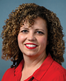
Frying Pan is in Utah’s 2nd congressional district. Its representative, Celeste Maloy (R), votes on the laws that decide what happens to this land. Public-lands grade so far: F. See every public-lands vote →