Gleason's Landing Campground and River Access
- Right now
- Closed for the seasonOut of the season the agency publishes
- Season
- May 3 – October 10Open May 3 through October 10
The place
the agency’s own description · what’s there
In the agency’s own words
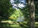
Gleasons Landing is a very popular campground on the banks of the Pere Marquette River. With a selection of shaded and secluded spots, the campground is perfect for peaceful nature immersion. The Pere Marquette River was designated a National Scenic River in 1978, the first in Michigan, and it regularly attracts many canoeing, kayaking and fishing enthusiasts. The 66-mile stretch of river begins east of Baldwin and empties into Lake Michigan at Ludington. Natural Features: The campground sits on a bluff overlooking the picturesque Pere Marquette River. It is surrounded by a mix of white pine and oak trees. Keep reading
The Huron-Manistee National Forests encompass a million acres throughout the northern portion of Michigan's Lower Peninsula. The forests provide recreation opportunities for visitors, habitat for fish and wildlife and resources for local industry. Brochure with Map : This brochure is set to print on 11 x 17 paper, landscape (wide) orientation. To print on 8 1/2 x 11 paper set the print area to "shrink to printable area", this will make the text on the page smaller. Flickr Photo Album Fish Your National Forests: This site can be accessed by Passenger Car; Fish available include: Salmon, Steelhead, Trout, Native Trout; Types of fishing available include: Wade, Shore, Non-motorized boat, Float tube, Fly, Spin, Bait;
Around the campground
- On the water
- Lake, River
Phone before you drive
recreation.gov publishes no availability for a campground you can’t reserve, so there’s no thirty-night reading to draw here. The season bar above is what the agency does publish.
Every line of the receipt · 4
What you actually pay
“Camping (per night) Single sites: $30.00 Day Use (per vehicle): Per day: $7.00 Extra vehicle: $10.00” · the U.S. Forest Service’s own fee record
How we know this receipt · 5
record Aug 24, 2026 · How we know all this
Getting there
the map and the coordinate
Where it is
 Gleasons LandingManistee National Forest · 0.0 miBowman Bridge Campground and River AccessManistee National Forest · 1.5 mi
 Bowman BridgeManistee National Forest · 1.6 miClaybanks CampgroundManistee National Forest · 1.9 miBowman Lake CampgroundManistee National Forest · 2.7 miSulak CampgroundManistee National Forest · 5.9 mi
The weather
the next four days · the thirty-year normal
Next four days, and the thirty-year normal
Forecast
NWS forecast for Baldwin, MI
Typical weather
Typical October night 37°F, day 60°F.
Coldest night of the open season: typical October night 37°F. Bring the bag rated for it.
Daily high and lowDays with 0.10 in or moreOutside the published season
A normal is the 1991-2020 average for the month, not a forecast: about half of all Julys are colder than the July line. The seven-day forecast above answers the other question.
The land, and who answers for it
who answers for it
Who answers for this land

Gleason's Landing Campground and River Access is in Michigan’s 2nd congressional district. Its representative, John Moolenaar (R), votes on the laws that decide what happens to this land. Public-lands grade so far: F. See every public-lands vote →