Gravel Flat Camping Area
2Heads up2 fires, nearest 14 mi
This is how it should work.
- Right now
- OpenThe agency lists it open
- A night
- FreeNo camping fee
- Season
- Year-roundOpen year-round
The place
the agency’s own description · what’s there
In the agency’s own words
The campground is located along the north side of the Kings River on a large sandy flat area. There is no shade so it is very hot during the summer months, but is a great place for camping in the spring and fall. Access is paved and dirt (last 1 mile). Vehicles must stay on roads. Each site has a table and grill. Please pack out all garbage. Poison Oak abounds in this area, please avoid plants with three leaf clusters: "Leaves of three, let it be!" Watch for rattlesnakes. When fire restrictions are in place (usually during the summer months) NO campfires or charcoal fires are permitted. Camp stoves are permitted. There is no cell phone coverage in the area, but a pay phone is available at Balch Camp.
Around the campground
- On the water
- River
- Cell signal · Cell signal · Forest Service says
- None
Nothing to book, just show up
One of 1,623 federal campgrounds where the site still goes to whoever pulls in first, and it costs nothing at all. Get there before noon on a summer weekend.
recreation.gov publishes no availability for a campground you can’t reserve, so there’s no thirty-night reading to draw here. The season bar above is what the agency does publish.
Every line of the receipt · 4
What you actually pay
Derived by CAMPANAC: the agency’s own record says there’s no camping fee, and no booking fee, because this campground takes no reservations. A weekend here means Friday and Saturday night. Optional charges (an extra vehicle, a second tent, a dump-station fee) are listed separately and aren’t in this total.
How we know this receipt · 5
record Aug 24, 2026 · How we know all this
Getting there
the map and the coordinate
Where it is
 Camp Four and Half CabinSequoia National Forest · 0.5 miCamp 4 CampgroundSequoia National Forest · 0.6 miMill Flat CampgroundSequoia National Forest · 1.1 miBear Wallow Camping AreaSierra National Forest · 1.3 mi
 Kirch Flat Group CampgroundSierra National Forest · 2.2 miKirch Flat CampgroundSierra National Forest · 2.3 mi
The weather
the next four days · the thirty-year normal
Next four days, and the thirty-year normal
Forecast
NWS forecast for Squaw Valley, CA
Typical weather
Typical October night 53°F, day 75°F.
Coldest month of the year: typical December night 37°F. Bring the bag rated for it.
Daily high and lowDays with 0.10 in or more
A normal is the 1991-2020 average for the month, not a forecast: about half of all Julys are colder than the July line. The seven-day forecast above answers the other question.
The land, and who answers for it
what threatens it · who answers for it
Roadless country, and what’s coming for it
You’re camping on ground somebody wants. We track the threats and the comment deadlines.
Who answers for this land
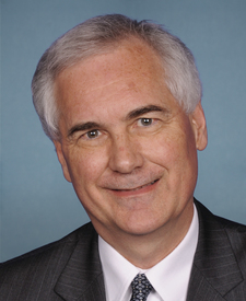
Gravel Flat Camping Area is in California’s 5th congressional district. Its representative, Tom McClintock (R), votes on the laws that decide what happens to this land. Public-lands grade so far: F. See every public-lands vote →
How we know
every fact on this page, and where it came from
“…are permitted. Camp stoves are permitted. There is no cell phone coverage in the area, but a pay phone is available at Balch Camp.”