Green River Float-in Campsites
- Right now
- Taking bookingsSites offered on 30 of the next 30 nights read 15:26 UTC
- A night
- $13From, per site
- Sites
- 17All of them booked ahead
The place
the agency’s own description · what’s there · 7 notices
In the agency’s own words
Take a step back in time and traverse the same scenic wonders that explorers such as John Wesley Powell and William Ashley once explored. The Green River provides spectacular fishing and river-running opportunities, as well as unique geology, outlaw history and Native American rock art. So come to navigate the waters and cast a rod in an adventure the whole family can enjoy. The Green River Float-In Campsites contain 17 sites for river goers to camp along the mighty Green River. Some of these sites can be reached on foot but most of these sites can only be reached by boat. Keep reading
Recreation
Section "A" (Flaming Gorge Dam to Little Hole Boat Launch) Section "A" of the Green River begins just below the Flaming Gorge Dam and proceeds seven miles through a narrow, breathtaking canyon to the Little Hole take-out. The towering red canyon cliffs, ponderosa pine, glassy clear water, abundant trout and rapids (class I and II) make section "A" of the Green River world famous. The Little Hole National Recreation Trail allows foot access to all seven miles of this stretch of river. Section "B" (Little Hole to Browns Park) It's a little more remote but that means there are fewer people, if that's the experience you're looking for. Limited access in this section allows for healthy brown trout populations to thrive. There are 17 river camps in section "B" that can be accessed only by hiking or floating in. Section "C" (Browns Park to the Utah/Colorado Border) Section "C" is the longest of the three sections. It meanders through the high desert valley of Browns Park to the Colorado state line, with wide open features and a lot of flat water. It's considered the best place to catch a football size trout on a dry fly, but it is also said to be the most challenging for fishing. The Green River offers excellent fishing for rainbow, brown and cutthroat trout. For more information on fishing the Green River, please visit Utah's Department of Wildlife Resources website .
Facilities
All of the river camps are equipped with a picnic table, campfire ring with benches, tent pads and a blind for a portable toilet. No potable water is available. Vault toilets can be found near Cottonwood Camp and Red Creek Camp. Float-in distance from Boat Launch Areas to Campsite: Stonefly I & II (river left) Distance From Spillway Launch: 8.2 miles Distance From Little Hole Launch: 1 mile Accessible by Foot: Yes Sand (river left) Distance From Spillway Launch: 8.3 miles Distance From Little Hole Launch: 1.1 miles Accessible by Foot: Yes Bootleg (river left) Distance From Spillway Launch: 8.42 miles Distance From Little Hole Launch: 1.22 miles Accessible by Foot: Yes Cats Paw (river left) Distance From Spillway Launch: 8.55 miles Distance From Little Hole Launch: 1.35 miles Accessible by Foot: Yes Cottonwood (river left) Distance From Spillway Launch: 8.75 miles Distance From Little Hole Launch: 1.55 miles Accessible by Foot: Yes Grasshopper I & II (river right) Distance From Spillway Launch: 9.35 miles Distance From Little Hole Launch: 2.15 miles Accessible by Foot: No Jackson Creek (river right) Distance From Spillway Launch: 9.65 miles Distance From Little Hole Launch: 2.45 miles Accessible by Foot: No Cicada (river right) Distance From Spillway Launch: 9.9 miles Distance From Little Hole Launch: 2.7 miles Accessible by Foot: No Trails End (river left) Distance From Spillway Launch: 10 miles Distance From Little Hole Launch: 2.8 miles Accessible by Foot: Yes Big Pine I & II (river left) Distance From Spillway Launch: 10.5 miles Distance From Little Hole Launch: 3.3 miles Accessible by Foot: No Pugmire Pocket (river right) Distance From Spillway Launch: 10.75 miles Distance From Little Hole Launch: 3.55 miles Accessible by Foot: No Red Creek I & II (river right) Distance From Spillway Launch: 11.6 miles Distance From Little Hole Launch: 4.4 miles Accessible by Foot: No Treetop (river right) Distance From Spillway Launch: 12.2 miles Distance From Little Hole Launch: 5 miles Accessible by Foot: No Natural Features The campsites are nestled alongside the beautiful Green River in an area typical of a high desert environment. These sites are surrounded by shady juniper, cottonwood and ponderosa pine trees and during the summer various species of wildflowers dot the landscape. Contact Info For facility specific information, please call (435) 781-5244.
Nearby Attractions
Flaming Gorge National Recreation Area is known not only for its beautiful red cliffs but also for its world-class fishing, boating, hiking, camping, water skiing, jet skiing, canoeing, kayaking, swimming and scuba diving. Click Here to learn more about the Ashley National Forest and the Flaming Gorge National Recreation Area. The Bureau of Reclamation offers guided tours of the Flaming Gorge Dams working hydroelectric plant and the dam itself; the adjacent visitor center contains area history exhibits. In Browns Park, the Bureau of Land Management maintains the historic John Jarvie Ranch. Step back in time and explore the property where John ran a general store, trading post, post office and river ferry. Since Browns Park was a hiding place for outlaws, John became acquainted with many colorful members of Browns Parks history including, Butch Cassidy and the Sundance Kid of the Wild Bunch; outlaws Matt Warner and Isom Dart; and Queen of the Rustlers, Ann Bassett. Click Here for more information about the John Jarvie Ranch. In the nearby town of Dutch John, there are several businesses that can provide services before and during your trip. These businesses include: Flaming Gorge Recreation Services (435)885-3191 Raft Rental, Guided Fishing, Shuttle Service, General Store, Lodging, Bait, Gas Green River Outfitters (435)885-3338 - Raft Rental, Guided Fishing, Shuttle Service, General Store, Lodging, Bait, Gas Flaming Gorge Resort (435)889-3773 - Raft Rental, Guided Fishing, Shuttle Service, General Store, Lodging, Bait, Gas
What the agency tells you
This is a boat-in facility, accessible by water; special regulations apply.
An unofficial trail can be used to access select camps on foot.
No potable water is available at the campsites.
Everything else this campground posts · 4
Requirements to launch: boater must carry a bail bucket, throw line, extra oar and must wear a life jacket while on the water. No motors allowed.
The Forest Service requires the use of portable toilet systems for all campers.
This campsite is located in the Flaming Gorge National Recreation Area and will require the purchase of a Recreational Use Pass
Don't Move Firewood: Help prevent the spread of tree-killing pests in our national forests by obtaining firewood near your destination and burning it on-site. For more information visit dontmovefirewood.org.
Tents and rigs
- Sites
- 17 · 17 boat-in
- Hookups
- None
- Accessible sites
- None listed
- Pets
- Allowed
- Campfires
- Allowed, barring fire bans
- Shade
- Every site
Facilities
- Toilets
- Vault Toilets · Portable Toilets
- “…benches, tent pads and a blind for a portable toilet. No potable water is available. Vault toilets can…”
- Drinking water
- None, bring your own
- “…pads and a blind for a portable toilet. No potable water is available. Vault toilets can be found near…”
- Boat ramp
- Yes
- Store
- Nearby
- Stay limit
- 3 nights
- recreation.gov facility rule maxStay
Around the campground
- On the water
- River, Creek
- Boating
- Fishing
- Hiking
- Wildlife viewing
7 of 17 sites open on Sat, Oct 17read 15:26 UTC
Every site here is reservable, and the record lists none held back for anyone who drives up.
OpenBooked
Watch for a cancellation
Full? Watch it.
One email when a night opens, plus More Than Just Parks dispatches. Unsubscribe any time.
We read recreation.gov once an hour, at 40 minutes past, and write the first time a site in your window is free for the nights you asked for.
Scanners that check every few minutes exist, and most of them charge. This one is free, it reads the same calendar, and it won’t always be first.
We make nothing when you book. The link goes straight to the government.
Every line of the receipt · 12
What you actually pay
Derived by CAMPANAC: the agency’s published rate for this season, $13 a night, plus one $8 recreation.gov reservation fee for the booking. A weekend here means Friday and Saturday night, booked once. Optional charges (an extra vehicle, a second tent, a dump-station fee) are listed separately and aren’t in this total.
Who keeps the booking fee
The agency’s own policy text says the reservation fee and the cancellation processing fee are “retained by the reservation service contractor”, and that a campground concessionaire will decline to refund them because “they did not receive these fees”. Recreation.gov is run under contract by Booz Allen Hamilton. What share of your booking fee the contractor keeps isn’t published in any federal dataset we can read, so we print no number for it. Our reporting on the contract →
How we know this receipt · 5
recreation.gov availability, read 15:26 UTC · rules read Sep 9, 2026 · rates Sep 10, 2026 · How we know all this
The sites
17 sites · which ones have room · the site map
The sites, ranked
from 17 mapped sitesAll 17 sites
The price is derived by CAMPANAC, not published per site: the per-night rate this campground publishes for each site’s own site type. 17 of the 17 sites listed carry one, and a site whose type has no published rate sits out of the price rather than being called free.
| Green River | Big Pine I | boat in | 986 ft | 192 ft | $13 |
| Green River | Big Pine II | boat in | 986 ft | 255 ft | $13 |
| Green River | Bootleg | boat in | 1050 ft | 179 ft | $13 |
| Green River | Cats Paw | boat in | 1050 ft | 170 ft | $13 |
| Green River | Cicada | boat in | 1192 ft | 694 ft | $13 |
| Green River | Cottonwood | boat in | 1122 ft | 156 ft | $13 |
| Green River | Grasshopper I | boat in | 1519 ft | 1,008 ft | $13 |
| Green River | Grasshopper II | boat in | 1519 ft | 526 ft | $13 |
| Green River | Jackson Creek | boat in | 1339 ft | 764 ftJackson Creek | $13 |
| Green River | Pugmire Pocket | boat in | 1391 ft | 655 ft | $13 |
| Green River | Red Creek I | boat in | 1247 ft | 693 ft | $13 |
| Green River | Red Creek II | boat in | 1247 ft | 645 ft | $13 |
| Green River | Sand | boat in | 998 ft | under 10 ft | $13 |
| Green River | Stonefly I | boat in | 872 ft | under 10 ft | $13 |
| Green River | Stonefly II | boat in | 872 ft | 27 ft | $13 |
| Green River | Trails End | boat in | 1192 ft | 141 ft | $13 |
| Green River | Treetops | boat in | 3956 ft | 615 ft | $13 |
Getting there
the map and the coordinate · the agency’s directions · the phone number
Where it is
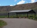 Dripping Springs Campground (UT)Flaming Gorge National Recreation Area · 2.3 miBig Pine II River CampFlaming Gorge National Recreation Area · 2.5 mi
 Arch Dam CampgroundFlaming Gorge National Recreation Area · 5.0 mi
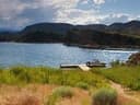 Dutch John Draw Group CampgroundFlaming Gorge National Recreation Area · 5.1 mi
 Dutch John Draw CampgroundFlaming Gorge National Recreation Area · 5.9 mi
 Mustang Ridge CampgroundFlaming Gorge National Recreation Area · 6.6 mi
From Vernal, Utah: Take U.S. Highway 191 north for 45 miles. Cross the Flaming Gorge Dam and turn right on the road leading to upper launch site at Spillway Boat Ramp. To launch from Little Hole continue on Highway 191 to the town of Dutch John and turn right on Little Hole Road. Follow that road for about 6 miles until you arrive at the Little Hole Boat Launch Area.
From Rock Springs, Wyoming: Take U.S. Highway 191 south for 63 miles. Just before crossing the dam, turn left on the road to Spillway Boat Ramp, or at the town of Dutch John, turn left off Highway 191 and go east on Little Hole Road about 6 miles to Little Hole Boat Launch Area.
The weather
the next four days · the thirty-year normal
Next four days, and the thirty-year normal
Forecast
NWS forecast for Dutch John, UT
Typical weather
Typical October night 32°F, day 62°F.
Coldest month of the year: typical January night 13°F, below freezing. Bring a bag rated colder than that, and expect ice in the water bottle.
Daily high and lowDays with 0.10 in or more
A normal is the 1991-2020 average for the month, not a forecast: about half of all Julys are colder than the July line. The seven-day forecast above answers the other question.
The land, and who answers for it
what threatens it · who answers for it
Roadless country, and what’s coming for it
You’re camping on ground somebody wants. We track the threats and the comment deadlines.
Who answers for this land

Green River Float-in Campsites is in Utah’s 3rd congressional district. Its representative, Mike Kennedy (R), votes on the laws that decide what happens to this land. Public-lands grade so far: F. See every public-lands vote →