Hole-in-the-Wall Campground
5Heads uppark alerts
- Right now
- OpenThe agency lists it open
- A night
- $25From, per site
- Sites
- 3837 on recreation.gov
- Season
- Year-roundOpen year-round
The place
the agency’s own description · what’s there · 9 notices
In the agency’s own words
Mojave preserves a diverse mosaic of ecological habitats and a 10,000 year history of human connection with the desert. Offering extensive opportunities to experience desert landscapes, the preserve promotes understanding and appreciation for the increasingly threatened resources of the Mojave Desert. This remote preserve encourages a sense of discovery and a connection to wild places. At 4,400 feet in elevation, Hole-in-the-Wall Campground is surrounded by sculptured volcanic rock walls and makes a great base camp for hikers. Keep reading
Recreation
There are over 1.6 million acres to explore. The popular main attractions are accessible by paved and unpaved roads and more remote areas of the park will require a high clearance, 4WD vehicle. Check out the must see highlights: Mojave National Preserve Must See Highlights Explore the preserve off the beaten path! Take your street legal vehicle along the historic Mojave Road or visit the multitude of canyons and mining roads. Be sure to have high clearance and 4WD. Do not enter mines. 4WD Routes Mojave offers many hikes to choose! Hiking Visit Zzyzx and learn about its history. It is also a great birding location due to its pond.
Facilities
Hole-in-the-Wall has 38 campsites. Each campsite contains 1-2 vehicle parking spots, picnic table, fire ring, and tent area. Water spigots and vault toilets are available around the campground. Camp hosts are typically present in the peak season months. A dump station is available for campers. Free WiFi is available 24/7 at the Hole-in-the-Wall Information Center.
Natural Features
Three of the four major North American deserts are found at Mojave National Preserve: the Mojave, Great Basin, and Sonoran. Dozens of seeps and springs coupled with varied elevations and soil types create microhabitats that support a diversity of plant and animal life. Cactus gardens, relict plant communities of white fir and chaparral and the densest, largest Joshua tree forest are all found here. Geologically, the region is just as diverse as it is ecologically. Mountain ranges, dry riverbeds, great mesas, towering sand dunes, striking cinders cones, domes and lava flows define Mojave. Ancient rocks that date back to 2.5 billion years old have been discovered in the Clark Mountains. Set out to search for the blooms across the preserve: Wildflowers Visit the world’s largest Joshua Tree forest around the Cima Dome area.
Nearby Attractions
Popular Hikes: Kelso Dunes - Hike to the top of our most popular sand dune! Rings Loop – 1.5 miles, Discover how Hole-in-the-Wall got its name as you ascend narrow Banshee Canyon with the help of metal rings mounted in the rock. Barber Peak - This loop trail encircles Barber Peak just west of Hole-in-the-Wall Campground. Lava Tube - Explore an underground wonder! High clearance vehicle recommended. Teutonia Peak - A mixed Joshua tree forest and Joshua tree graveyard beckon en route to a rocky peak with expansive views of Cima Dome and beyond! This area burned in August 2020.
What the agency tells you
Maximum occupancy is 8 people. Parking is limited to 2 vehicles/trailers per site, a truck and trailer count as two vehicles.
Plan ahead: Gas and food are not available within the preserve.
Generator hours are from 8am - 7pm. Quiet hours are from 9pm to 7am.
Everything else this campground posts · 6
Wood gathering is prohibited within the park.
Washing dishes or clothing is not permitted at water faucets.
All pets must be always leashed (6 feet or less in length). Pets must not be left unattended.
Feeding wildlife is prohibited.
There is no cell coverage at the campground. Please have your confirmation and site information available.
Free public Wi-Fi is available 24/7 at the Hole-in-the-Wall Information Center.
Tents and rigs
- Sites
- 38 · 2 walk-in
- Hookups
- None
- Longest rig
- 30 ft
- Accessible sites
- None listed
- Pets
- Allowed
- Campfires
- Allowed, barring fire bans
- Shade
- Little
Facilities
- Toilets
- Vault Toilets - year round
- Drinking water
- Yes
- Dump station
- Yes
Around the campground
- Night sky · 401st darkest of 1,201 in CA
- Bortle 3
31 of 74 site-nights open this Friday and Saturdayread 15:52 UTC
recreation.gov lists 37 of the 38 campsites the agency files here. The rest aren’t on its booking system, so a reservation won’t get you one.
OpenBooked
Watch for a cancellation
Full? Watch it.
One email when a night opens, plus More Than Just Parks dispatches. Unsubscribe any time.
We read recreation.gov once an hour, at 40 minutes past, and write the first time a site in your window is free for the nights you asked for.
Scanners that check every few minutes exist, and most of them charge. This one is free, it reads the same calendar, and it won’t always be first.
We make nothing when you book. The link goes straight to the government.
Every line of the receipt · 12
What you actually pay
Derived by CAMPANAC: the agency’s published rate for this season, $25 a night, plus one $8 recreation.gov reservation fee for the booking. A weekend here means Friday and Saturday night, booked once. Optional charges (an extra vehicle, a second tent, a dump-station fee) are listed separately and aren’t in this total.
Who keeps the booking fee
The agency’s own policy text says the reservation fee and the cancellation processing fee are “retained by the reservation service contractor”, and that a campground concessionaire will decline to refund them because “they did not receive these fees”. Recreation.gov is run under contract by Booz Allen Hamilton. What share of your booking fee the contractor keeps isn’t published in any federal dataset we can read, so we print no number for it. Our reporting on the contract →
How we know this receipt · 5
recreation.gov availability, read 15:52 UTC · rules read Sep 9, 2026 · rates Sep 10, 2026 · How we know all this
The sites
38 sites · which ones have room · the site map
The sites, ranked
from 37 mapped sitesAll 38 sites
Toilet distances are OpenStreetMap’s, measured for 38 of the 38 sites listed. A site with no reading is unknown, never far.
The price is derived by CAMPANAC, not published per site: the per-night rate this campground publishes for each site’s own site type. 35 of the 38 sites listed carry one, and a site whose type has no published rate sits out of the price rather than being called free.
| A | 1 | type not stated | 25 ft | 7.4 mi | 171 ft | ||
| A | 10 | standard nonelectric | 25 ft | 60 ft | 7.4 mi | 185 ft | $25 |
| A | 11 | standard nonelectric | 25 ft | 105 ft | 7.4 mi | 83 ft | $25 |
| A | 12 | standard nonelectric | 25 ft | 143 ft | 7.4 mi | 131 ft | $25 |
| A | 13 | standard nonelectric | 30 ft | 118 ft | 7.4 mi | 248 ft | $25 |
| A | 14 | standard nonelectric | 30 ft | 118 ft | 7.4 mi | 207 ft | $25 |
| A | 15 | standard nonelectric | 25 ft | 112 ft | 7.4 mi | 235 ft | $25 |
| A | 16 | standard nonelectric | 25 ft | 112 ft | 7.4 mi | 132 ft | $25 |
| A | 17 | standard nonelectric | 25 ft | 119 ft | 7.4 mi | 292 ft | $25 |
| A | 18 | standard nonelectric | 25 ft | 119 ft | 7.4 mi | 201 ft | $25 |
| A | 19 | standard nonelectric | 25 ft | 89 ft | 7.4 mi | 78 ft | $25 |
| A | 2 | standard nonelectric | 25 ft | 130 ft | 7.4 mi | 139 ft | $25 |
| A | 20 | standard nonelectric | 25 ft | 89 ft | 7.4 mi | 134 ft | $25 |
| A | 21 | hike to | 25 ft | 156 ft | 7.4 mi | 353 ft | |
| A | 22 | hike to | 25 ft | 156 ft | 7.4 mi | 216 ft | |
| A | 23 | standard nonelectric | 30 ft | 113 ft | 7.4 mi | 305 ft | $25 |
| A | 24 | standard nonelectric | 25 ft | 113 ft | 7.4 mi | 200 ft | $25 |
| A | 25 | standard nonelectric | 30 ft | 115 ft | 7.4 mi | 87 ft | $25 |
| A | 26 | standard nonelectric | 30 ft | 134 ft | 7.5 mi | 101 ft | $25 |
| A | 27 | standard nonelectric | 25 ft | 122 ft | 7.5 mi | 234 ft | $25 |
| A | 28 | standard nonelectric | 30 ft | 122 ft | 7.5 mi | 296 ft | $25 |
| A | 29 | standard nonelectric | 25 ft | 143 ft | 7.4 mi | 79 ft | $25 |
| A | 3 | standard nonelectric | 25 ft | 67 ft | 7.4 mi | 211 ft | $25 |
| A | 30 | standard nonelectric | 25 ft | 78 ft | 7.4 mi | 149 ft | $25 |
| A | 31 | standard nonelectric | 25 ft | 56 ft | 7.5 mi | 138 ft | $25 |
| A | 32 | standard nonelectric | 25 ft | 56 ft | 7.5 mi | 84 ft | $25 |
| A | 33 | standard nonelectric | 25 ft | 98 ft | 7.5 mi | 32 ft | $25 |
| A | 34 | standard nonelectric | 25 ft | 64 ft | 7.4 mi | 71 ft | $25 |
| A | 35 | standard nonelectric | 30 ft | 103 ft | 7.4 mi | 139 ft | $25 |
| A | 36 | standard nonelectric | 25 ft | 103 ft | 7.5 mi | 171 ft | $25 |
| A | 37 | standard nonelectric | 25 ft | 75 ft | 7.5 mi | 222 ft | $25 |
| A | 38 | standard nonelectric | 30 ft | 75 ft | 7.5 mi | 151 ft | $25 |
| A | 4 | standard nonelectric | 25 ft | 64 ft | 7.4 mi | 134 ft | $25 |
| A | 5 | standard nonelectric | 25 ft | 67 ft | 7.4 mi | 219 ft | $25 |
| A | 6 | standard nonelectric | 25 ft | 87 ft | 7.4 mi | 121 ft | $25 |
| A | 7 | standard nonelectric | 30 ft | 60 ft | 7.4 mi | 240 ft | $25 |
| A | 8 | standard nonelectric | 25 ft | 84 ft | 7.4 mi | 191 ft | $25 |
| A | 9 | standard nonelectric | 25 ft | 78 ft | 7.4 mi | 218 ft | $25 |
25 of 38 listed
Getting there
the map and the coordinate · the agency’s directions · the phone number
Where it is
 Black Canyon Group and Equestrian CampgroundMojave National Preserve · 0.5 mi
 Mid Hills CampgroundMojave National Preserve · 5.9 mi
 Katherine Landing RV ParkLake Mead National Recreation Area · 49 mi
 Katherine Landing CampgroundLake Mead National Recreation Area · 49 mi
 Cottonwood Cove CampgroundLake Mead National Recreation Area · 50 mi
 Cottonwood Cove RV ParkLake Mead National Recreation Area · 50 mi
From Los Angeles, Barstow, and Joshua Tree via Interstate 40: Exit Essex Road and drive north for 10 miles and turn right at the junction to Black Canyon Road. Continue for 10 miles to Hole-in-the-Wall. The roads are paved until the turn-off into the campground. Cell phone service is unreliable.
From Death Valley and Las Vegas via Interstate 15: From the Kelbaker Road, Cima Road, or Nipton Road entrances, make your way to Kelso-Cima Road and turn east onto Cedar Canyon Road. Continue onto Cedar Canyon Road for 6 miles and turn right onto Black Canyon Road for 9 miles.
The weather
the next four days · the thirty-year normal
Next four days, and the thirty-year normal
Forecast
NWS forecast for Cal-Nev-Ari, NV
Typical weather
Typical October night 57°F, day 74°F.
Coldest month of the year: typical December night 40°F. Bring the bag rated for it.
Daily high and lowDays with 0.10 in or more
A normal is the 1991-2020 average for the month, not a forecast: about half of all Julys are colder than the July line. The seven-day forecast above answers the other question.
The land, and who answers for it
what threatens it · who answers for it
What threatens this place
You’re camping on ground somebody wants. We track the threats and the comment deadlines.
Who answers for this land
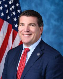
Hole-in-the-Wall Campground is in California’s 23rd congressional district. Its representative, Jay Obernolte (R), votes on the laws that decide what happens to this land. Public-lands grade so far: F. See every public-lands vote →