Indian Flat Group Site
5Heads up5 fires, nearest 27 mi
- Right now
- Listed not openA database flag with no reason and no date
- Sites
- 1All of them booked ahead
The place
the agency’s own description · what’s there · 6 notices
In the agency’s own words
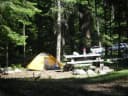
Indian Flat Group Campground is set on the banks of the Bumping River in the eastern foothills of the Cascades mountain range. Situated beneath a towering mixed conifer forest, this site offers a wonderful setting for large groups looking for a secluded camping experience. Keep reading
Recreation
Indian Flat Group Campground is within 10 miles of opportunities to hike, mountain bike, ride horses, ski, raft and enjoy a multitude of outdoor recreational activities throughout the year. Nearby Bumping Lake offers visitors opportunities to boat, fish, swim or simply relax on its sandy beach. The American Ridge Trail offers hikers, overnight backpackers and horseback riders fantastic opportunities to absorb some of the area's stunning beauty. Extending from Bumping River to the notable Pacific Crest trail, the American Ridge Trail offers over 26 miles of towering forests, stretches of meadows, alpine lakes and fantastic ridge line views.
Facilities
Indian Flat Group Campground has one large site and several other spur sites that extend around a campground loop. The campground accommodates up to 65 people and 22 vehicles. The site is equipped with picnic tables, campfire rings and four vault toilets. Drinking water is available at this site.
Natural Features
Okanogan National Forest offers stunning scenic views, with high, glaciated alpine peaks, valleys of old growth forest and rugged shrub-steppe country making up the diverse landscape. Elevations range from below 1,000 feet to more than 9,000 feet. Precipitation varies greatly throughout the area, ranging from approximately 140 inches along the Cascade Crest to only 10 inches along the eastern edge. Visitors can expect many days of warm, sunny weather in the summer, and winters with clear skies and plenty of snow. The surrounding undeveloped wilderness, clean streams and diverse forests support an abundance of wildlife, including deer, squirrels, native fish, black bear and migratory birds. Goat Rocks Wilderness is a stunning adventure for those wanting to traverse higher elevations. Peaks within the area are remnants of an extinct volcano, taking the name "Goat Rocks," in honor of the numerous mountain goats traversing this isolated region. Gilbert Peak is the highest summit in this area, at an elevation of 8,184 feet.
Nearby Attractions
Boulder Cave National Recreation Trail is one of the most popular places in the Naches District. Visitors can walk the accessible trail along the river or explore Boulder Cave. Interpretive signs along the trail explain the geology, plants, animals and fire history of the area. Visitors enjoy Mt. Rainer National Park, where interpretive programs and exhibits offer education about the diverse landscape and history of the area. The Pacific Crest Trail (PCT), one of the world's premier National Scenic Trails, showcases some of North America's most fantastic scenery winding its way its way from Mexico to Canada through California, Oregon and Washington, is accessible near the campground. Visitors will also enjoy traversing the Chinook Scenic Byway, considered one of Washington's premier driving excursions. Spectacular views of Mount Rainier and surrounding landscape dominate this 92-mile journey.
What the agency tells you
No trash collection provided; please pack out all garbage
No electric hookups available
Security is provided by access through a locked gate; the combination to the lock will be included in confirmation letter
Everything else this campground posts · 3
Livestock not allowed at this campground
Click here for more information about Okanogan National Forest
Don't Move Firewood: Please protect Pacific Northwest forests by preventing the spread of invasive species. Firewood can carry insects and diseases that can threaten the health of our western forests. You can make a difference by obtaining and burning your firewood near your camping destination. Visit Dontmovefirewood.org for further information.
Tents and rigs
- Sites
- 1 · 1 group
- Hookups
- None
- Longest rig
- 30 ft
- Accessible sites
- None listed
- Shade
- Every site
Facilities
- Toilets
- Vault Toilets
- “…picnic tables, campfire rings and four vault toilets. Drinking water is available at this site. Natural…”
- Drinking water
- Yes
- “…campfire rings and four vault toilets. Drinking water is available at this site. Natural Features…”
Around the campground
- On the water
- Lake, River, Creek, Beach, Meadow
- Birding
- Wildlife viewing
- Night sky · 266th darkest of 400 in WA
- Bortle 3
No reading yet, book on recreation.gov
Every site here is reservable, and the record lists none held back for anyone who drives up.
No availability snapshot inside the last 36 hours, so this page draws nothing rather than ageing a reading into fiction.
Watch for a cancellation
Full? Watch it.
One email when a night opens, plus More Than Just Parks dispatches. Unsubscribe any time.
We read recreation.gov once an hour, at 40 minutes past, and write the first time a site in your window is free for the nights you asked for.
Scanners that check every few minutes exist, and most of them charge. This one is free, it reads the same calendar, and it won’t always be first.
Tell me when the season opens
Watch for the season to open
One email when the season goes on sale, plus More Than Just Parks dispatches. Unsubscribe any time.
We check once an hour, at 40 minutes past, and write the first time the agency has that season on sale.
Scanners that check every few minutes exist, and most of them charge. This one is free, it reads the same calendar, and it won’t always be first.
We make nothing when you book. The link goes straight to the government.
Every line of the receipt · 13
What you actually pay
Who keeps the booking fee
The agency’s own policy text says the reservation fee and the cancellation processing fee are “retained by the reservation service contractor”, and that a campground concessionaire will decline to refund them because “they did not receive these fees”. Recreation.gov is run under contract by Booz Allen Hamilton. What share of your booking fee the contractor keeps isn’t published in any federal dataset we can read, so we print no number for it. Our reporting on the contract →
How we know this receipt · 5
rules read Sep 9, 2026 · rates Oct 1, 2026 · How we know all this
The sites
1 sites · the site map
All 1 sites
The price is derived by CAMPANAC, not published per site: the per-night rate this campground publishes for each site’s own site type. 1 of the 1 sites listed carry one, and a site whose type has no published rate sits out of the price rather than being called free.
| AREA INDIAN FLAT GROUP SITE | 001 | group standard area nonelectric | 30 ft | 164 ft | $70 |
Getting there
the map and the coordinate · the agency’s directions · the phone number
Where it is
 Cedar Springs Campground (WA)Snoqualmie National Forest · 0.8 mi
 American Forks CampgroundSnoqualmie National Forest · 0.9 mi
 American River Guard StationSnoqualmie National Forest · 0.9 mi
 American Ridge LodgeSnoqualmie National Forest · 1.2 mi
 Kaner Flat Group SiteSnoqualmie National Forest · 2.3 mi
 Kaner Flat CampgroundSnoqualmie National Forest · 2.3 mi
The campground is on the south side of SR 410 near milepost 89.
From Naches, WA travel west on State Route (SR) 12 for 4.4 miles. Continue straight onto SR 410 W for 26.5 miles.
From Enumclaw, WA depart SR 164/Griffin Ave toward Wells St. After ½ mile turn left onto SR 410/Roosevelt Ave. Follow SR 410 approximately 67 miles east.
The weather
the next four days · the thirty-year normal
Next four days, and the thirty-year normal
Forecast
NWS forecast for Cliffdell, WA
Typical weather
Typical October night 37°F, day 62°F.
Coldest month of the year: typical December night 24°F, below freezing. Bring a bag rated colder than that, and expect ice in the water bottle.
Daily high and lowDays with 0.10 in or more
A normal is the 1991-2020 average for the month, not a forecast: about half of all Augusts are colder than the August line. The seven-day forecast above answers the other question.
The land, and who answers for it
what threatens it · who answers for it
Roadless country, and what’s coming for it
You’re camping on ground somebody wants. We track the threats and the comment deadlines.
Who answers for this land
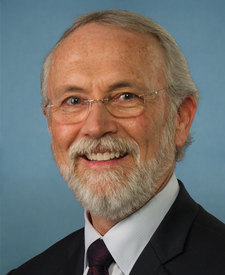
Indian Flat Group Site is in Washington’s 4th congressional district. Its representative, Dan Newhouse (R), votes on the laws that decide what happens to this land. Public-lands grade so far: F. See every public-lands vote →