John Day River Basin Developed Campgrounds
We don’t think it should be. Every campground should hold some sites for whoever drives up.Tell your representative →
- Right now
- Taking bookingsSites offered on 2 of the next 30 nights read 14:28 UTC
- A night
- $5From, per site
- Sites
- 21All of them booked ahead
The place
the agency’s own description · what’s there · 2 notices
In the agency’s own words
The Central Oregon Field Office of the Bureau of Land Management oversees four separate fee campgrounds within the John Day River Basin in Central Oregon. Service Creek and Muleshoe Campgrounds are located near Service Creek, Oregon along the John Day River and State Route 207. Big Bend and Lone Pine Campgrounds are located between Kimberly and Monument along the North Fork of the John Day River and State Route 402. The region is rural and tends to be quiet except during spring boating and fall hunting seasons. Keep reading
At around 2,000 feet in elevation, you'll see mostly sage and juniper with the occasional ponderosa pine. This area is a high-desert, so expect highly variable weather conditions especially in the spring and fall. Mid-summer tends to be very hot, but the river is nearby if you need to cool off. The winter is often cold and still. Campgrounds are open year-round, and sites are first-come, first-served only. Reservations are not available. You must physically arrive at the campground to purchase and claim your campsite. Once on-site, you can pay for your campsite(s) by scanning the QR code using the Recreation.gov mobile app. The QR code is posted at the campground kiosk. There is no reliable cell service at any of the campgrounds. Download the free Recreation.gov mobile app on Android or iOS prior to your arrival. You will be able to reserve your campsite using the app even without cell service. Your payment will process once you return to cell service. The most reliable cell service in the region is in Spray. Fees can also be paid with check or cash using the fee envelope and drop box at each campground. Refer to the onsite campground kiosk for further instructions.
Recreation
Many travelers visit this region along the Journey Through Time Scenic Byway . Beginning in Biggs and ending in Baker City, Oregon, the Scenic Byway travels 286 miles through northcentral and eastern Oregon. John Day River Basin Developed Campgrounds make for a great resting point along this scenic and historic journey. They are also well situated if you are interested in visiting the John Day Fossil Beds National Monument . The John Day River Basin is well known for its river related activities. These include fishing, boating, photography, wildlife viewing, camping, and simply relaxing by the river. The spring snowmelt attracts boaters from around the country. Both Service Creek and Muleshoe serve as common entry points to boat the Wild and Scenic section of the John Day River. A permit is required year-round to boat between Service Creek and Tumwater Falls. For further information visit the John Day River Day Use Permits and our John Day River Overnight Permits webpages.
Facilities
The John Day River Basin Developed Campgrounds are basic in both design and amenities. Each campsite is flat and has a fire ring and picnic table. Each campground has an ADA accessible vault toilet. No garbage collection or drinking water is available at any of the campgrounds. There is no reliable cell phone coverage . Service Creek Campground has four walk-in only tent sites in a one acre area under large ponderosa trees. All sites are close to each other. You must walk your camping equipment into the campsites. Parking is available in a large, open gravel lot. Service Creek is also a boat launch and is a great location to camp the night before a river trip. Boaters often leave trucks with trailers in the parking lot while on the river. The mornings can be busy during spring months with boaters preparing for a multi-day river trip. Muleshoe Campground has six graveled drive-in sites that are flat and overlook the John Day River. They are all close to each other. If you are looking for more privacy, there are two walk-in sites that are a short walk up a hill. Muleshoe also offers a primitive boat launch. Lone Pine Campground has five graveled drive-in sites that are flat. Some of the sites are closer to the river than others. The entrance road drops down into the campground and helps provide privacy from the main road. Big Bend Campground has four graveled drive-in sites that are flat and are all near the river. A steep gravel road leads down into the campground. The entrance provides privacy from the road but can be a challenge to some vehicles. Four-wheel drive and caution is recommended.
Natural Features
All four campgrounds are on the river with the road nearby. Be ready for goregous views of desert landscapes with steep hillsides and dark night skies. Without a dam to tame its waters, the river changes drastically from still pools in the summer to a cold and brown torrent in the spring. Juniper trees and the occasional ponderosa pine will provide shade and shelter from hot summer sun and canyon winds.
Nearby Attractions
John Day Fossil Beds National Monument Fossil Museum Charges & Cancellations Campsites are first-come, first-served . No changes and no refunds are available.
What the agency tells you
• All campsites are first-come, first-served. Campsites are not reservable. • All campers must register at the campground kiosk. • Payment can be made by scanning the QR code at the campground kiosk. • To use the QR code, you must download the Recreation.gov mobile app prior to arrival. • Onsite cash or check are also accepted methods of payment. See the onsite campground kiosk for instructions. • There is no reliable cell phone coverage at any of the campgrounds. • No garbage service or drinking water is available. Please pack it in, pack it out. • Each site can have up to 8 people. • Stay limit is 14 days in a 28-day period within 25 miles. • Fires are not allowed from June 1 - October 15 • When allowed, fires must: o Be contained within designated fire rings. o Be attended at all times unless fully extinguished. o Not be used to burn or dispose of trash or food. Please: • Camp in designated sites only. • Do not alter or modify sites. • Keep motor vehicles on designated roads and parking areas. • Do not leave personal property unattended for more than 24 hours. • Do not hold campsites for others. • Remain quiet from 10 pm to 7 am. • Do not run generators during quiet hours. • Keep pets on leash or under physical control and clean up after them. • Do not discharge firearms or fireworks into or from developed recreation sites. • Enjoy your stay!
The proposed John Day Basin Fee Area Business Plan is open for comment and can be found here. Please email questions/comments to blm_John_day_river@blm.gov. Comments are due by September 15th, 2025.
Tents and rigs
- Sites
- 21 · 6 walk-in
- Hookups
- None
- Accessible sites
- None listed
- Pets
- Allowed
Facilities
- Toilets
- Vault Toilets
- “…Each campground has an ADA accessible vault toilet. No garbage collection or drinking water is…”
- Boat ramp
- Yes
Around the campground
- On the water
- River, Creek
- River Trips
- Stargazing
- Water access
Full this Saturdayread 14:28 UTC
How full the weekend is nationally.
1 campground has sites open within 30 miles, read 16:43 UTC. See them
OpenBookedNot reservable
Watch for a cancellation
Watch this campground
One email when a night opens, plus More Than Just Parks dispatches. Unsubscribe any time.
We read recreation.gov once an hour, at 40 minutes past, and write the first time a site in your window is free for the nights you asked for.
Scanners that check every few minutes exist, and most of them charge. This one is free, it reads the same calendar, and it won’t always be first.
Tell me when the season opens
Watch for the season to open
One email when the season goes on sale, plus More Than Just Parks dispatches. Unsubscribe any time.
We check once an hour, at 40 minutes past, and write the first time the agency has that season on sale.
Scanners that check every few minutes exist, and most of them charge. This one is free, it reads the same calendar, and it won’t always be first.
We make nothing when you book. The link goes straight to the government.
Every line of the receipt · 14
What you actually pay
“Fees are $5.00 per site/night plus $2 for each additional vehicle over the first vehicle, excluding towed vehicles.” · the Bureau of Land Management’s own fee record
Derived by CAMPANAC: the agency’s published rate for this season, $5 a night, plus one $8 recreation.gov reservation fee for the booking. A weekend here means Friday and Saturday night, booked once. Optional charges (an extra vehicle, a second tent, a dump-station fee) are listed separately and aren’t in this total.
“Campsites are first-come, first-served. No changes and no refunds are available.” · this campground’s own terms
Who keeps the booking fee
The agency’s own policy text says the reservation fee and the cancellation processing fee are “retained by the reservation service contractor”, and that a campground concessionaire will decline to refund them because “they did not receive these fees”. Recreation.gov is run under contract by Booz Allen Hamilton. What share of your booking fee the contractor keeps isn’t published in any federal dataset we can read, so we print no number for it. Our reporting on the contract →
How we know this receipt · 7
Open within 30 miles this weekend · 1
Sites the agency is offering this Friday and Saturday that nobody has taken, nearest first. read 16:43 UTC
- Bull Prairie Campground (OR)Umatilla National Forest · 21 mi · 22 of 36 site-nights open
recreation.gov availability, read 14:28 UTC · rules read Sep 9, 2026 · rates Sep 10, 2026 · How we know all this
The sites
21 sites · which ones have room · the site map
The sites, ranked
from 21 mapped sitesAll 21 sites
Toilet distances are OpenStreetMap’s, measured for 12 of the 21 sites listed. A site with no reading is unknown, never far.
The price is derived by CAMPANAC, not published per site: the per-night rate this campground publishes for each site’s own site type. 21 of the 21 sites listed carry one, and a site whose type has no published rate sits out of the price rather than being called free.
Measured shade is NLCD Tree Canopy Cover 2024 (USDA Forest Service / MRLC) read at the site’s own coordinate, 27% canopy or more, and only for the sites the agency gave no Shade value. It never changes the agency’s own shaded count beside it.
| Big Bend | Big Bend -1 | standard nonelectric | 161 ft | 98 ftNorth Fork John Day River | $5 | |
| Big Bend | Big Bend -2 | standard nonelectric | 110 ft | 112 ftNorth Fork John Day River | $5 | |
| Big Bend | Big Bend -3 | standard nonelectric | 100 ft | 167 ftNorth Fork John Day River | $5 | |
| Big Bend | Big Bend -4 | standard nonelectric | 100 ft | 143 ftNorth Fork John Day River | $5 | |
| Lone Pine | Lone Pine -1 | standard nonelectric | 50 ft | 49 ftNorth Fork John Day River | $5 | |
| Lone Pine | Lone Pine -2 | standard nonelectric | 50 ft | 47 ftNorth Fork John Day River | $5 | |
| Lone Pine | Lone Pine -3 | standard nonelectric | 95 ft | 53 ftNorth Fork John Day River | $5 | |
| Lone Pine | Lone Pine -4 | standard nonelectric | 89 ft | 176 ftNorth Fork John Day River | $5 | |
| Lone Pine | Lone Pine -5 | standard nonelectric | 89 ft | 261 ftNorth Fork John Day River | $5 | |
| Muleshoe | Muleshoe -1 | standard nonelectric | 19 ft | 277 ft | 250 ft | $5 |
| Muleshoe | Muleshoe -2 | standard nonelectric | 19 ft | 260 ft | 268 ft | $5 |
| Muleshoe | Muleshoe -3 | standard nonelectric | 42 ft | 233 ft | 307 ft | $5 |
| Muleshoe | Muleshoe -4 | standard nonelectric | 45 ft | 212 ft | 347 ft | $5 |
| Muleshoe | Muleshoe -5 | standard nonelectric | 35 ft | 195 ft | 389 ft | $5 |
| Muleshoe | Muleshoe -6 | standard nonelectric | 35 ft | 181 ft | 421 ft | $5 |
| Muleshoe | Muleshoe -7 | walk to | 63 ft | 395 ft | 160 ft | $5 |
| Muleshoe | Muleshoe -8 | walk to | 63 ft | 418 ft | 208 ft | $5 |
| Service Creek | Service Creek -1 | walk to | 131 ft | 128 ft | 108 ft | $5 |
| Service Creek | Service Creek -2 | walk to | 60 ft | 163 ft | 83 ft | $5 |
| Service Creek | Service Creek -3 | walk to | 60 ft | 116 ft | 141 ft | $5 |
| Service Creek | Service Creek -4 | walk to | 91 ft | 145 ft | 199 ft | $5 |
Getting there
the map and the coordinate · the agency’s directions · the phone number
Where it is
 Tamarack CabinUmatilla National Forest · 18 miFairview CampgroundUmatilla National Forest · 18 mi
 Lone Pine CampgroundPrineville Central Oregon Field Office · 19 miBig Bend CampgroundPrineville Central Oregon Field Office · 19 mi
Service Creek Campground:
From Prineville, Oregon, take US 26 east out of town and drive 46.5 miles to OR 207 N. Turn left and drive 23.5 miles. Service Creek Campground and boat launch will be on the right.
Muleshoe Campground:
From Prineville, Oregon, take US 26 east out of town and drive 46.5 miles to OR 207 N. Turn left and drive 23.8 miles. Pass Service Creek Campground, and at the stop sign take a right onto OR 207 N. Drive for 1.9 miles and Muleshoe Campground will be on your right.
The weather
the next four days · the thirty-year normal
Next four days, and the thirty-year normal
Forecast
NWS forecast for Spray, OR
Typical weather
Typical October night 40°F, day 66°F.
Coldest month of the year: typical December night 28°F, below freezing. Bring a bag rated colder than that, and expect ice in the water bottle.
Daily high and lowDays with 0.10 in or more
A normal is the 1991-2020 average for the month, not a forecast: about half of all Julys are colder than the July line. The seven-day forecast above answers the other question.
The land, and who answers for it
who answers for it · a letter you can send
Who answers for this land
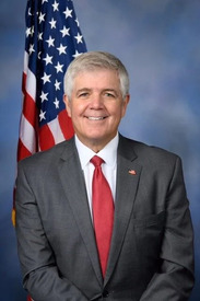
John Day River Basin Developed Campgrounds is in Oregon’s 2nd congressional district. Its representative, Cliff Bentz (R), votes on the laws that decide what happens to this land. Public-lands grade so far: F. See every public-lands vote →
Who can change it · 3
Two offices, two different asks. The draft to the agency asks it to set aside a published share of the sites here for whoever drives up. The draft to Congress asks why that share is zero and presses for a published minimum at the campgrounds it funds.
- The member who votes the moneyCliff BentzU.S. Representative · Oregon’s 2nd district
- Your senator, on the same appropriationJeff MerkleyU.S. Senator · Oregon
- Your senator, on the same appropriationRon WydenU.S. Senator · Oregon
Read the draft, or change the wording
For the camper who turned up, or tried to book, and couldn’t get in. Every draft is written from this campground’s own record (its agency, its unit, its site count and its own weekend) and the buttons above copy whichever wording is selected here.
Asks them to put the question to the agency in writing, and to press for a published minimum share of walk-up sites across the campgrounds they fund.
Subject Walk-up camping at John Day River Basin Developed Campgrounds, Oregon
Dear Cliff Bentz,

I’m a constituent in Oregon’s 2nd district. I tried to camp at John Day River Basin Developed Campgrounds, Oregon, and couldn’t.

All 21 sites at John Day River Basin Developed Campgrounds are reservable, and the agency's own record lists none held back for somebody who drives up. On Saturday, October 17, the one site recreation.gov was offering there was already booked.

1,623 of the 7,647 federal campgrounds in this country still keep at least some sites for whoever arrives first. John Day River Basin Developed Campgrounds keeps none, and that’s a choice somebody made rather than a rule.

I’m not asking you to run John Day River Basin Developed Campgrounds. I’m asking you to put it to the Bureau of Land Management in writing: why is the share of first-come sites there zero, and what would a published minimum share cost? Please press for that minimum at the federal campgrounds you fund.

The people who open these campgrounds, collect the fees and keep the water running are seasonal positions. At GS-5, base pay plus the government's own 36.25% benefit factor, one costs about $47,414 a year. One percent of the $13.3 billion the USS Gerald R. Ford cost to procure would pay for about 2,800 of them for a year. Both figures are the government's own (a Congressional Research Service report and an OPM pay table), and I’m glad to send them.

Sent about John Day River Basin Developed Campgrounds (Oregon) via campanac.com
Asks them to put the question to the agency in writing, and to press for a published minimum share of walk-up sites across the campgrounds they fund.
Subject Walk-up camping at John Day River Basin Developed Campgrounds, Oregon
Dear Jeff Merkley,

I’m a constituent in Oregon. I tried to camp at John Day River Basin Developed Campgrounds, Oregon, and couldn’t.

All 21 sites at John Day River Basin Developed Campgrounds are reservable, and the agency's own record lists none held back for somebody who drives up. On Saturday, October 17, the one site recreation.gov was offering there was already booked.

1,623 of the 7,647 federal campgrounds in this country still keep at least some sites for whoever arrives first. John Day River Basin Developed Campgrounds keeps none, and that’s a choice somebody made rather than a rule.

I’m not asking you to run John Day River Basin Developed Campgrounds. I’m asking you to put it to the Bureau of Land Management in writing: why is the share of first-come sites there zero, and what would a published minimum share cost? Please press for that minimum at the federal campgrounds you fund.

The people who open these campgrounds, collect the fees and keep the water running are seasonal positions. At GS-5, base pay plus the government's own 36.25% benefit factor, one costs about $47,414 a year. One percent of the $13.3 billion the USS Gerald R. Ford cost to procure would pay for about 2,800 of them for a year. Both figures are the government's own (a Congressional Research Service report and an OPM pay table), and I’m glad to send them.

Sent about John Day River Basin Developed Campgrounds (Oregon) via campanac.com
Asks them to put the question to the agency in writing, and to press for a published minimum share of walk-up sites across the campgrounds they fund.
Subject Walk-up camping at John Day River Basin Developed Campgrounds, Oregon
Dear Ron Wyden,

I’m a constituent in Oregon. I tried to camp at John Day River Basin Developed Campgrounds, Oregon, and couldn’t.

All 21 sites at John Day River Basin Developed Campgrounds are reservable, and the agency's own record lists none held back for somebody who drives up. On Saturday, October 17, the one site recreation.gov was offering there was already booked.

1,623 of the 7,647 federal campgrounds in this country still keep at least some sites for whoever arrives first. John Day River Basin Developed Campgrounds keeps none, and that’s a choice somebody made rather than a rule.

I’m not asking you to run John Day River Basin Developed Campgrounds. I’m asking you to put it to the Bureau of Land Management in writing: why is the share of first-come sites there zero, and what would a published minimum share cost? Please press for that minimum at the federal campgrounds you fund.

The people who open these campgrounds, collect the fees and keep the water running are seasonal positions. At GS-5, base pay plus the government's own 36.25% benefit factor, one costs about $47,414 a year. One percent of the $13.3 billion the USS Gerald R. Ford cost to procure would pay for about 2,800 of them for a year. Both figures are the government's own (a Congressional Research Service report and an OPM pay table), and I’m glad to send them.

Sent about John Day River Basin Developed Campgrounds (Oregon) via campanac.com