Kirkham
1Heads up1 fire 40 mi away
- Right now
- Closedrecreation.gov lists every site closed this weekend, read 15:57 UTC
- Sites
- 14In the agency’s record
The place
the agency’s own description · what’s there · 9 notices
In the agency’s own words
Kirkham Campground is located next to the South Fork Payette River just east of Lowman, Idaho, along Highway 21 at an elevation of 4,000 feet. Visitors enjoy soaking in popular Kirkham Hot Springs on the banks of the river and exploring the scenic Kirkham Ridge Trail. Keep reading
Recreation
Popular Kirkham Hot Springs is located at the river's edge within the campground. A trail with staircases leads down to the soaking pools and small steaming waterfalls. The South Fork Payette River offers whitewater rafting, kayaking and trout fishing. The Deadwood and Danskin River Access areas are nearby. Kirkham Ridge Trail is one of the Lowman Ranger District's premier trails. It begins less than 1/4-mile away and stretches through beautiful country for 35 miles, connecting with many other trails in the area. It is open to hiking, mountain biking and horses. Sections of the trail are open seasonally to off-road vehicles.
Facilities
The campground contains several single-family sites and one double site, all of which are accessible. Each site is equipped with a picnic table and campfire ring with grill. Some sites have small picnic shelters for shade. Vault toilets, drinking water and trash collection are provided. A campground host is on-site. Roads and parking spurs are paved. A small gas station/cafe and mechanic are nearby.
Natural Features
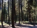
The campground offers little shade, though a few Ponderosa pines are scattered throughout the site. The campground can be very hot and sunny during the summer. Wildflowers dot the landscape.
Nearby Attractions
Numerous natural hot springs pools can be found along Highway 21, also known as the Ponderosa Pine Scenic Byway, and the Banks-Lowman Highway, also known as the Wildlife Canyon Scenic Byway. Both byways offer scenic views, wildlife watching, historical information kiosks and several trail opportunities. Whitewater rafting and kayaking are popular activities on the South Fork and Main Payette Rivers. Several companies in the area offer guided half and full-day trips.
What the agency tells you
Idaho OHV Safety Message
Maximum two vehicles per site; additional vehicles must use parking lot and pay a fee
Day use fee for non-campers is $5
Everything else this campground posts · 6
No entrance after 10 p.m.
Additional sites may be available on a first-come, first-served basis
Please contact the Lowman Ranger District at 208-259-3361 for off-season camping information
Click here for more information on the Boise National Forest
Please click here for further information about the facility and recreation opportunities in the area.
Don't Move Firewood: Help prevent the spread of tree-killing pests in our national forests by obtaining firewood near your destination and burning it on-site. For more information visit dontmovefirewood.org.
Tents and rigs
- Sites
- 14
- Hookups
- None
- Longest rig
- 80 ft
- Paved pads
- All
- Accessible sites
- 14
- Shade
- Every site
Facilities
- Toilets
- Vault Toilets
- “…have small picnic shelters for shade. Vault toilets, drinking water and trash collection are provided.…”
- Drinking water
- Yes
- “…shelters for shade. Vault toilets, drinking water and trash collection are provided. A campground…”
Around the campground
- On the water
- Hot springs, Waterfall, River
- Biking
- Fishing
- Hiking
- Wildlife viewing
- Night sky · 316th darkest of 523 in ID
- Bortle 2
Nothing to book until it reopensread 15:57 UTC
recreation.gov lists every site closed this weekend
Every one of the next thirty nights is in recreation.gov’s record and not one site is being offered on any of them. That’s a campground closed or not yet released for booking, not a sold-out one.
Tell me when it reopens
Watch for it to come back
One email when the agency reopens it, plus More Than Just Parks dispatches. Unsubscribe any time.
We check the agency’s own record once an hour, at 40 minutes past, and write the first time it stops saying closed.
Scanners that check every few minutes exist, and most of them charge. This one is free, it reads the same calendar, and it won’t always be first.
Every line of the receipt · 8
What you actually pay
Who keeps the booking fee
The agency’s own policy text says the reservation fee and the cancellation processing fee are “retained by the reservation service contractor”, and that a campground concessionaire will decline to refund them because “they did not receive these fees”. Recreation.gov is run under contract by Booz Allen Hamilton. What share of your booking fee the contractor keeps isn’t published in any federal dataset we can read, so we print no number for it. Our reporting on the contract →
How we know this receipt · 3
Why this page can’t say why
recreation.gov lists every site at Kirkham closed this Friday and Saturday night. The U.S. Forest Service has published no closure notice we hold, so this page can’t say why, and it won’t fill the gap with a guess. A closed night isn’t a sold-out one: the reservations its record still carries were taken before the sites were closed.
There’s no notice to quote and no reason to argue with, so this page offers you the watch and the list below, and no letter.
Open within 60 miles · 2
The agency’s own word that these are open, not our reading of a season.
- Ninemeyer CampgroundBoise National Forest · 22 mi · walk-up
- Abbott CampgroundSawtooth National Forest · 36 mi
recreation.gov availability, read 15:57 UTC · rules read Sep 9, 2026 · record Aug 23, 2026 · How we know all this
The sites
16 records · which ones have room · the site map
The sites, ranked
from 15 mapped sitesAll 16 records
Toilet distances are OpenStreetMap’s, measured for 16 of the 16 sites listed. A site with no reading is unknown, never far.
| KIRK | 001 | day use | 25 ft | yes | 42 ft | 163 ft | 150 ft |
| KIRK | 002 | standard nonelectric | 35 ft | yes | 79 ft | 72 ft | 222 ft |
| KIRK | 003 | standard nonelectric | 30 ft | yes | 45 ft | 139 ft | 188 ft |
| KIRK | 004 | standard nonelectric | 35 ft | yes | 78 ft | 50 ft | 178 ft |
| KIRK | 005 | standard nonelectric | 25 ft | yes | 45 ft | 127 ft | 145 ft |
| KIRK | 006 | standard nonelectric | 50 ft | yes | 49 ft | 117 ft | 99 ft |
| KIRK | 007 | standard nonelectric | 50 ft | yes | 49 ft | 110 ft | 54 ft |
| KIRK | 008 | standard nonelectric | 50 ft | yes | 129 ft | 94 ft | 91 ft |
| KIRK | 009 | standard nonelectric | 25 ft | yes | 73 ft | 119 ft | 206 ft |
| KIRK | 010 | standard nonelectric | 45 ft | yes | 75 ft | 97 ft | 281 ft |
| KIRK | 011 | standard nonelectric | 35 ft | yes | 73 ft | 190 ft | 193 ft |
| KIRK | 012 | standard nonelectric | 45 ft | yes | 55 ft | 198 ft | 134 ft |
| KIRK | 013 | standard nonelectric | 80 ft | yes | 55 ft | 215 ft | 180 ft |
| KIRK | 014 | standard nonelectric | 25 ft | yes | 42 ft | 179 ft | 116 ft |
| KIRK | 015 | standard nonelectric | 30 ft | yes | 98 ft | 173 ft | 58 ft |
| KIRK | 016 | day use | 30 ft | yes | 112 ft | 72 ft |
The agency files 2 more records here that aren’t sites for the night. It files them as day use. They’re in the table above, marked for what they are, and none of them is counted as a site.
Getting there
the map and the coordinate · the agency’s directions · the phone number
Where it is
 Mountain ViewBoise National Forest · 3.0 mi
 HelendeBoise National Forest · 3.6 mi
 Park Creek Campground and Group sitesBoise National Forest · 3.6 mi
 Park Creek (Idaho)Boise National Forest · 3.7 miDeadwood CampgroundBoise National Forest · 5.8 mi
 Pine Flats (ID)Boise National Forest · 7.0 mi
From Boise, Idaho, take State Highway 55 to Banks. Turn east onto the Banks-Lowman Highway and travel to Lowman. Turn left on Highway 21. The campground is located 5 miles east at milepost 77.
The weather
the next four days · the thirty-year normal
Next four days, and the thirty-year normal
Forecast
NWS forecast for Lowman, ID
Typical weather
Typical October night 31°F, day 64°F.
Coldest month of the year: typical January night 19°F, below freezing. Bring a bag rated colder than that, and expect ice in the water bottle.
Daily high and lowDays with 0.10 in or more
A normal is the 1991-2020 average for the month, not a forecast: about half of all Julys are colder than the July line. The seven-day forecast above answers the other question.
The land, and who answers for it
what threatens it · who answers for it
What threatens this place
You’re camping on ground somebody wants. We track the threats and the comment deadlines.
Who answers for this land
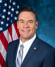
Kirkham is in Idaho’s 1st congressional district. Its representative, Russ Fulcher (R), votes on the laws that decide what happens to this land. Public-lands grade so far: F. See every public-lands vote →