Long Meadow
5Heads up5 fires, nearest 24 mi
- Right now
- Nobody has saidNo season, no closure, no bookings to read
- A night
- $8From, per site
- Sites
- 41 on recreation.gov
The place
the agency’s own description · what’s there
In the agency’s own words
This location is available on a first-come, first-served basis only. Visitors are required to physically arrive at the campground to purchase and claim a site. Once on-site, you may be able to pay for your campsite(s) by scanning a QR code using the Recreation.gov mobile app, and the Scan and Pay feature. If this option is available, you will need to first download the free Recreation.gov mobile app https://www.recreation.gov/mobile-app prior to your arrival as some remote areas have limited or no cellular service.
Tents and rigs
- Sites
- 4
- Hookups
- None
- Accessible sites
- None listed
No reading yet, book on recreation.gov
recreation.gov lists 1 of the 4 campsites the agency files here. The rest aren’t on its booking system, so a reservation won’t get you one.
No availability snapshot inside the last 36 hours, so this page draws nothing rather than ageing a reading into fiction.
Watch for a cancellation
Full? Watch it.
One email when a night opens, plus More Than Just Parks dispatches. Unsubscribe any time.
We read recreation.gov once an hour, at 40 minutes past, and write the first time a site in your window is free for the nights you asked for.
Scanners that check every few minutes exist, and most of them charge. This one is free, it reads the same calendar, and it won’t always be first.
We make nothing when you book. The link goes straight to the government.
Every line of the receipt · 12
What you actually pay
Derived by CAMPANAC: the agency’s published rate for this season, $8 a night, plus one $8 recreation.gov reservation fee for the booking. A weekend here means Friday and Saturday night, booked once. Optional charges (an extra vehicle, a second tent, a dump-station fee) are listed separately and aren’t in this total.
Who keeps the booking fee
The agency’s own policy text says the reservation fee and the cancellation processing fee are “retained by the reservation service contractor”, and that a campground concessionaire will decline to refund them because “they did not receive these fees”. Recreation.gov is run under contract by Booz Allen Hamilton. What share of your booking fee the contractor keeps isn’t published in any federal dataset we can read, so we print no number for it. Our reporting on the contract →
How we know this receipt · 5
rules read Sep 9, 2026 · rates Oct 1, 2026 · How we know all this
The sites
4 sites · the site map
All 4 sites
Toilet distances are OpenStreetMap’s, measured for 1 of the 4 sites listed. A site with no reading is unknown, never far.
The price is derived by CAMPANAC, not published per site: the per-night rate this campground publishes for each site’s own site type. 1 of the 4 sites listed carry one, and a site whose type has no published rate sits out of the price rather than being called free.
Measured shade is NLCD Tree Canopy Cover 2024 (USDA Forest Service / MRLC) read at the site’s own coordinate, 27% canopy or more, and only for the sites the agency gave no Shade value. It never changes the agency’s own shaded count beside it.
Getting there
the map and the coordinate · the agency’s directions · the phone number
Where it is
 Kaner Flat CampgroundSnoqualmie National Forest · 5.5 mi
 Kaner Flat Group SiteSnoqualmie National Forest · 5.5 mi
 American Forks CampgroundSnoqualmie National Forest · 6.4 mi
 American River Guard StationSnoqualmie National Forest · 6.4 mi
From Naches, travel west on Highway 12 for 4.4 miles. Continue straight onto Highway 410 W for 24.2 miles. Turn right on Little Naches Road / Forest Road 1900 and follow 4 miles. Turn left on Forest Road 1902 and follow ½ mile. Entrance is on left side of road.
The weather
the next four days · the thirty-year normal
Next four days, and the thirty-year normal
Forecast
NWS forecast for Cliffdell, WA
Typical weather
Typical October night 38°F, day 49°F.
Coldest month of the year: typical December night 24°F, below freezing. Bring a bag rated colder than that, and expect ice in the water bottle.
Daily high and lowDays with 0.10 in or more
A normal is the 1991-2020 average for the month, not a forecast: about half of all Augusts are colder than the August line. The seven-day forecast above answers the other question.
The land, and who answers for it
what threatens it · who answers for it
Roadless country, and what’s coming for it
You’re camping on ground somebody wants. We track the threats and the comment deadlines.
Who answers for this land
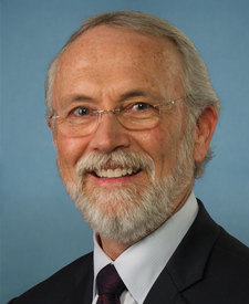
Long Meadow is in Washington’s 4th congressional district. Its representative, Dan Newhouse (R), votes on the laws that decide what happens to this land. Public-lands grade so far: F. See every public-lands vote →