Lost Horse Guard Station
4Heads up4 fires, nearest 8 mi
- Right now
- Nobody has saidNo season, no closure, no bookings to read
- Sites
- 1All of them booked ahead
The place
the agency’s own description · what’s there · 15 notices
In the agency’s own words
Winter 2025 - 2026 is the first winter season the cabin is available for rent during the winter. Please call Darby Ranger Station with questions prior to visit. Please let us know how we can improve the facility. From January - March the cabin must be accessed by snowmobile or other over-snow vehicles via a 14 mile route that may not be recently groomed. Road and snow conditions can change rapidly. Please plan accordingly, prepare and check conditions before you go. Missoula Avalanche Center https://missoulaavalanche.org/ Grooming Information https://www.bitterrootrr.org/grooming--trail-info. Keep reading
html The Lost Horse Guard Station was built in 1938 by request of George Case, Moose Creek District Ranger, to assist the Forest Service’s efforts to administer and manage the high country of the southern Bitterroot Range. Using funds from the Works Progress Administration (WPA), the cabin was constructed by Emil Schwartz, from Wisdom, MT and known for a paying close attention to detail. Its quality of construction is evident through the minimal amount of required repairs and restoration over the 80 years since its construction. It is an excellent example of a Region One standard plan log cabin and guard station, with saddle-notched random-length log crowns, a drive through porch, native stone foundation and cedar shingle roof. The cabin features two sets of full sized bunk beds, a wood burning stove as the heat source and a propane cook stove. There is no drinking water at this cabin, please bring your own water for drinking, cleaning etc. There is no trash service at this cabin. PACK IT IN, PACK IT OUT. Firewood is only provided January - March.
Recreation
Visitors to the Lost Horse Guard Station have access to a multitude of recreation opportunities. Hiking : There are many trails that are close to the cabin. The Bailey Lake Trailhead is within walking distance. Travel one mile to the west to Bear Creek Pass and access the Bear Creek Trail, Lower and Upper Bear Lakes, Coquina Lake, Fish Lake and the South Fork of Lost Horse Creek Drainage. Travel 2 miles to the North to access the Twin Lakes Trail and Wahoo Pass Trail and the vast expanse of the Selway-Bitterroot Wilderness. Fishing : Along with Lost Horse Creek, anglers can drive or hike to any of the lakes mentioned above. Expect to find Brook Trout, Westslope Cutthroat trout, Rainbow trout, Bull trout, Brown trout and Mountain Whitefish. DISCLAIMER* Some of the lakes in the area are in Idaho. Please obtain the appropriate licenses in the state that you will be fishing in. Hunting : Many species are at home in the Lost Horse Creek drainage. Hunters can strike out in search of whitetail deer, mule deer, black bear, elk and mountain grouse species. Skiing : With routine heavy snowfall, this area is a great opportunity for Cross Country Skiiers with some areas being groomed and lots of wild untouched snow. Over Snow Travel : While the road makes for an easier ride, deep powder can be found very easily in a variety of terrain for riders of any experience level. NOTE* Motorized travel is not permitted in the Wilderness Area Horseback: Bear Creek Pass and Twin Lakes both feature ramps and hitching posts for those riders looking to either take a leisurely day ride or venture into the labyrinth of trails that disect the Selway-Bitterroot Wilderness. Kayak/Canoe/SUP : Just 2 miles from the cabin, motorized boats are prohibited on Twin Lakes, this makes for a great opportunity for non motorized craft. Opportunities for other activities such as climbing, bird watching, photography and general nature viewing abound in this area.
Natural Features
The cabin resides nearly 18 miles from Highway 93 in the Lost Horse Creek drainage on the west side of the beatuful Bitterroot Valley. The Lost Horse Road was built in 1936 by the Civilian Conservation Corps (CCC). The drainages on the west side of the valley differ from the surrounding landscape. These glacial carved canyons are home to towering peaks, craggy granite cliffs, serene alpine lakes, steep avalanche chutes, flowing creeks and cascading waterfalls. These features create a microclimate in the canyon that sustains a dense mixed coniferous forest that contains ponderosa pine in the lower/drier sites; Douglas-fir, western hemlock and western red cedar along the creek, and lodgepole pine, subalpine fir, Engelmann spruce and whitebark pine in the higher elevations. The Lost Horse Road provides access into the Bitterroot Mountains much further than the typical eastern boundary of the Selway-Bitterroot Wilderness. The Selway-Bitterroot Wilderness can be accessed at Bear Creek Pass and Twin Lakes, which are both within 2 miles of the Lost Horse Guard Station.
What the agency tells you
Lost Horse Guard Station is only accessible by wheeled motorized vehicle during summer months. From January - March the cabin must be accessed by snowmobile or other over-snow vehicles via a 14 mile route that may not be recently groomed. Road and snow conditions can change rapidly. Please plan accordingly, prepare and check conditions before you go. - Missoula Avalanche Center https://missoulaavalanche.org/ - Grooming Information https://www.bitterrootrr.org/grooming--trail-info.html - Bitterroot NF Over Snow Map https://www.fs.usda.gov/sites/nfs/files/legacy-media/bitterroot/Bitterroot%20OSMVUM%20North.pdf
Guests are responsible for their own travel arrangements and safety
Winter - Be aware of sliding snow from roof as cabin heats up. Please park snowmobiles and store gear accordingly.
Everything else this campground posts · 12
This facility is located in a remote area; before making a reservation, become aware of bear , water and weather safety, including avalanche danger.
Please turn on propane before each use and off when not in use. (Valve is located on the North side of the cabin)
Water is not available at the cabin. Guests will need to bring their own water.
All garbage and food must be packed out
Pets are not allowed at the cabin
Guests should be aware that there is a risk of exposure to hantavirus when visiting remote cabins; click here to learn more.
This is a remote cabin that may be unoccupied for extended periods of time. Mice may be present in cabin - there are supplies to trap mice and remove safely in cabin. Please do your part to help mitigate rodents by picking up food crumbs, cleaning thoroughly, and trapping mice if they are present.
Parking space is limited to two vehicles
The cabin remains locked; a week before your scheduled arrival, contact the Darby Ranger District during office hours to obtain a key code
Firewood is only provided from January - March.
Don't Move Firewood: Prevent the spread of tree-killing pests by obtaining firewood near your destination and burning it on-site. For more information visit dontmovefirewood.org
Learn more about the Bitterroot National Forest
Tents and rigs
- Sites
- 1 · 1 cabin
- Hookups
- None
- Accessible sites
- None listed
- Shade
- Every site
Facilities
- Toilets
- Vault Toilets
- VAULT TOILETS on 1 of 1 campsite records
- Drinking water
- None, bring your own
- “…heat source and a propane cook stove. There is no drinking water at this cabin, please bring your own water for…”
- Firewood
- Mentioned
Around the campground
- On the water
- Waterfall, Lake, Creek
No reading yet, book on recreation.gov
Every site here is reservable, and the record lists none held back for anyone who drives up.
No availability snapshot inside the last 36 hours, so this page draws nothing rather than ageing a reading into fiction.
Watch for a cancellation
Full? Watch it.
One email when a night opens, plus More Than Just Parks dispatches. Unsubscribe any time.
We read recreation.gov once an hour, at 40 minutes past, and write the first time a site in your window is free for the nights you asked for.
Scanners that check every few minutes exist, and most of them charge. This one is free, it reads the same calendar, and it won’t always be first.
Tell me when the season opens
Watch for the season to open
One email when the season goes on sale, plus More Than Just Parks dispatches. Unsubscribe any time.
We check once an hour, at 40 minutes past, and write the first time the agency has that season on sale.
Scanners that check every few minutes exist, and most of them charge. This one is free, it reads the same calendar, and it won’t always be first.
We make nothing when you book. The link goes straight to the government.
Every line of the receipt · 12
What you actually pay
Who keeps the booking fee
The agency’s own policy text says the reservation fee and the cancellation processing fee are “retained by the reservation service contractor”, and that a campground concessionaire will decline to refund them because “they did not receive these fees”. Recreation.gov is run under contract by Booz Allen Hamilton. What share of your booking fee the contractor keeps isn’t published in any federal dataset we can read, so we print no number for it. Our reporting on the contract →
How we know this receipt · 5
rules read Sep 9, 2026 · rates Sep 10, 2026 · How we know all this
The sites
1 sites
All 1 sites
The price is derived by CAMPANAC, not published per site: the per-night rate this campground publishes for each site’s own site type. 1 of the 1 sites listed carry one, and a site whose type has no published rate sits out of the price rather than being called free.
| Lost Horse Guard Station | Lost Horse Guard Station | cabin nonelectric | $50 |
Getting there
the map and the coordinate · the phone number
Where it is
 Schumaker CampgroundBitterroot National Forest · 1.4 mi
 Three Frogs CampgroundBitterroot National Forest · 13 mi
 Woods CabinBitterroot National Forest · 13 mi
 Lake Como CampgroundBitterroot National Forest · 13 mi
 Three Sisters Group Site (MT)Bitterroot National Forest · 13 mi
 Blodgett CampgroundBitterroot National Forest · 15 mi
The weather
the next four days · the thirty-year normal
Next four days, and the thirty-year normal
Forecast
NWS forecast for Charlos Heights, MT
Typical weather
Typical October night 26°F, day 54°F.
Coldest month of the year: typical December night 10°F, below freezing. Bring a bag rated colder than that, and expect ice in the water bottle.
Daily high and lowDays with 0.10 in or more
A normal is the 1991-2020 average for the month, not a forecast: about half of all Julys are colder than the July line. The seven-day forecast above answers the other question.
The land, and who answers for it
what threatens it · who answers for it
What threatens this place
You’re camping on ground somebody wants. We track the threats and the comment deadlines.
Who answers for this land
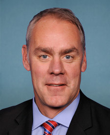
Lost Horse Guard Station is in Montana’s 1st congressional district. Its representative, Ryan Zinke (R), votes on the laws that decide what happens to this land. Public-lands grade so far: F. See every public-lands vote →