National Park Service · Mammoth Cave National Park · KY
Site Turnhole Bend.
This site, photographed by the agency
Filed by the agency against this site and 1 other campsite here
Back-country Turnhole Bend campsite · Donna Shand, Kelsie Martin, Deb Spillman
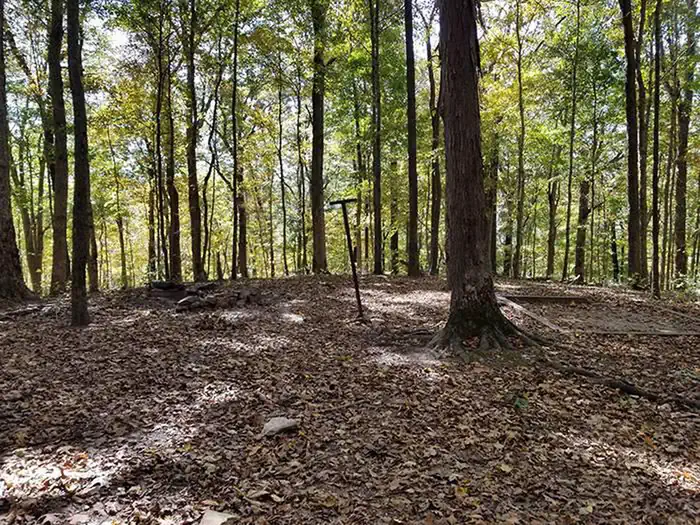
Shared frame: SHA-256 of the agency’s own file, compared across every campsite photograph at this campground · Sep 12, 2026
Hike ToType
Reservablerecreation.gov lists it
680 ftElevation
90%Tree cover
1,057 ftWater · to Green River
Elevation: USGS 3DEP elevation point query at this site’s coordinate · Sep 7, 2026
Tree cover: NLCD Tree Canopy Cover 2024 (USDA Forest Service / MRLC), one 30 m cell at this coordinate · Sep 9, 2026
The site
TypeHike To
LoopTurnhole Bend
HookupsNone
Site AccessHike In
Capacity/Size RatingSingle
Max Num of People8
ShadeYes
Pets AllowedYes
Campfire AllowedYes
Checkin Time12:00 PM
Checkout Time11:00 AM
Condition RatingGood
Fire PitYes
Location RatingGood
Min Num of People1
Site RatingBasic
Tent PadsYes
AccessibleNot listed
The record, complete · 15
Water HookupNo
What fits here
Small Tentno length limit listed
Recreation.gov lists these as the equipment permitted on this site. A length is the ceiling for that equipment; where none is published we say so rather than guess.
Book this exact site
Opens this site’s own calendar on recreation.gov.
Site Turnhole Bend on recreation.govSource: Recreation.gov
The campground
Every site, the season, fees, weather, and what’s happening on this land right now: Mammoth Cave Backcountry Camping →
Source: CAMPANAC campground index