Marsden Tract Group Campsite
4Heads uppark alerts
- Right now
- Taking bookingsSites offered on 30 of the next 30 nights read 16:49 UTC
- Sites
- 6All of them booked ahead
The place
the agency’s own description · what’s there · 11 notices
In the agency’s own words
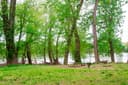
Scouts built the Marsden Tract Group Campground to provide access to larger campsites within easy commuting distance of the D.C. Metro area. It is located at Mile 11.5 on the C&O Canal Towpath, between the Carderock Recreation Area and the historic Old Anglers Inn (private). The group campsites are nestled in the woods between the Canal and the Potomac River and they are a short distance from many recreational opportunities. Fishing, rock climbing, paddling and hiking are but a few possibilities while staying at Marsden Tract. Alcoholic beverages are prohibited. Keep reading
Recreation
The most popular activity for Marsden Tract campers is hiking the three sections (A, B and C) of the Billy Goat Trail, one of the most popular and challenging rock hikes in the east. There are also many woodland trails for beginners and experts alike. Fishing is also a popular pastime in both the C&O Canal and the Potomac River. Be sure to acquire a Maryland fishing license for those age 16 or older. Virginia licenses are approved for fishing in the Potomac only.
Facilities
The campground has six group campsites; all will accommodate up to 30 campers at each site. Each campsite has a picnic table and a fire ring. Potable water is located a short walk up the towpath and across the footbridge heading towards MacArthur Blvd (water may not be available during cold winter months). Portable toilets are located near Campsite 1. No vehicle traffic is allowed on the towpath and access to the campsites is by foot only. Carderock Recreation Area or Angler's Inn are the two closest parking areas. Each is a one-mile walk respectively. There are flush toilets located at the Angler's parking area. There is a temporary stopping area on MacArthur Blvd near the intersection of Brickyard Rd. This area may be used to off-load gear and be walked down the hill, however overnight parking in this area is not permitted.
Natural Features
Marsden Tract Group Campsite is just south of the Great Falls of the Potomac and Mather Gorge. These two stunning features provide an excellent example of local geology while showing the sheer force and power of nature. Contact Info This location is unstaffed. To speak with our main office for general information, please call: (301) 739-4200.
Nearby Attractions
Marsden Tract Group Campsite is located about 14 miles (22.5 km) outside of Washington, D.C., providing affordable camping near the nation's capital. Many campers will base out of Marsden to see the sites such as the Smithsonian Institution, National Mall, Capitol and The White House.
Charges & Cancellations
No rain dates or weather-related refunds.
What the agency tells you
Parking and Access. Overnight parking is allowed only at the Carderock Recreation Area and the parking lot across from the Angler's Inn. Both parking lots are a one-mile (1.6 km) walk respectively. There is a temporary stopping area on MacArthur Blvd near the intersection of Brickyard Rd. This area may be used to off-load gear and be walked down the hill. However, overnight parking in this area is not permitted.
Check-in. You may arrive anytime after check-in time (1:00 pm) regardless of light conditions. There is no campsite host or staff. Just have a copy of your confirmation email available on a phone or printed. If someone is squatting in your campsite and you need law enforcement assistance please call US Park Police - (202) 610-7500. Check-out. Check out time is 12:00 noon ET the day after the reservation.
Campfires. Fires are permitted only in established fire rings. Please ensure that your fire is extinguished completely each time you leave the area.
Everything else this campground posts · 8
Firewood. The cutting or defacing of any live growth is strictly prohibited. Kiln fired or dried wood may be brought into the park. Fallen dead timber in the park may be used for on-site firewood. Bring handsaws to cut fallen wood. Chainsaws are prohibited. Park Rangers reserve the right to ban all fires during periods of drought.
Quiet Hours. Please observe quiet hours between 10:00 p.m. and 6:00 a.m.
No Alcohol or Marijuana. Alcoholic beverages are prohibited. Marijuana is illegal on federal property.
Pets. Pets are allowed in the campgrounds. They must be restrained by a 6 ft. leash at all times and their waste must be picked up and taken with the owner.
Remove All Trash. The park is a 'Trash Free Park' and trashcans are not provided. Trash must be picked up and the area left in a clean condition before the group departs. Bring trash bags.
No Swimming. Swimming and/or wading in the Potomac River or the C&O Canal is extremely dangerous and prohibited by law in this area of the park.
Water. The hand pump well is turned on April 15 - October 31 and located up the towpath and across the bridge towards MacArthur Blvd. Please bring water for use if camping between November 1 - April 14. Portable toilets are located near Campsite 1.
Emergencies. If someone is "squatting" in the campsite OR for emergencies, please call the National Capital Region Communications Center at 1-866-677-6677.
Tents and rigs
- Sites
- 6 · 6 tent-only, 6 group
- Hookups
- None
- Accessible sites
- None listed
- Pets
- Allowed
- Campfires
- Allowed, barring fire bans
- Shade
- Every site
Facilities
- Toilets
- Portable Toilets - year round
- Drinking water
- Yes
- Stay limit
- 30 nights
- recreation.gov facility rule maxStay
Around the campground
- On the water
- River
- Biking
- Hiking
- Fall color · reported 6 days ago, 12 km away
- Minimal color
3 of 12 site-nights open this Friday and Saturdayread 16:49 UTC
Every site here is reservable, and the record lists none held back for anyone who drives up.
OpenBooked
Watch for a cancellation
Full? Watch it.
One email when a night opens, plus More Than Just Parks dispatches. Unsubscribe any time.
We read recreation.gov once an hour, at 40 minutes past, and write the first time a site in your window is free for the nights you asked for.
Scanners that check every few minutes exist, and most of them charge. This one is free, it reads the same calendar, and it won’t always be first.
Tell me when the season opens
Watch for the season to open
One email when the season goes on sale, plus More Than Just Parks dispatches. Unsubscribe any time.
We check once an hour, at 40 minutes past, and write the first time the agency has that season on sale.
Scanners that check every few minutes exist, and most of them charge. This one is free, it reads the same calendar, and it won’t always be first.
We make nothing when you book. The link goes straight to the government.
Every line of the receipt · 12
What you actually pay
“No rain dates or weather-related refunds.” · this campground’s own terms
Who keeps the booking fee
The agency’s own policy text says the reservation fee and the cancellation processing fee are “retained by the reservation service contractor”, and that a campground concessionaire will decline to refund them because “they did not receive these fees”. Recreation.gov is run under contract by Booz Allen Hamilton. What share of your booking fee the contractor keeps isn’t published in any federal dataset we can read, so we print no number for it. Our reporting on the contract →
How we know this receipt · 6
recreation.gov availability, read 16:49 UTC · rules read Sep 9, 2026 · rates Sep 10, 2026 · How we know all this
The sites
6 sites · which ones have room · the site map
The sites, ranked
from 6 mapped sitesAll 6 sites
Toilet distances are OpenStreetMap’s, measured for 6 of the 6 sites listed. A site with no reading is unknown, never far.
The price is derived by CAMPANAC, not published per site: the per-night rate this campground publishes for each site’s own site type. 6 of the 6 sites listed carry one, and a site whose type has no published rate sits out of the price rather than being called free.
| Marsden Tract Group Campsite | 001 | group tent only area nonelectric | 200 ft | 467 ft | 327 ft | $40 |
| Marsden Tract Group Campsite | 002 | group tent only area nonelectric | 185 ft | 458 ftPotomac River | 421 ft | $40 |
| Marsden Tract Group Campsite | 003 | group tent only area nonelectric | 185 ft | 295 ftPotomac River | 548 ft | $40 |
| Marsden Tract Group Campsite | 004 | group tent only area nonelectric | 114 ft | 424 ft | 808 ft | $40 |
| Marsden Tract Group Campsite | 005 | group tent only area nonelectric | 142 ft | 379 ft | 783 ft | $40 |
| Marsden Tract Group Campsite | 006 | group tent only area nonelectric | 114 ft | 460 ftPotomac River | 698 ft | $40 |
Getting there
the map and the coordinate · the agency’s directions
Where it is
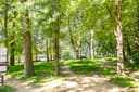 Swains Lock Hiker-Biker CampsiteChesapeake and Ohio Canal National Historical Park · 3.9 mi
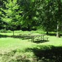 Rock Creek Park Group Picnic Areas (DC)Rock Creek Park · 9.2 mi
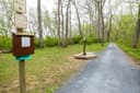 Horsepen Branch Hiker-Biker Overnight (HBO) CampsiteChesapeake and Ohio Canal National Historical Park · 12 mi
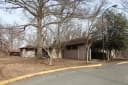 Fort Dupont Park Picnic Areas16 mi
 Chisel Branch Hiker-Biker Overnight (HBO) Campsite16 mi
 Greenbelt CampgroundNational Capital Parks · 17 mi
You may park at either the Carderock Recreation Area or the gravel lots across from the Anglers Inn Restaurant. We recommend Carderock as it is slightly closer to walk the towpath to the campsite from there. Search "Billy Goat Trail C - North Parking Lot" on Google Maps for the best directions.
- From I-495 in Maryland: 1. Take Exit 41 toward Carderock/Great Falls. 2. Merge onto the Clara Barton Pkwy and continue 1 mile to the Carderock exit (on the right is the David Taylor Model Basin-9500 MacArthur Blvd., West Bethesda, MD 20817). 3. Take the Carderock exit and at the stop sign, turn left to cross over the Clara Barton Pkwy. Follow the road until you reach a second stop sign. 4. Turn right and continue to the end of the road at Lot 4. Take the short walking path to the canal. Turn upstream and hike about a 1/2 mile.
- From I-495 in Virginia: 1. Take Exit 41 (Carderock/Glen Echo) from the American Legion Bridge and at the fork, bear left toward Great Falls/Carderock. 2. Merge onto the Clara Barton Pkwy and continue 1 mile to the Carderock exit (on the right is the David Taylor Model Basin 9500 MacArthur Blvd., West Bethesda, MD 20817). 3. Take the Carderock exit and at the stop sign, turn left to cross over the Clara Barton Pkwy. Follow the road until you reach a second stop sign. 4. Turn right and continue to the end of the road at Lot 4. Take the short walking path to the canal. Turn upstream and hike about a 1/2 mile.
- From Washington (Georgetown): 1. From the intersection of Street and Key Bridge, go west for approximately .5 miles and bear left onto Canal Road. 2. Stay straight on Canal Road which turns into the Clara Barton Pkwy and follow the Clara Barton Pkwy for approximately 9 miles to the Carderock exit (on the right is the David Taylor Model Basin -9500 MacArthur Blvd., West Bethesda, MD 20817). 3. Take the Carderock exit and at the stop sign, turn left to cross over the Clara Barton Pkwy. Follow the road until you reach a second stop sign. 4. Turn right and continue to the end of the road at Lot 4. Take the short walking path to the canal. Turn upstream and hike about a 1/2 mile.
The weather
the next four days · the thirty-year normal
Next four days, and the thirty-year normal
Forecast
NWS forecast for Potomac, MD
Typical weather
Typical October night 47°F, day 68°F.
Coldest month of the year: typical January night 26°F, below freezing. Bring a bag rated colder than that, and expect ice in the water bottle.
Daily high and lowDays with 0.10 in or more
A normal is the 1991-2020 average for the month, not a forecast: about half of all Julys are colder than the July line. The seven-day forecast above answers the other question.
The land, and who answers for it
who answers for it
Who answers for this land
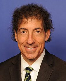
Marsden Tract Group Campsite is in Maryland’s 8th congressional district. Its representative, Jamie Raskin (D), votes on the laws that decide what happens to this land. Public-lands grade so far: A+. See every public-lands vote →