Mill Pond Campground
3Heads up3 fires, nearest 30 mi
This is how it should work.
- Right now
- OpenInside the published season, our reading; a database flag says not open
- Season
- May 24Opens May 24. No closing date published.
The place
the agency’s own description · what’s there
In the agency’s own words
This lies along Sullivan Creek and offers great opportunities for hiking on a looped trail system and connects to Mill Pond Historic Site. The Sullivan Creek Trail #565 connects the campground with the Mill Pond Flume Trail #520 , Floodplain Trail #523, Elk Creek Trail #560 , and Mill Pond Historic Site .
Around the campground
- On the water
- Creek
Nothing to book, just show up
One of 1,623 federal campgrounds where the site still goes to whoever pulls in first. Get there before noon on a summer weekend.
recreation.gov publishes no availability for a campground you can’t reserve, so there’s no thirty-night reading to draw here. The season bar above is what the agency does publish.
Every line of the receipt · 4
What you actually pay
“Camping: $29/single site Extra vehicle: none Day use: $10” · the U.S. Forest Service’s own fee record
How we know this receipt · 5
record Aug 24, 2026 · How we know all this
Getting there
the map and the coordinate
Where it is
 West SullivanColville National Forest · 0.5 mi
 East SullivanColville National Forest · 0.6 miWest Sullivan CampgroundColville National Forest · 1.1 mi
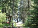 Noisy CreekColville National Forest · 4.9 mi
 Edgewater CampgroundColville National Forest · 8.6 miSilver Creek CampgroundColville National Forest · 11 mi
The weather
the next four days · the thirty-year normal
Next four days, and the thirty-year normal
Forecast
NWS forecast for Metaline Falls, WA
Typical weather
Typical May night 41°F, day 67°F.
Coldest night of the open season: typical May night 41°F. Bring the bag rated for it.
Daily high and lowDays with 0.10 in or moreOutside the published season
A normal is the 1991-2020 average for the month, not a forecast: about half of all Augusts are colder than the August line. The seven-day forecast above answers the other question.
The land, and who answers for it
what threatens it · who answers for it
Roadless country, and what’s coming for it
You’re camping on ground somebody wants. We track the threats and the comment deadlines.
Who answers for this land

Mill Pond Campground is in Washington’s 5th congressional district. Its representative, Michael Baumgartner (R), votes on the laws that decide what happens to this land. Public-lands grade so far: F. See every public-lands vote →