Minton Peak Lookout
1Heads up1 fire 44 mi away
- Right now
- Nobody has saidNo season, no closure, no bookings to read
- Sites
- 1All of them booked ahead
The place
the agency’s own description · what’s there · 8 notices
In the agency’s own words
Minton Peak Lookout is situated in the Rocky Mountains at an elevation of 5,351 feet in the Kootenai National Forest. The original lookout was constructed in 1932, replaced in 1968, and completely rebuilt in 2011. The mountain was named after Col. David Minton, an Ohio cavalryman who homesteaded (and is buried) near the mouth of Minton Creek. The lookout is typically open from late June through mid-October and is accessible by car. This rustic retreat offers a few amenities, but guests should pack in most of their own supplies and gear. Keep reading
Recreation
Mountain roads and scenic trails provide access to explore the area.
Facilities
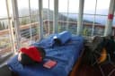
The 14x14 foot cabin sits on a five foot tower. The lookout has windows on all sides and is encircled by a catwalk. The cabin sleeps four people and is equipped with two twin size beds with mattresses. Other amenities include a table and chairs, wood stove for heat, two-burner cooktop (propane not provided), broom and dustpan. Firewood is provided. An outhouse with a vault toilet and a campfire ring are located outside. The lookout does not have electricity or water. Guests should bring enough water for drinking, cooking and cleaning. Items such as cooking gear, bedding, lanterns, matches, extra toilet paper, trash bags, dish soap and towels are not available.
Natural Features
The lookout sits five feet off the ground and is surrounded by an evergreen forest. It offers panoramic views of the Clark Fork Valley, the Bitterroot Mountains to the west and the Cabinet Range to the east. This is an ideal vantage point to enjoy sunrises and sunsets and gaze out at starry skies on clear nights.
What the agency tells you
Please call the Ranger District at (406) 827-3533 prior to arrival to confirm your stay
Check-in 2:00 pm / Check-out 11:00 am
There is no water source available at the lookout; guests must provide their own for drinking, cooking and washing.
Everything else this campground posts · 5
Access depends on weather conditions.
Please pack out all trash and food and clean the lookout before departure.
There is a 5 consecutive day stay limit. A break of 7 days is requested before making another reservation.
Be aware, this facility is not cleaned between user visits. It is up to individual renters to bring their own cleaning supplies and clean before and after site use.
Don't Move Firewood: Prevent the spread of tree-killing pests by obtaining firewood near your destination and burning it on-site. For more information visit dontmovefirewood.org.
Tents and rigs
- Sites
- 1 · 1 cabin
- Hookups
- None
- Accessible sites
- None listed
- Pets
- Allowed
- Campfires
- Allowed, barring fire bans
Facilities
- Toilets
- Vault Toilets
- “…Firewood is provided. An outhouse with a vault toilet and a campfire ring are located outside. The…”
- Firewood
- Mentioned
- Stay limit
- 15 nights
- recreation.gov facility rule maxStay
No reading yet, book on recreation.gov
Every site here is reservable, and the record lists none held back for anyone who drives up.
No availability snapshot inside the last 36 hours, so this page draws nothing rather than ageing a reading into fiction.
Watch for a cancellation
Full? Watch it.
One email when a night opens, plus More Than Just Parks dispatches. Unsubscribe any time.
We read recreation.gov once an hour, at 40 minutes past, and write the first time a site in your window is free for the nights you asked for.
Scanners that check every few minutes exist, and most of them charge. This one is free, it reads the same calendar, and it won’t always be first.
Tell me when the season opens
Watch for the season to open
One email when the season goes on sale, plus More Than Just Parks dispatches. Unsubscribe any time.
We check once an hour, at 40 minutes past, and write the first time the agency has that season on sale.
Scanners that check every few minutes exist, and most of them charge. This one is free, it reads the same calendar, and it won’t always be first.
We make nothing when you book. The link goes straight to the government.
Every line of the receipt · 12
What you actually pay
Who keeps the booking fee
The agency’s own policy text says the reservation fee and the cancellation processing fee are “retained by the reservation service contractor”, and that a campground concessionaire will decline to refund them because “they did not receive these fees”. Recreation.gov is run under contract by Booz Allen Hamilton. What share of your booking fee the contractor keeps isn’t published in any federal dataset we can read, so we print no number for it. Our reporting on the contract →
How we know this receipt · 5
rules read Sep 9, 2026 · rates Sep 10, 2026 · How we know all this
The sites
1 sites · the site map
All 1 sites
The price is derived by CAMPANAC, not published per site: the per-night rate this campground publishes for each site’s own site type. 1 of the 1 sites listed carry one, and a site whose type has no published rate sits out of the price rather than being called free.
| MINTON PEAK LOOKOUT | 001 | lookout | 4,392 ft | $55 |
Getting there
the map and the coordinate · the agency’s directions · the phone number
Where it is
 Gem Peak Lookout RentalKaniksu National Forest · 8.7 miBerlin Flats Group CampgroundCoeur d'Alene National Forest · 8.8 mi
 Sex Peak. Lookout RentalKaniksu National Forest · 9.4 mi
 Little Guard LookoutCoeur d'Alene National Forest · 11 mi
From Trout Creek, take Cedar Street to Pine Street. Turn right and follow for 5.89 miles. (Pine St. turns into Marten Cr. Road). Turn left on Minton Peak Road 322 and follow for 7.9 miles to the lookout Road 322A. Follow this road for 0.62 miles to the lookout.
The weather
the next four days · the thirty-year normal
Next four days, and the thirty-year normal
Forecast
NWS forecast for Trout Creek, MT
Typical weather
Typical October night 32°F, day 44°F.
Coldest month of the year: typical December night 18°F, below freezing. Bring a bag rated colder than that, and expect ice in the water bottle.
Daily high and lowDays with 0.10 in or more
A normal is the 1991-2020 average for the month, not a forecast: about half of all Julys are colder than the July line. The seven-day forecast above answers the other question.
The land, and who answers for it
what threatens it · who answers for it
What threatens this place
You’re camping on ground somebody wants. We track the threats and the comment deadlines.
Who answers for this land
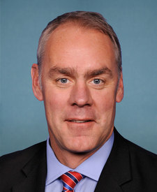
Minton Peak Lookout is in Montana’s 1st congressional district. Its representative, Ryan Zinke (R), votes on the laws that decide what happens to this land. Public-lands grade so far: F. See every public-lands vote →