National Park Service · Hawai'i Volcanoes National Park · HI

Nāmakanipaio

5Heads uppark alerts
Information
Kīlauea eruption Volcanic eruptions can be hazardous. Stay out of closed areas and monitor air quality. Eruptions can last a few hours and are often separated by pauses lasting several weeks.
Information
Sulphur Banks Bridge Closed; Boardwalk is Open The Sulphur Banks Bridge is damaged and closed until further notice. The Haʻakulamanu area, boardwalk and Sulphur Banks Trail are open and accessible from the west side near Steam Vents.
Caution
Protect Yourself from Volcanic Tephra Volcanic ash, rock and glassy strands (tephra) is present at Kīlauea summit and can irritate your skin, eyes and respiratory system. For your safety, do not handle it. Eye protection, long sleeves, long pants, a hat, closed-toe shoes and a…
Information
Mauna Loa Road Closed Past First Cattle Guard for Tree Removal Mauna Loa Road will be closed to all use from the first cattle guard to Mauna Loa Lookout for tree removal starting September 23 through October 29, 2026. The tree work will prepare the area for the Mauna Loa Road Rehabilitation Project.…
Caution
Kīpukapuaulu Trail Closed Due to Hazardous Trees and Hanging Limbs Kīpukapuaulu Trail remains closed due to numerous hazardous trees and hanging limbs resulting from several recent storms. Managers are developing a plan and will reopen the trail when it is safe.
Alerts: National Park Service alerts API · Oct 17, 2026
Reservable, and some sites walk-up16 of the 16 sites are kept for whoever pulls in first; the rest are booked ahead.
Right now
Nobody has saidNo season, no closure, no bookings to read
A night
$15From, per site
Sites
1616 of them walk-up
3,920 ftElevation
1.7 miWater · an unnamed pondOcean · 10.8 mi · to the Pacific Ocean
7.5 miSW of Mountain View, HI
16Walk-up sites
0%Tree cover

The place

the agency’s own description · what’s there

In the agency’s own words

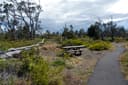
Nāmakanipaio Campground is located 31.5 miles south of Hilo on Highway-11 at 4,000' elevation. It is a large, open grassy area with tall eucalyptus and 'ōhi'a trees. This campground has restrooms, water, picnic tables and barbecue pits. Campfires are permitted in the barbeque pits only. If there are more than 2 people in your party, you can expand to 4 people per site with another tent. Maximum stay is 7 days.

Source: National Park Service API · Aug 24, 2026

Facilities

Toilets
Flush Toilets - year round
Drinking water
Yes
Source: National Park Service and agency records

Some sites book, the rest walk up

recreation.gov publishes no availability for a campground you can’t reserve, so there’s no thirty-night reading to draw here. The season bar above is what the agency does publish.

Booking window6 months outBooking opens 6 months ahead; today unlocks arrivals through April 16, 2027. The agency publishes no reservable season in the record we hold, so the window may close earlier than that.recreation.gov
A night$15Per site, fromthe agency’s fee record
A weekend$30DerivedFriday and Saturday, everything includedours, from the lines above
Runs itNational Park Servicethe agency’s record
Every line of the receipt · 5

What you actually pay

The sign priceNational Park Service
A night, from$15
Per tent site$15
The booking feerecreation.gov
We hold no recreation.gov booking record for this campground, so we can’t say whether a booking fee applies.
What a stay costs
One night, fromDerived$15
A weekend, Friday and Saturday, fromDerived$30

Derived by CAMPANAC: the lowest per-night amount the agency’s fee record states ($15), and no booking fee, because this campground takes no reservations. A weekend here means Friday and Saturday night. Optional charges (an extra vehicle, a second tent, a dump-station fee) are listed separately and aren’t in this total.

How we know this receipt · 5
Source: National Park Service API · Aug 24, 2026

record Aug 24, 2026 · How we know all this

Seen something wrong here? Tell us.

Getting there

the map and the coordinate · the phone number
Coordinate19.42537, -155.29588
The phone8665367972

Where it is

Source: National Park Service API · Aug 24, 2026

The weather

the next four days · the thirty-year normal

Next four days, and the thirty-year normal

Forecast

Tonight58°Chance Rain Showers65% rain
Saturday71°Isolated Rain Showers then Sunny16% rain
Saturday Night59°Isolated Rain Showers20% rain
Sunday71°Sunny5% rain

NWS forecast for Volcano Golf Course, HI

Typical weather

Typical October night 55°F, day 72°F.

80°40°

Daily high and lowDays with 0.10 in or more

A normal is the 1991-2020 average for the month, not a forecast: about half of all Augusts are colder than the August line. The seven-day forecast above answers the other question.

Measured at: HAWAII VOL NP HQ 54, HI (USC00511303), 3 miles away and 51 ft higher

The land, and who answers for it

who answers for it

Who answers for this land

Jill Tokuda, official portrait

Nāmakanipaio is in Hawaii’s 2nd congressional district. Its representative, Jill Tokuda (D), votes on the laws that decide what happens to this land. Public-lands grade so far: A. See every public-lands vote →

Seen something wrong here? Tell us.

How we know

every fact on this page, and where it came from
Right now: National Park Service publishes no season and no closure for this campground, and it takes no bookings we can read. That’s a gap in the record and not a locked gate: the number below is the only way to be sure.
Cell signal: the Park Service’s own campground description, read as text by CAMPANAC. None of this is a measurement. It’s what the land manager published about the place, and phones, carriers and weather all disagree with each other; treat it as a warning, not a promise.
Nearest place of any size: Volcano Golf Course, HI, 1.2 mi SW (a census designated place). Straight line.