Needle Creek Reservoir Camping Area
- Right now
- OpenInside the published season, our reading
- A night
- FreeNo camping fee
- Season
- June 1Opens June 1. No closing date published.
The place
the agency’s own description · what’s there
In the agency’s own words
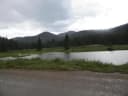
Elevation: 8830' Needle Creek Reservoir lies between Highways 50 and 114 in the Cochetopa Hills along the headwaters of Needle Creek. This reservoir was constructed in 1962 for irrigation water storage. Its low elevation, 8,830 feet, and easy access make it a favorite fishing area for many. Fishing is usually good at this site, where rainbow and brook trout average ten to eleven inches. Boats are allowed in the reservoir, but most people fish from shore with good success.
Around the campground
- On the water
- Reservoir, Creek
Phone before you drive
recreation.gov publishes no availability for a campground you can’t reserve, so there’s no thirty-night reading to draw here. The season bar above is what the agency does publish.
Every line of the receipt · 4
What you actually pay
Derived by CAMPANAC: the agency’s own record says there’s no camping fee, and no booking fee, because this campground takes no reservations. A weekend here means Friday and Saturday night. Optional charges (an extra vehicle, a second tent, a dump-station fee) are listed separately and aren’t in this total.
How we know this receipt · 5
record Aug 24, 2026 · How we know all this
Getting there
the map and the coordinate
Where it is
 Upper Crossing Guard StationSan Luis Valley Field Office · 16 mi
 Monarch ParkSan Isabel National Forest · 17 miPitkin Campground - Gunnison RDGunnison National Forest · 18 mi
The weather
the next four days · the thirty-year normal
Next four days, and the thirty-year normal
Forecast
NWS forecast for Pitkin, CO
Typical weather
Typical June night 36°F, day 75°F.
Coldest night of the open season: typical June night 36°F. Bring the bag rated for it.
Daily high and lowDays with 0.10 in or moreOutside the published season
A normal is the 1991-2020 average for the month, not a forecast: about half of all Julys are colder than the July line. The seven-day forecast above answers the other question.
The land, and who answers for it
what threatens it · who answers for it
What threatens this place
You’re camping on ground somebody wants. We track the threats and the comment deadlines.
Who answers for this land

Needle Creek Reservoir Camping Area is in Colorado’s 3rd congressional district. Its representative, Jeff Hurd (R), votes on the laws that decide what happens to this land. Public-lands grade so far: F. See every public-lands vote →