Primitive campsites at Cedar Mesa Campground
2Heads uppark alerts
This is how it should work.
- Right now
- Nobody has saidNo season, no closure, no bookings to read
- Sites
- 55 of them walk-up
The place
the agency’s own description · what’s there
In the agency’s own words
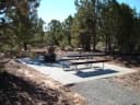
It is located approximately 23 miles (37.0 km) south of Utah State Highway 24 on the Notom-Bullfrog Road and is at 5,500 feet (1,676 m) in elevation. This primitive, no-fee campground has five sites, each with a picnic table and fire grate. There is also a pit toilet, but no water is available. The campground is open year-round, but visitors should check with the Capitol Reef Visitor Center for road conditions prior to planning an overnight stay. No reservations; first-come, first-served.
Facilities
- Toilets
- Vault Toilets - year round
- Drinking water
- None, bring your own
Around the campground
- Night sky · 6th darkest of 458 in UT
- Bortle 1
- Fall color · reported 10 days ago, 34 km away
- Patchy color
Nothing to book, just show up
One of 1,623 federal campgrounds where the site still goes to whoever pulls in first. Get there before noon on a summer weekend.
recreation.gov publishes no availability for a campground you can’t reserve, so there’s no thirty-night reading to draw here. The season bar above is what the agency does publish.
Every line of the receipt · 3
What you actually pay
How we know this receipt · 4
rules read Sep 7, 2026 · record Aug 23, 2026 · How we know all this
Getting there
the map and the coordinate
Where it is
 Lower BownsDixie National Forest · 13 miMcMillan Spring CampgroundRichfield Field Office · 14 mi
 Rosebud ATVDixie National Forest · 15 miOak Creek CampgroundDixie National Forest · 15 miOak Creek Rec Site (Boulder, UT)Dixie National Forest · 15 miUpper Pleasant Creek CampgroundDixie National Forest · 15 mi
The weather
the next four days · the thirty-year normal
Next four days, and the thirty-year normal
Forecast
NWS forecast for Boulder, UT
Typical weather
Typical October night 43°F, day 66°F.
Coldest month of the year: typical January night 21°F, below freezing. Bring a bag rated colder than that, and expect ice in the water bottle.
Daily high and lowDays with 0.10 in or more
A normal is the 1991-2020 average for the month, not a forecast: about half of all Julys are colder than the July line. The seven-day forecast above answers the other question.
The land, and who answers for it
what threatens it · who answers for it
Roadless country, and what’s coming for it
You’re camping on ground somebody wants. We track the threats and the comment deadlines.
Who answers for this land

Primitive campsites at Cedar Mesa Campground is in Utah’s 2nd congressional district. Its representative, Celeste Maloy (R), votes on the laws that decide what happens to this land. Public-lands grade so far: F. See every public-lands vote →