Pumice Flat Group Camp
1Heads up1 fire 40 mi away
- Right now
- Listed not openA database flag with no reason and no date
- Sites
- 4All of them booked ahead
The place
the agency’s own description · what’s there · 10 notices
In the agency’s own words
Pumice Flat Group Camp is located in the Red's Meadows and Devils Postpile section of the eastern Sierra Nevada Mountains, just west of the full-service community of Mammoth Lakes, California. This group camping facility provides access to some of the most spectacular wilderness in the Sierras and many outdoor activities such as horseback riding, fishing, hiking, photography and geologic study of the dramatic landscape. Devils Postpile National Monument and the famous Ansel Adams Wilderness are nearby for campers to explore. Keep reading
Recreation
This campground is a great base camp for hiking the area's many trails. Within a few miles, campers will find trailheads to the Ansel Adams Wilderness, Pacific Crest Trail and John Muir Trails. There is a mandatory shuttle that takes hikers to nearby trailheads. Fishing enthusiasts can try for trout in the lake or the North Fork of the San Joaquin River.
Facilities
The group camp is within the main Pumice Flat Campground, which offers first-come, first-served individual sites. The group area consists of four group campsites, spaced well apart and located fairly close to either creek. Picnic tables, campfire rings and food storage lockers are provided. The road to the facility is narrow, single-lane and only accessible in summer.
Natural Features
The campground sits in a lodgepole pine forest surrounded by high mountain peaks and adjacent to two creeks. The elevation is 7,700 feet. The area boasts some very interesting geologic features, including numerous lakes and rugged mountains, which lend themselves well to photography. Many species of wildlife call the mountains home, such as black bear, mountain lions, mule deer, pine marten, pika, fish and birds.
Nearby Attractions
The Red's Meadow Pack Station and Resort are about 2.5 miles away at the end of Red's Meadow Road. A general store and cafe are available. The trailhead for Rainbow Falls also begins here. The area is very close to Devils Postpile National Monument and the Ansel Adams Wilderness. Both areas have numerous trails and unparalleled photographic opportunities. Devils Postpile National Monument Ansel Adams Wilderness Charges & Cancellations Once your reservation start date has begun, neither the Recreation.gov Contact Center nor the campground manager will be able to modify your reservation.
What the agency tells you
Reserved Sites will be held until checkout time (NOON) the day following your arrival date. Sites must be occupied by the checkout time of the second day to hold a reservation or the site will be forfeited and released to other guests. Please call the office at 760-934-5795 if you need to inform the campground of an arrival time greater than 24 hours after your arrival date, or if you will not use your reservation whatsoever.
A Forest Service access fee will be charged; call 760-924-5500 for information
Mosquitoes can be abundant in early to mid summer; campers should come prepared
Everything else this campground posts · 7
This is a high elevation facility; please use caution when traveling from lower elevations; campground usually not clear of snow until late May or early June
Be bear aware; keep all food out of site in approved containers or locked inside your vehicle and remove all food from area after eating; always keep a clean camp and do not feed any wild animals
Once your reservation start date has begun, neither the Recreation.gov Contact Center nor the campground manager will be able to modify your reservation.
Fire Restrictions: Fire restrictions may be imposed at any time due to hot, dry weather conditions, at which time campfires and charcoal fires may not be allowed. For current fire conditions or weather closures contact the Mammoth Lakes Visitor Center, (760) 924-5500, or the Mono Lakes Visitor Center, (760) 647-3044.
Don't Move Firewood: Protect California's forests from tree-killing pests by buying your firewood locally and burning it on-site. For more information visit firewood.ca.gov.
Click here for more information about Inyo National Forest
Only 2 pets per site allowed.
Tents and rigs
- Sites
- 4 · 4 group
- Hookups
- None
- Longest rig
- 40 ft
- Accessible sites
- None listed
- Pets
- Allowed
- Shade
- Every site
Facilities
- Store
- Nearby
- Bear boxes
- Yes
- Stay limit
- 14 nights
- recreation.gov facility rule maxStay
Around the campground
- On the water
- Lake, River, Creek, Meadow
- Fishing
- Hiking
- Night sky · 476th darkest of 1,201 in CA
- Bortle 3
- Fall color · reported 12 days ago, 3.4 km away
- Peak color
No reading yet, book on recreation.gov
Every site here is reservable, and the record lists none held back for anyone who drives up.
No availability snapshot inside the last 36 hours, so this page draws nothing rather than ageing a reading into fiction.
Watch for a cancellation
Full? Watch it.
One email when a night opens, plus More Than Just Parks dispatches. Unsubscribe any time.
We read recreation.gov once an hour, at 40 minutes past, and write the first time a site in your window is free for the nights you asked for.
Scanners that check every few minutes exist, and most of them charge. This one is free, it reads the same calendar, and it won’t always be first.
We make nothing when you book. The link goes straight to the government.
Every line of the receipt · 9
What you actually pay
“Once your reservation start date has begun, neither the Recreation.gov Contact Center nor the campground manager will be able to modify your reservation.” · this campground’s own terms
Who keeps the booking fee
The agency’s own policy text says the reservation fee and the cancellation processing fee are “retained by the reservation service contractor”, and that a campground concessionaire will decline to refund them because “they did not receive these fees”. Recreation.gov is run under contract by Booz Allen Hamilton. What share of your booking fee the contractor keeps isn’t published in any federal dataset we can read, so we print no number for it. Our reporting on the contract →
How we know this receipt · 5
rules read Sep 9, 2026 · record Aug 23, 2026 · How we know all this
The sites
4 sites · which ones have room · the site map
The sites, ranked
from 4 mapped sitesAll 4 sites
| FLT2 | 002 | group standard nonelectric | 30 ft | 142 ft | 658 ft |
| FLT3 | 003 | group standard nonelectric | 30 ft | 155 ft | 626 ft |
| FLT4 | 004 | group standard nonelectric | 40 ft | 298 ft | 855 ft |
| PUMI | 001 | group standard nonelectric | 40 ft | 142 ft | 677 ft |
OpenStreetMap has no toilet mapped within 1 km of this campground, so no site here carries a toilet distance. That’s a gap in the map, not a finding about the campground.
Getting there
the map and the coordinate · the agency’s directions
Where it is
 Agnew Horse CampInyo National Forest · 2.7 mi
 Agnew Meadows Group CampInyo National Forest · 2.7 mi
 Twin Lakes CampgroundInyo National Forest · 4.2 mi
From U.S. Highway 395, take Highway 203 west through the town of Mammoth Lakes. At the second traffic light, turn right onto Minaret (203). Pass the Mammoth Mountain Ski Area and Minaret Vista. Continue a few miles on Red's Meadow Road to the campground turnoff.
The weather
the next four days · the thirty-year normal
Next four days, and the thirty-year normal
Forecast
NWS forecast for Mammoth Lakes, CA
Typical weather
Typical October night 36°F, day 65°F.
Coldest month of the year: typical January night 21°F, below freezing. Bring a bag rated colder than that, and expect ice in the water bottle.
Daily high and lowDays with 0.10 in or more
A normal is the 1991-2020 average for the month, not a forecast: about half of all Julys are colder than the July line. The seven-day forecast above answers the other question.
The land, and who answers for it
what threatens it · who answers for it
Roadless country, and what’s coming for it
You’re camping on ground somebody wants. We track the threats and the comment deadlines.
Who answers for this land
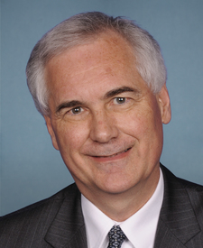
Pumice Flat Group Camp is in California’s 5th congressional district. Its representative, Tom McClintock (R), votes on the laws that decide what happens to this land. Public-lands grade so far: F. See every public-lands vote →