Quigley Group Use
- Right now
- Nobody has saidNo season, no closure, no bookings to read
- Sites
- 1All of them booked ahead
The place
the agency’s own description · what’s there · 6 notices
In the agency’s own words
Quigley Group Use Site sits in forested mountain terrain on the top of MacDonald Pass about 15 miles west of Helena, Montana. Quigley is on public land managed by the Helena Ranger District of the Helena-Lewis and Clark National Forest and is adjacent to the Continental Divide National Scenic (CDNST) trail. Located right on the Continental Divide at 6,300 feet elevation, there are spectacular views of surrounding country encompassing meadows, timbered slopes, and mountains. The site is available for rental from June 1 to October 15 each year and closed at all other times. Keep reading
Recreation
Quigley Group Use offers outdoor enthusiasts the opportunity to hike, bike and enjoy a long list of outdoor recreational activities on and around the Continental Divide Trail system. Hunting, photography, and exploration are all great recreational activities in this area. There is an extensive road system 10 miles to the west (Little Blackfoot) and five miles to the east (Rimini and Priest Pass) where many people use trucks or ride off-highway vehicles in the summer and fall to see the general area and old mining relics. The area to the south and north is sparsely roaded and offers a non-motorized, more remote experience.
Facilities
Quigley Group Use Site is an undeveloped camping area able to accommodate approximately 40 people. There is limited trailer parking and trailers should not exceed 20 feet in length. Space is available for 10-12 four-person tents. There are no camper hook ups and water is not available. There is one vault toilet on-site. Large groups staying for a longer period often choose to have portable toilet(s) delivered at the start of thier stay and pickup up before the end of their stay, at their own expense.
Natural Features
At an elevation of 6,300 feet, beneath a canopy of lodgepole pine and Douglas fir trees, this Group Site is an ideal setting for larger families or groups seeking relaxation and recreation. Nearby rugged ridges, meadows, forests and grasslands provide wildlife diverse ecosystems. Grizzly bear, deer, elk, gray wolf, moose, black bear, mountain lion, all call the area home. Contact Info For facility specific information, please call (406) 449-5201.
Nearby Attractions
The Continental Divide National Scenic Trail (CDNST) mile 616 is just a few hundred feet from the group use site, and the CDNST runs due north and south from there. The City of Helena is about 15 miles away via US Highway 12. Note, the area is near a fee campground and a trailhead, and both are well used by the general public all summer long. The area is not remote, and users can expect to encounter other people recreating.
What the agency tells you
Hookups are not available.
Do not move Firewood: Prevent the spread of tree-killing pests by attaining firewood near your destination and burning it on site. For more information visit. www.dontmovefirewood.org
Check out time is 11:00 a.m. and check in is at 2:00 p.m.
Everything else this campground posts · 3
Learn more about the Helena-Lewis and Clark National Forest by visiting https://www.fs.usda.gov/hlcnf. This site also details all of the motorized travel and food storage regulations.
Entry to the group use site is by combination locked gate; please see the welcome letter with your reservation for the combination.
All garbage and food must be packed out.
Tents and rigs
- Sites
- 1 · 1 group
- Hookups
- None
- Accessible sites
- None listed
- Pets
- Allowed
- Campfires
- Allowed, barring fire bans
- Shade
- Little
Facilities
- Toilets
- Vault Toilets
- “…and water is not available. There is one vault toilet on-site. Large groups staying for a longer period…”
- Drinking water
- None, bring your own
- “There are no camper hook ups and water is not available.”
Around the campground
- On the water
- Meadow
- Backpacking
- Biking
- Birding
- Hiking
- Horseback riding
- Hunting
- Mountain biking
- Off Highway Vehicle Trails
- Picnicking
- Scenic drives
- Stargazing
- Wildlife viewing
No reading yet, book on recreation.gov
Every site here is reservable, and the record lists none held back for anyone who drives up.
No availability snapshot inside the last 36 hours, so this page draws nothing rather than ageing a reading into fiction.
Watch for a cancellation
Full? Watch it.
One email when a night opens, plus More Than Just Parks dispatches. Unsubscribe any time.
We read recreation.gov once an hour, at 40 minutes past, and write the first time a site in your window is free for the nights you asked for.
Scanners that check every few minutes exist, and most of them charge. This one is free, it reads the same calendar, and it won’t always be first.
Tell me when the season opens
Watch for the season to open
One email when the season goes on sale, plus More Than Just Parks dispatches. Unsubscribe any time.
We check once an hour, at 40 minutes past, and write the first time the agency has that season on sale.
Scanners that check every few minutes exist, and most of them charge. This one is free, it reads the same calendar, and it won’t always be first.
We make nothing when you book. The link goes straight to the government.
Every line of the receipt · 13
What you actually pay
Who keeps the booking fee
The agency’s own policy text says the reservation fee and the cancellation processing fee are “retained by the reservation service contractor”, and that a campground concessionaire will decline to refund them because “they did not receive these fees”. Recreation.gov is run under contract by Booz Allen Hamilton. What share of your booking fee the contractor keeps isn’t published in any federal dataset we can read, so we print no number for it. Our reporting on the contract →
How we know this receipt · 5
rules read Sep 9, 2026 · rates Sep 10, 2026 · How we know all this
The sites
1 sites · the site map
All 1 sites
Toilet distances are OpenStreetMap’s, measured for 1 of the 1 sites listed. A site with no reading is unknown, never far.
The price is derived by CAMPANAC, not published per site: the per-night rate this campground publishes for each site’s own site type. 1 of the 1 sites listed carry one, and a site whose type has no published rate sits out of the price rather than being called free.
| Area Quigley Group Use Site | Quigley Group Use Site | group standard nonelectric | 1,920 ft | 2,757 ft | $50 |
Getting there
the map and the coordinate · the agency’s directions · the phone number
Where it is
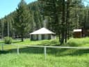 Moose Creek CabinHelena National Forest · 3.5 mi
 Park Lake CampgroundHelena National Forest · 11 mi
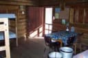 Kading CabinHelena National Forest · 12 mi
 Lost Horse CabinHelena National Forest · 15 miCromwell Dixon CampgroundHelena National Forest · 17 mi
From Helena, Montana, take US-12 W west for 13 miles to the top of MacDonald Pass, turn left (south) at the Cromwell-Dixon Campground sign and cross the large cattleguard. Turm left (east) again, travel about 500 feet and cross a second cattleguard. Then, turn left (north) again and you'll be at the gated entrance into the Quigley Day Use area.
The weather
the next four days · the thirty-year normal
Next four days, and the thirty-year normal
Forecast
NWS forecast for Elliston, MT
Typical weather
Typical October night 27°F, day 54°F.
Coldest month of the year: typical December night 7°F, below freezing. Bring a bag rated colder than that, and expect ice in the water bottle.
Daily high and lowDays with 0.10 in or more
A normal is the 1991-2020 average for the month, not a forecast: about half of all Julys are colder than the July line. The seven-day forecast above answers the other question.
The land, and who answers for it
what threatens it · who answers for it
Roadless country, and what’s coming for it
You’re camping on ground somebody wants. We track the threats and the comment deadlines.
Who answers for this land

Quigley Group Use is in Montana’s 2nd congressional district. Its representative, Troy Downing (R), votes on the laws that decide what happens to this land. Public-lands grade so far: F. See every public-lands vote →