Rattlesnake Campground and Group sites
- Right now
- Nobody has saidNo season, no closure, no bookings to read
The place
the agency’s own description · what’s there
In the agency’s own words
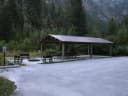
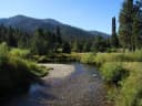
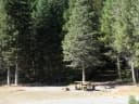
Rattlesnake Campground is located approximately 14 miles north of Crouch, Idaho along the Middle Fork Payette River at an elevation of 3,621 feet. The Middle Fork drainage offers excellent trail opportunities. Fishing and hunting are popular activities as well. Natural Features: The campground is situated on the banks of the Middle Fork Payette River among Douglas fir and lodgepole pine trees, which offer partial shade. A few sites offer river views through the dense vegetation on the banks. A variety of wildlife makes its home in the Middle Fork drainage, including deer, elk and red-tailed hawks. Keep reading
Recreation: The Middle Fork Payette River offers good to excellent fishing most of the year. Anglers cast for whitefish and rainbow trout. Many trails for hiking, mountain biking, horseback and ATV riding can be found in the area. The One Spoon Trail, Rattlesnake Trail and 465 ATV Trail are all in the vicinity of the campground. In-season big game hunting for deer, elk and bear is a popular activity in the surrounding mountains.
Around the campground
- On the water
- River
Phone before you drive
recreation.gov publishes no availability for a campground you can’t reserve, so there’s no thirty-night reading to draw here. The season bar above is what the agency does publish.
Every line of the receipt · 3
What you actually pay
How we know this receipt · 4
record Aug 24, 2026 · How we know all this
Getting there
the map and the coordinate
Where it is
 RattlesnakeBoise National Forest · 0.0 miHardscrabble CampgroundBoise National Forest · 2.1 miTie Creek CampgroundBoise National Forest · 4.6 mi
 Silver Creek CampgroundBoise National Forest · 5.8 mi
 Boiling Springs CabinBoise National Forest · 6.9 mi
 Peace Valley CampgroundBoise National Forest · 7.7 mi
The weather
the next four days · the thirty-year normal
Next four days, and the thirty-year normal
Forecast
NWS forecast for Smiths Ferry, ID
Typical weather
Typical October night 31°F, day 64°F.
Coldest month of the year: typical January night 19°F, below freezing. Bring a bag rated colder than that, and expect ice in the water bottle.
Daily high and lowDays with 0.10 in or more
A normal is the 1991-2020 average for the month, not a forecast: about half of all Julys are colder than the July line. The seven-day forecast above answers the other question.
The land, and who answers for it
what threatens it · who answers for it
What threatens this place
You’re camping on ground somebody wants. We track the threats and the comment deadlines.
Who answers for this land

Rattlesnake Campground and Group sites is in Idaho’s 1st congressional district. Its representative, Russ Fulcher (R), votes on the laws that decide what happens to this land. Public-lands grade so far: F. See every public-lands vote →