River Road
- Right now
- Taking bookingsSites offered on 30 of the next 30 nights read 15:59 UTC
- A night
- $23–$26Across the site types the agency prices
- Sites
- 21All of them booked ahead
The place
the agency’s own description · what’s there · 7 notices
In the agency’s own words
River Road Campground sits along the shores of Fourche LaFave River and Nimrod Dam, cradled between Arkansas' Ouachita and Ozark Mountains. Visitors are greeted with shaded campsites, beautiful scenery and many outdoor recreation opportunities. Nimrod Lake provides the ideal spot to get away from it all, relax and enjoy yourself. Keep reading
Recreation
Fishing is one of the most popular activities at the lake, with an abundance of crappie, largemouth bass, catfish and bream available. Boating, water skiing and tubing are also popular, with 11 boat ramps conveniently located around the lake, however, skiing and tubing are only allowed from the tip of Carden Point eastward toward the dam because areas west of there are too hazardous. Campers are likely to spot white-tailed deer, eastern wild turkey, bobwhite quail, squirrel, rabbit, fox, mink, black bear, dove and waterfowl in the area. Seasonal hunting is also permitted throughout the forested area around the lake, except in or near recreation areas.
Facilities
With 21 spacious and modern campsites (15 campsites in the River Road Loop and 6 campsites in the Project Point Loop) and one large day use group picnic shelter, River Road Campground has plenty of room for the family. A boat ramp into the river and playground are also provided.
Natural Features
Nimrod Dam was completed in 1942 as part of a comprehensive plan for flood control and development of water resources in the Fourche LaFave River. Although recreation was not part of the initial mission of the dam project, the lake and surrounding 21,000 acres of pristine land have now become a recreational oasis for outdoor enthusiasts.
Nearby Attractions
Nimrod Lake is conveniently located adjacent to State Highway 7, a National Scenic Byway and other nearby points of interest like Petit Jean State Park, Mount Nebo State Park and Hot Springs National Park.
What the agency tells you
Check-in time: 3:00 p.m.
Check-out time: 1:00 p.m.
Park attendants are on duty from 8 a.m. to 12 a.m. & 2 p.m. to 6 p.m.
Everything else this campground posts · 4
Two tents or one RV and one tent per campsite.
Off-road vehicles not permitted. Highway legal transportation only.
Group Shelters are Day Use Only. Camping is not allowed at group shelters.
Don't Move Firewood: Protect your forests from tree-killing pests by buying your firewood locally and burning it on-site. Visit Dontmovefirewood.org for further information.
Tents and rigs
- Sites
- 21
- Hookups
- 20 electric, 15 water
- Longest rig
- 78 ft
- Paved pads
- All
- Accessible sites
- None listed
- Pets
- Allowed
- Campfires
- Allowed, barring fire bans
- Shade
- Every site
Facilities
- Drinking water
- Yes
- WATER SPIGOT on 1 of 22 campsite records
- Dump station
- Yes
- recreation.gov lists “Dump Station”
- Boat ramp
- Yes
- Playground
- Yes
- Stay limit
- 42 nights
- recreation.gov facility rule maxStay
Around the campground
- On the water
- Hot springs, Lake, River
- Boating
- Fishing
- Night sky · 78th darkest of 158 in AR
- Bortle 4
26 of 42 site-nights open this Friday and Saturdayread 15:59 UTC
Every site here is reservable, and the record lists none held back for anyone who drives up.
OpenBooked
Watch for a cancellation
Full? Watch it.
One email when a night opens, plus More Than Just Parks dispatches. Unsubscribe any time.
We read recreation.gov once an hour, at 40 minutes past, and write the first time a site in your window is free for the nights you asked for.
Scanners that check every few minutes exist, and most of them charge. This one is free, it reads the same calendar, and it won’t always be first.
Tell me when the season opens
Watch for the season to open
One email when the season goes on sale, plus More Than Just Parks dispatches. Unsubscribe any time.
We check once an hour, at 40 minutes past, and write the first time the agency has that season on sale.
Scanners that check every few minutes exist, and most of them charge. This one is free, it reads the same calendar, and it won’t always be first.
We make nothing when you book. The link goes straight to the government.
Every line of the receipt · 16
What you actually pay
Derived by CAMPANAC: the agency’s published rates for this season, $23–$26 a night, plus one $8 recreation.gov reservation fee for the booking. A weekend here means Friday and Saturday night, booked once. Optional charges (an extra vehicle, a second tent, a dump-station fee) are listed separately and aren’t in this total.
Who keeps the booking fee
The agency’s own policy text says the reservation fee and the cancellation processing fee are “retained by the reservation service contractor”, and that a campground concessionaire will decline to refund them because “they did not receive these fees”. Recreation.gov is run under contract by Booz Allen Hamilton. What share of your booking fee the contractor keeps isn’t published in any federal dataset we can read, so we print no number for it. Our reporting on the contract →
How we know this receipt · 5
recreation.gov availability, read 15:59 UTC · rules read Sep 9, 2026 · rates Oct 1, 2026 · How we know all this
The sites
22 records · which ones have room · the site map
The sites, ranked
from 21 mapped sitesAll 22 records
The price is derived by CAMPANAC, not published per site: the per-night rate this campground publishes for each site’s own site type. 20 of the 22 sites listed carry one, and a site whose type has no published rate sits out of the price rather than being called free.
| PROJ | P01 | standard electric | 35 ft | 30 amp | 65 ft | 160 ft | $23–$26 |
| PROJ | P02 | standard electric | 26 ft | 30 amp | 50 ft | 147 ft | $23–$26 |
| PROJ | P03 | standard electric | 35 ft | 30 amp | 46 ft | 164 ft | $23–$26 |
| PROJ | P04 | standard electric | 33 ft | 30 amp | 40 ft | 234 ft | $23–$26 |
| PROJ | P05 | standard electric | 78 ft | 30 amp | 40 ft | 193 ft | $23–$26 |
| PROJ | P06 | standard electric | 27 ft | 30 amp | 41 ft | 244 ft | $23–$26 |
| RROA | 001 | standard electric | 50 ft | 30 amp | 235 ft | 192 ft | $23–$26 |
| RROA | 002 | standard electric | 63 ft | 50 amp | 93 ft | 273 ft | $23–$26 |
| RROA | 003 | standard electric | 44 ft | 50 amp | 93 ft | 297 ft | $23–$26 |
| RROA | 004 | standard electric | 40 ft | 50 amp | 95 ft | 315 ft | $23–$26 |
| RROA | 005 | standard electric | 50 ft | 50 amp | 95 ft | 380 ft | $23–$26 |
| RROA | 006 | type not stated | 60 ft | 30 amp | 429 ft | ||
| RROA | 007 | standard electric | 50 ft | 30 amp | 124 ft | 369 ft | $23–$26 |
| RROA | 008 | standard electric | 58 ft | 30 amp | 72 ft | 155 ft | $23–$26 |
| RROA | 009 | standard electric | 47 ft | 30 amp | 61 ft | 85 ft | $23–$26 |
| RROA | 010 | standard electric | 28 ft | 30 amp | 61 ft | 82 ft | $23–$26 |
| RROA | 011 | standard electric | 40 ft | 30 amp | 75 ft | 131 ft | $23–$26 |
| RROA | 012 | standard electric | 60 ft | 30 amp | 75 ft | 191 ft | $23–$26 |
| RROA | 013 | standard electric | 42 ft | 30 amp | 103 ft | 291 ft | $23–$26 |
| RROA | 014 | standard electric | 75 ft | 30 amp | 113 ft | 175 ft | $23–$26 |
| RROA | 015 | standard electric | 39 ft | 30 amp | 108 ft | 165 ft | $23–$26 |
| RROA | GS001 | day use | 20 amp | 103 ft | 358 ft | $75 |
The agency files 1 more record here that isn’t a site for the night. It files it as day use. It’s in the table above, marked for what it is, and it isn’t counted as a site.
OpenStreetMap has no toilet mapped within 1 km of this campground, so no site here carries a toilet distance. That’s a gap in the map, not a finding about the campground.
Getting there
the map and the coordinate · the agency’s directions · the phone number
Where it is
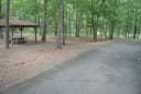 Quarry Cove0.8 mi
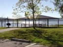 Carden Point2.4 mi
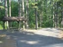 Carter Cove4.9 miSouth Fourche Recreation Area6.2 mi
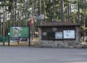 Sunlight Bay8.5 miFourche Mountain Recreation AreaOuachita National Forest · 14 mi
From Ola, Arkansas, take Route 7 south for 9 miles to the Access Road and follow the signs to the campground.
The weather
the next four days · the thirty-year normal
Next four days, and the thirty-year normal
Forecast
NWS forecast for Ola, AR
Typical weather
Typical October night 51°F, day 76°F.
Coldest month of the year: typical January night 31°F, below freezing. Bring a bag rated colder than that, and expect ice in the water bottle.
Daily high and lowDays with 0.10 in or more
A normal is the 1991-2020 average for the month, not a forecast: about half of all Julys are colder than the July line. The seven-day forecast above answers the other question.
The land, and who answers for it
who answers for it
Who answers for this land

River Road is in Arkansas’s 2nd congressional district. Its representative, J. French Hill (R), votes on the laws that decide what happens to this land. Public-lands grade so far: F. See every public-lands vote →