Sage Creek Campground
This is how it should work.
- Right now
- Nobody has saidNo season, no closure, no bookings to read
The place
the agency’s own description · what’s there
In the agency’s own words
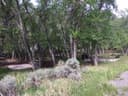
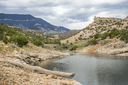
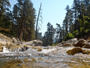
Sage Creek Campground is the only campground in the Pryor Mountains. It is located along the banks of Sage Creek. Big Ice Cave Picnic Ground , and the Bureau of Land Management Pryor Mountain Wild Horse Range are also located in the Pryor Mountains. Numerous motorized trails are located in the Pryor Mountains. See the current year's edition of motor vehicle use map (and legend ) for the area and road closures. There is a 16 day maximum stay in all Beartooth Ranger District campgrounds Camp sites: 12 Host : No Max Trailer Length : 30ft Accessible Facilities: Vault toilets Trash Pickup: No Firewood: No. Keep reading
Don't move firewood to other areas or bring in outside firewood.Prevent the spread of tree-killing insects by obtaining firewood near your destination and burning it there. Reservations : No Reservations. This campground does not use a reservation system, it is managed on a first-come, first-served basis. * Please be advised that there is not consistent potable water here. Call the district office to learn if there is water, or plan ahead and bring your own. Directions from the town of Bridger: [ This route is not advised for campers or horse trailers. High clearance vehicles are recommended ] Drive south of Bridger for 2.8 miles and turn left on Pryor Mountain Road. Drive 12.2 miles until the road dead ends. Turn right to continue on Pryor Mountain Road/ Railroad Grade Rd. Drive 2.8 miles and turn left onto Pryor Mountain Road/ Railroad Grade Rd. In 2.2 miles, turn right onto Railroad Grade Rd. This becomes Forest Road 2500 (Powerline Road). We recommend high clearance vehicles for this section of road. It is rocky and a single track. Drive 6.9 miles and turn right onto Pryor Mountain Road/ Forest Road 2308. Drive 0.3 miles and turn left onto Sage Creek Rd. Drive 0.3 miles to Sage Creek Campground. Roads in the Pryor Mountains become impassable when wet. Powerline Road Access Map For access with campers or trailers , it is recommended to access the Pryor Mountains from the south, via the Crooked Creek Road. From Bridger, drive 21.5 miles south on Hwy-310 to Warren (a conveyeor belt for a quarry goes over the road). Turn left onto Quarry Rd and drive 6.9 miles (at 4.3 miles, the road name changes to Helt Rd). Veer to the right onto Gyp Springs Rd and drive for 7.1 miles. Turn left onto Helt Rd and drive for 0.2 miles, then veer to the right onto Crooked Creek Rd. Drive 6 miles to the Forest Service boundary. Continue another 3.4 miles to Tie Flats. Turn left onto Pryor Mountain Rd (Forest Road 2308) and drive 7.6 miles. Turn right onto Sage Creek Road and drive 0.3 miles to Sage Creek Campground, on your right. [approximate driving time from Bridger, MT: 2.5 hours]. Pryor Mountain Access Map Information: Beartooth Ranger District 6811 Hwy 212 Red Lodge, MT 59068 (406) 446-2103
Facilities
- Toilets
- Vault Toilets
- “…Length : 30ft Accessible Facilities: Vault toilets Trash Pickup: No Firewood: No. Don't move firewood…”
- Firewood
- Mentioned
Around the campground
- On the water
- Creek
- Picnicking
Nothing to book, just show up
One of 1,623 federal campgrounds where the site still goes to whoever pulls in first. Get there before noon on a summer weekend.
recreation.gov publishes no availability for a campground you can’t reserve, so there’s no thirty-night reading to draw here. The season bar above is what the agency does publish.
Every line of the receipt · 3
What you actually pay
How we know this receipt · 4
rules read Sep 7, 2026 · record Aug 23, 2026 · How we know all this
Getting there
the map and the coordinate
Where it is


The weather
the next four days · the thirty-year normal
Next four days, and the thirty-year normal
Forecast
NWS forecast for Pryor, MT
Typical weather
Typical October night 31°F, day 56°F.
Coldest month of the year: typical January night 14°F, below freezing. Bring a bag rated colder than that, and expect ice in the water bottle.
Daily high and lowDays with 0.10 in or more
A normal is the 1991-2020 average for the month, not a forecast: about half of all Julys are colder than the July line. The seven-day forecast above answers the other question.
The land, and who answers for it
who answers for it
Who answers for this land

Sage Creek Campground is in Montana’s 2nd congressional district. Its representative, Troy Downing (R), votes on the laws that decide what happens to this land. Public-lands grade so far: F. See every public-lands vote →