Sagehen Creek Campground
1Heads up1 fire 43 mi away
This is how it should work.
- Right now
- Listed not openA database flag with no reason and no date
The place
the agency’s own description · what’s there
In the agency’s own words
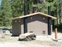
Sagehen Creek Campground is a remote, rustic campground along Sagehen Creek approximately seven miles west of Highway 89 North. It is adjacent to a beautiful meadow with shade provided by lodgepole pine. Prepare for mosquitos in the early camping season. Not suitable for large RVs. Rough native surface roads in campground. Accessible vault toilet. Picnic tables and fire rings provided. Firewood not available for purchase. Elevation: 6500 feet. No water or trash services provided. Pack it in, pack it out No fee for staying in Sagehen Creek campground. No reservations – first come, first served. Keep reading
CAMPING IS LIMITED TO 14 DAYS PER YEAR. Directions: From Truckee take Highway 89 North for approximately eight miles to Sagehen Summit. Take a left onto 260 Road and go approximately 0.10 mile to four-way intersection. Continue on 260 Road (middle road, not to field station) for approximately 1.5 miles. Take a left onto 11 Road for approximately three miles. At bottom of paved hill, take a left at Sagehen Campground sign. Campground will be on the right in approximately 0.5 mile.
Facilities
- Toilets
- Vault Toilets
- “…surface roads in campground. Accessible vault toilet. Picnic tables and fire rings provided. Firewood…”
- Drinking water
- None, bring your own
- “…for purchase. Elevation: 6500 feet. No water or trash services provided. Pack it in, pack it out…”
- Firewood
- Sold here
Around the campground
- On the water
- Creek, Meadow
- Auto Touring
- Biking
- Fall color · reported 11 days ago, 32 km away
- Patchy color
Nothing to book, just show up
One of 1,623 federal campgrounds where the site still goes to whoever pulls in first. Get there before noon on a summer weekend.
recreation.gov publishes no availability for a campground you can’t reserve, so there’s no thirty-night reading to draw here. The season bar above is what the agency does publish.
Every line of the receipt · 3
What you actually pay
How we know this receipt · 4
rules read Sep 7, 2026 · record Aug 23, 2026 · How we know all this
Getting there
the map and the coordinate
Where it is
 Lower Little TruckeeTahoe National Forest · 3.7 mi
 Upper Little TruckeeTahoe National Forest · 4.0 miLakeside CampgroundTahoe National Forest · 5.7 mi
 Lakeside (Truckee)Tahoe National Forest · 5.8 mi
 Prosser FamilyTahoe National Forest · 6.4 mi
 Prosser Ranch GroupTahoe National Forest · 6.7 mi
The weather
the next four days · the thirty-year normal
Next four days, and the thirty-year normal
Forecast
NWS forecast for Truckee, CA
Typical weather
Typical October night 29°F, day 63°F.
Coldest month of the year: typical January night 17°F, below freezing. Bring a bag rated colder than that, and expect ice in the water bottle.
Daily high and lowDays with 0.10 in or more
A normal is the 1991-2020 average for the month, not a forecast: about half of all Julys are colder than the July line. The seven-day forecast above answers the other question.
The land, and who answers for it
what threatens it · who answers for it
Roadless country, and what’s coming for it
You’re camping on ground somebody wants. We track the threats and the comment deadlines.
Who answers for this land

Sagehen Creek Campground is in California’s 3rd congressional district. Its representative, Kevin Kiley (I), votes on the laws that decide what happens to this land. Public-lands grade so far: F. See every public-lands vote →