Sardine Peak Lookout
- Right now
- Nobody has saidNo season, no closure, no bookings to read
- Sites
- 1All of them booked ahead
The place
the agency’s own description · what’s there · 11 notices
In the agency’s own words
Sardine Peak is a forest fire lookout tower that was constructed in 1935 by the Civilian Conservation Corps. It is a three story enclosed tower with external stairs. Presently the top room or observation cab is the only rentable space. Sardine sits at an elevation of 8,138 feet in the Eastern Sierra Nevada Mountains of Tahoe National Forest, approximately 20 miles from Truckee, California. The lookout does not have electricity, water or garbage service. It does have a propane tank to operate propane-powered appliances. Keep reading
Recreation
Hiking, mountain biking and off road vehicle use are popular around this lookout. Stampede and Boca Reservoirs are nearby for fishing, boating and swimming.
Facilities
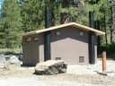
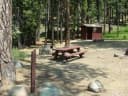
The interior of the cab is 14 feet long and 14 feet wide and contains two twin beds, a dry sink, a table and four chairs, two propane lights, a propane cast iron heat stove and a propane stove/oven for cooking. A limited assortment of cooking utensils, pots and pans are provided. There is an accessible vault toilet, a picnic table and fire ring are located outside below the lookout. Firewood is not provided. Visitors need to bring their own bedding, toilet paper and other personal items.
Natural Features
The lookout tower sits on a mountain top with spectacular views of Stampede Reservoir, Boca Reservoir, Sardine Valley, Independence Lake, the top of the Sierra Buttes and western Nevada.
Nearby Attractions
Kyburz Flat Interpretive Area, The Boca Townsite Interpretive Area, and a mountain bike loop within Sardine Valley are all nearby. Contact Info For facility specific information, please call (530) 430-8912.
What the agency tells you
Before arrival, visitors should call the Sierraville Ranger District at (530) 430-8912 (Monday through Friday) for road, weather and fire conditions between 8:30AM and 12:30 PM.
The lookout is accessed by an unimproved Forest Service Road; passenger cars are not recommended.
First time visitors should arrange to arrive to the lookout before sunset to avoid getting lost.
Everything else this campground posts · 8
The key for the lookout is kept in a lockbox at the lookout; renters will be given the combination to the gate and the lockbox in an email used when making the reservation.
No water is available; visitors must bring their own supply.
Wildlife is abundant; all food must be kept in secured containers.
Pack out all food and trash.
Lightning may be a hazard during summer storms.
Renters must provide a valid contact phone number so the district staff may contact renters to provide updated information before arrival.
Learn more about the Tahoe National Forest.
Don't move firewood: Protect California's forests from tree killing pests by buying your firewood locally and burning it on-site.
Tents and rigs
- Sites
- 1 · 1 cabin
- Hookups
- None
- Longest rig
- 15 ft
- Accessible sites
- None listed
- Pets
- Allowed
- Campfires
- Allowed, barring fire bans
Facilities
- Toilets
- Vault Toilets
- “…are provided. There is an accessible vault toilet, a picnic table and fire ring are located outside…”
- Firewood
- Mentioned
- Stay limit
- 5 nights
- recreation.gov facility rule maxStay
Around the campground
- On the water
- Reservoir, Lake
- Historic site
- Night sky · 961st darkest of 1,201 in CA
- Bortle 4
- Fall color · reported 3 days ago, 35 km away
- No change
No reading yet, book on recreation.gov
Every site here is reservable, and the record lists none held back for anyone who drives up.
No availability snapshot inside the last 36 hours, so this page draws nothing rather than ageing a reading into fiction.
Watch for a cancellation
Full? Watch it.
One email when a night opens, plus More Than Just Parks dispatches. Unsubscribe any time.
We read recreation.gov once an hour, at 40 minutes past, and write the first time a site in your window is free for the nights you asked for.
Scanners that check every few minutes exist, and most of them charge. This one is free, it reads the same calendar, and it won’t always be first.
We make nothing when you book. The link goes straight to the government.
Every line of the receipt · 12
What you actually pay
Who keeps the booking fee
The agency’s own policy text says the reservation fee and the cancellation processing fee are “retained by the reservation service contractor”, and that a campground concessionaire will decline to refund them because “they did not receive these fees”. Recreation.gov is run under contract by Booz Allen Hamilton. What share of your booking fee the contractor keeps isn’t published in any federal dataset we can read, so we print no number for it. Our reporting on the contract →
How we know this receipt · 5
rules read Sep 9, 2026 · rates Sep 10, 2026 · How we know all this
The sites
1 sites · the site map
All 1 sites
The price is derived by CAMPANAC, not published per site: the per-night rate this campground publishes for each site’s own site type. 1 of the 1 sites listed carry one, and a site whose type has no published rate sits out of the price rather than being called free.
Measured shade is NLCD Tree Canopy Cover 2024 (USDA Forest Service / MRLC) read at the site’s own coordinate, 27% canopy or more, and only for the sites the agency gave no Shade value. It never changes the agency’s own shaded count beside it.
| SARDINE PEAK LOOKOUT | 01 | lookout | 15 ft | 3,188 ft | $75 |
Getting there
the map and the coordinate · the agency’s directions · the phone number
Where it is
 Upper Little TruckeeTahoe National Forest · 4.5 mi
 Lower Little TruckeeTahoe National Forest · 4.6 mi
 Emigrant GroupTahoe National Forest · 6.1 mi
 Logger CampgroundTahoe National Forest · 6.3 mi
 Cold CreekTahoe National Forest · 6.8 mi
From the Sierraville Ranger District Office, proceed south on Highway 89 for 12 miles to Sierra County Road S450. Turn left onto road S450 and proceed east for 4 miles to Sierra County Road S650, the Lemon Canyon Road. Turn left onto County Road S650 and proceed north for 2 miles to Forest Service Road 650-75, the Sardine Peak Lookout Road and proceed 4 miles to the locked gate. Sardine Peak Lookout is about 250 yards beyond the locked gate.
The weather
the next four days · the thirty-year normal
Next four days, and the thirty-year normal
Forecast
NWS forecast for Sierra Brooks, CA
Typical weather
Typical October night 36°F, day 55°F.
Coldest month of the year: typical December night 23°F, below freezing. Bring a bag rated colder than that, and expect ice in the water bottle.
Daily high and lowDays with 0.10 in or more
A normal is the 1991-2020 average for the month, not a forecast: about half of all Julys are colder than the July line. The seven-day forecast above answers the other question.
The land, and who answers for it
what threatens it · who answers for it
Roadless country, and what’s coming for it
You’re camping on ground somebody wants. We track the threats and the comment deadlines.
Who answers for this land

Sardine Peak Lookout is in California’s 3rd congressional district. Its representative, Kevin Kiley (I), votes on the laws that decide what happens to this land. Public-lands grade so far: F. See every public-lands vote →