South Fork Campgound
- Right now
- Listed not openA database flag with no reason and no date
The place
the agency’s own description · what’s there
In the agency’s own words
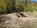
The South Fork Campground is a first-come, first-served campground located in the Williams Fork Valley. Facilities: There are 21 non-electric sites that will accommodate tents, trailers and RVs. Each site contains a tent pad, fire grate and picnic table. Additional facilities include restrooms, trash service and drinking water. The South Fork Campground is the only campground on the Sulphur Ranger District that is designated for horse camping. There is a small corral in the campground for one or two horses. No water troughs. Group campsite : South Fork Campground also has one non-electric group site that can hold up to 25 people. The group site may be reserved. Recreation: Popular activities include hiking and horseback riding on nearby trails and in the Byers Peak Wilderness area, where Wilderness regulations apply. View a COTREX map . View a campground map .
Facilities
- Toilets
- Yes, the record doesn't say what kind
- “Additional facilities include restrooms, trash service and drinking water.”
Around the campground
- Fall color · reported 7 days ago, 23 km away
- Peak color
Phone before you drive
recreation.gov publishes no availability for a campground you can’t reserve, so there’s no thirty-night reading to draw here. The season bar above is what the agency does publish.
Every line of the receipt · 4
What you actually pay
How we know this receipt · 4
record Aug 24, 2026 · How we know all this
Getting there
the map and the coordinate
Where it is
 South Fork Group Site - Arapaho NF (CO)Arapaho National Forest · 0.2 mi
 Sugarloaf CampgroundArapaho National Forest · 0.5 miColumbine Landing Recreation Site6.2 mi
 Blue River Campground (CO)White River National Forest · 7.3 mi
 Horseshoe CampgroundArapaho National Forest · 8.0 mi
 Prairie Point Campground (CO)White River National Forest · 11 mi
The weather
the next four days · the thirty-year normal
Next four days, and the thirty-year normal
Forecast
NWS forecast for Silverthorne, CO
Typical weather
Typical October night 21°F, day 54°F.
Coldest month of the year: typical January night 2°F, below freezing. Bring a bag rated colder than that, and expect ice in the water bottle.
Daily high and lowDays with 0.10 in or more
A normal is the 1991-2020 average for the month, not a forecast: about half of all Julys are colder than the July line. The seven-day forecast above answers the other question.
The land, and who answers for it
what threatens it · who answers for it
Roadless country, and what’s coming for it
You’re camping on ground somebody wants. We track the threats and the comment deadlines.
Who answers for this land

South Fork Campgound is in Colorado’s 2nd congressional district. Its representative, Joe Neguse (D), votes on the laws that decide what happens to this land. Public-lands grade so far: A+. See every public-lands vote →