Springy Point
3Heads up3 fires, nearest 27 mi
- Right now
- Nobody has saidNo season, no closure, no bookings to read
- A night
- $30From, per site
- Sites
- 38All of them booked ahead
The place
the agency’s own description · what’s there · 6 notices
In the agency’s own words
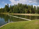
Springy Point Campground is situated amid firs, cedars and pines overlooking the Pend Oreille River with views of the Cabinet and Selkirk Mountains. The city of Sandpoint is just a short trip across the water and offers a marina, parks, shopping and plenty of sightseeing opportunities. Keep reading
Recreation
Water sports are the most popular activity at Springy Point, and with a boat ramp located on-site, kayaking, canoeing, water skiing, jet skiing and fishing are never far out of reach. A large swimming area provides visitors with comfortable access to the river's clear, clean waters. Visitors may also enjoy biking or hiking across the Long Bridge into the town of Sandpoint for a change of scenery or stroll around town. For the bird watchers or moose watchers, a short trip up to the Pack River Area to watch wildlife provides a great day trip.
Facilities
Springy Point Campground offers 38 shady campsites near the water. 36 are standard non-electric, with two walk-to sites. Amenities include drinking water, flush toilets and showers. A small picnic shelter is located off of the beach may be reserved through the recreation.gov website.
Natural Features
Lake Pend Oreille is a glacier-carved lake surrounded by scenic mountains in the northern Idaho Panhandle. It is one of the largest and deepest natural lakes in the western United States with depths plunging more than 1,200 ft., in some areas. The area around the Lake is the traditional home of the Kalispell Indians. French settlers named the area "Pend Oreille," which means "ear pendant," after observing the large shell earrings worn by the Kalispell people.
Nearby Attractions
The Albeni Falls Visitor Center features exhibits on the history of the dam and the natural features of the area, with tours of the dam given Saturdays during the summer.
What the agency tells you
Group shelter reservations: You are responsible for following all regulations posted under the "Need to Know" and "Site Details" sections for each respective shelter. Please read these sections before making a reservation.
Campsites are by reservation only. There are no First Come, First Served sites.
Campsites are for camping only. Reserving for day-use activities without intending to camp is prohibited.
Everything else this campground posts · 3
All camping equipment must be located on the campsite impact areas, or if undefined, located 10-15ft from the fire ring and off all vegetation.
Site Limits: (a) 2 Motorized Vehicles (b) 1 Camping unit (RV, motorhome, camper van, etc) (c) 2 tents (d) 8 people
No unlicensed motorized vehicles allowed, including side-by-sides, ATVs, etc.
Tents and rigs
- Sites
- 38 · 2 walk-in
- Hookups
- None
- Longest rig
- 40 ft
- Accessible sites
- None listed
- Pets
- Allowed
- Campfires
- Allowed, barring fire bans
- Shade
- 37 of 38 sites
Facilities
- Toilets
- Flush Toilets
- “…sites. Amenities include drinking water, flush toilets and showers. A small picnic shelter is located off…”
- Showers
- Yes, the record doesn’t say what kind
- “Amenities include drinking water, flush toilets and showers.”
- Drinking water
- Yes
- “…two walk-to sites. Amenities include drinking water, flush toilets and showers. A small picnic shelter…”
- Dump station
- Yes
- recreation.gov lists “Dump Station”
- Boat ramp
- Yes
- Stay limit
- 14 nights
- recreation.gov facility rule maxStay
Around the campground
- On the water
- Lake, River, Beach
- Boating
- Fishing
- Picnicking
- Swimming
- Night sky · 516th darkest of 523 in ID
- Bortle 4
- Fall color · reported 14 days ago, 29 km away
- No change
No reading yet, book on recreation.gov
Every site here is reservable, and the record lists none held back for anyone who drives up.
No availability snapshot inside the last 36 hours, so this page draws nothing rather than ageing a reading into fiction.
Watch for a cancellation
Full? Watch it.
One email when a night opens, plus More Than Just Parks dispatches. Unsubscribe any time.
We read recreation.gov once an hour, at 40 minutes past, and write the first time a site in your window is free for the nights you asked for.
Scanners that check every few minutes exist, and most of them charge. This one is free, it reads the same calendar, and it won’t always be first.
Tell me when the season opens
Watch for the season to open
One email when the season goes on sale, plus More Than Just Parks dispatches. Unsubscribe any time.
We check once an hour, at 40 minutes past, and write the first time the agency has that season on sale.
Scanners that check every few minutes exist, and most of them charge. This one is free, it reads the same calendar, and it won’t always be first.
We make nothing when you book. The link goes straight to the government.
Every line of the receipt · 13
What you actually pay
Derived by CAMPANAC: the agency’s published rate for this season, $30 a night, plus one $8 recreation.gov reservation fee for the booking. A weekend here means Friday and Saturday night, booked once. Optional charges (an extra vehicle, a second tent, a dump-station fee) are listed separately and aren’t in this total.
Who keeps the booking fee
The agency’s own policy text says the reservation fee and the cancellation processing fee are “retained by the reservation service contractor”, and that a campground concessionaire will decline to refund them because “they did not receive these fees”. Recreation.gov is run under contract by Booz Allen Hamilton. What share of your booking fee the contractor keeps isn’t published in any federal dataset we can read, so we print no number for it. Our reporting on the contract →
How we know this receipt · 5
rules read Sep 9, 2026 · rates Oct 1, 2026 · How we know all this
The sites
39 records · which ones have room · the site map
The sites, ranked
from 39 mapped sitesAll 39 records
Toilet distances are OpenStreetMap’s, measured for 39 of the 39 sites listed. A site with no reading is unknown, never far.
The price is derived by CAMPANAC, not published per site: the per-night rate this campground publishes for each site’s own site type. 38 of the 39 sites listed carry one, and a site whose type has no published rate sits out of the price rather than being called free.
| BIRC | 01 | standard nonelectric | 30 ft | 88 ft | 316 ft | 204 ft | $30 |
| BIRC | 02 | standard nonelectric | 30 ft | 67 ft | 407 ft | 186 ft | $30 |
| BIRC | 03 | standard nonelectric | 30 ft | 52 ft | 379 ft | 104 ft | $30 |
| BIRC | 04 | standard nonelectric | 20 ft | 53 ft | 425 ft | 156 ft | $30 |
| BIRC | 05 | standard nonelectric | 30 ft | 52 ft | 416 ft | 132 ft | $30 |
| BIRC | 06 | standard nonelectric | 30 ft | 36 ft | 356 ft | 73 ft | $30 |
| BIRC | 07 | standard nonelectric | 30 ft | 36 ft | 324 ft | 49 ft | $30 |
| BIRC | 08 | standard nonelectric | 30 ft | 76 ft | 380 ft | 127 ft | $30 |
| BIRC | 09 | standard nonelectric | 30 ft | 66 ft | 289 ft | 139 ft | $30 |
| BIRC | 10 | standard nonelectric | 20 ft | 64 ft | 335 ft | 194 ft | $30 |
| BIRC | 11 | standard nonelectric | 30 ft | 53 ft | 251 ft | 197 ft | $30 |
| BIRC | 12 | standard nonelectric | 20 ft | 53 ft | 289 ft | 232 ft | $30 |
| BIRC | 13 | standard nonelectric | 20 ft | 21 ft | 254 ft | 278 ft | $30 |
| BIRC | 14 | standard nonelectric | 20 ft | 21 ft | 234 ft | 280 ft | $30 |
| BIRC | 15 | standard nonelectric | 30 ft | 34 ft | 174 ft | 251 ft | $30 |
| BIRC | 16 | standard nonelectric | 30 ft | 34 ft | 152 ft | 239 ft | $30 |
| BIRC | 17 | standard nonelectric | 20 ft | 53 ft | 144 ft | 181 ft | $30 |
| BIRC | 18 | standard nonelectric | 20 ft | 59 ft | 200 ft | 158 ft | $30 |
| BIRC | 19 | standard nonelectric | 25 ft | 53 ft | 152 ft | 146 ft | $30 |
| BIRC | 20 | standard nonelectric | 20 ft | 48 ft | 213 ft | 97 ft | $30 |
| BIRC | 21 | standard nonelectric | 20 ft | 48 ft | 199 ft | 88 ft | $30 |
| BIRC | 22 | standard nonelectric | 20 ft | 41 ft | 146 ft | 138 ft | $30 |
| BIRC | 23 | standard nonelectric | 20 ft | 41 ft | 156 ft | 141 ft | $30 |
| BIRC | 24 | standard nonelectric | 20 ft | 76 ft | 221 ft | 127 ft | $30 |
| BIRC | 25 | standard nonelectric | 40 ft | 76 ft | 233 ft | 187 ft | $30 |
| CEDA | 26 | standard nonelectric | 20 ft | 63 ft | 194 ft | 109 ft | $30 |
| CEDA | 27 | standard nonelectric | 20 ft | 58 ft | 143 ft | 49 ft | $30 |
| CEDA | 28 | standard nonelectric | 20 ft | 58 ft | 131 ft | 103 ft | $30 |
| CEDA | 29 | standard nonelectric | 25 ft | 22 ft | 88 ft | 192 ft | $30 |
| CEDA | 30 | standard nonelectric | 20 ft | 44 ft | 191 ft | 171 ft | $30 |
| CEDA | 31 | standard nonelectric | 20 ft | 22 ft | 108 ft | 193 ft | $30 |
| CEDA | 32 | standard nonelectric | 20 ft | 52 ft | 107 ft | 243 ft | $30 |
| CEDA | 33 | standard nonelectric | 20 ft | 44 ft | 189 ft | 214 ft | $30 |
| CEDA | 34 | standard nonelectric | 30 ft | 42 ft | 80 ft | 328 ft | $30 |
| CEDA | 35 | standard nonelectric | 30 ft | 67 ft | 180 ft | 279 ft | $30 |
| CEDA | 36 | standard nonelectric | 30 ft | 67 ft | 107 ft | 385 ft | $30 |
| CEDA | 37 | walk to | 15 ft | 34 ft | 38 ft | 333 ft | $30 |
| CEDA | 38 | walk to | 15 ft | 34 ft | 26 ft | 367 ft | $30 |
| Group | Day Use Shelter | day use | 142 ft | 76 ft | 269 ft |
The agency files 1 more record here that isn’t a site for the night. It files it as day use. It’s in the table above, marked for what it is, and it isn’t counted as a site.
25 of 39 listed
Getting there
the map and the coordinate · the agency’s directions · the phone number
Where it is
 Green Bay CampgroundKaniksu National Forest · 9.1 mi
 Riley Creek10 miMaiden Rock CampgroundKaniksu National Forest · 10 mi
 Sam OwenKaniksu National Forest · 14 miWhiskey Rock Bay CampgroundKaniksu National Forest · 14 mi
 Priest River15 mi
From Sandpoint, Idaho, take US 95 south across the Long Bridge, then turn west onto Lakeshore Drive. After three miles turn right into the campground.
The weather
the next four days · the thirty-year normal
Next four days, and the thirty-year normal
Forecast
NWS forecast for Dover, ID
Typical weather
Typical October night 34°F, day 56°F.
Coldest month of the year: typical December night 23°F, below freezing. Bring a bag rated colder than that, and expect ice in the water bottle.
Daily high and lowDays with 0.10 in or more
A normal is the 1991-2020 average for the month, not a forecast: about half of all Augusts are colder than the August line. The seven-day forecast above answers the other question.
The land, and who answers for it
what threatens it · who answers for it
Roadless country, and what’s coming for it
You’re camping on ground somebody wants. We track the threats and the comment deadlines.
Who answers for this land
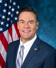
Springy Point is in Idaho’s 1st congressional district. Its representative, Russ Fulcher (R), votes on the laws that decide what happens to this land. Public-lands grade so far: F. See every public-lands vote →