Surveyors Lookout
2Heads up2 fires, nearest 15 mi
- Right now
- Nobody has saidNo season, no closure, no bookings to read
- Sites
- 1All of them booked ahead
The place
the agency’s own description · what’s there · 9 notices
In the agency’s own words
Located near the Mallard-Larkins Pioneer Area Attractions, Surveyors Lookout is perched atop a 30 foot tower, providing phenomenal views of Snow Peak and the surrounding mountains. The cabin is listed on the National Historic Register for Lookouts and offers visitors a unique camping experience in the Idaho Panhandle National Forest. The original pole structure lookout was built in 1931 as part of a network of lookouts used to spot fires in the Upper St. Joe Country. The original lookout was replaced with the current treated timber structure in 1964. Access to the lookout is via a rugged single-lane road with pullouts, and is not recommended for low clearance vehicles. Road may be slick when wet. Keep reading
Recreation
The Mallard-Larkins Pioneer Area straddles the divide between the Little North Fork Clearwater River basins and the North Fork Clearwater River. This beautiful area attracts hikers and some technical rock climbers. Hunting and trout fishing are offered in designated areas. From the lookout, there is access to Scribner Falls Trail #106 and nearby access to Surveyor's Ridge Trail #40, Horseshoe Loop Trail #141, and Northbound Creek Trail #111. A scenic drive through the upper St. Joe country is an excellent way to take in the sights leading up to the lookout.
Facilities
Surveyors Lookout can accommodate up to four guests. Furnishings include a propane cook stove, heater and lights. A twin bed and two extra mattresses are provided, along with a chest with some drawers. A refrigerator is also available, but it is very small and unreliable. It is recommended that guests bring a cooler with ice as backup. Cooking pots and utensils are included. No drinking water is available; guests should bring plenty of their own. An alternate option is to collect water from a spring located 1.4 miles down the access road. This water is non-potable and must be boiled or treated before consuming. Items to pack include food, bedding, a first aid kit, dish soap, towels, toiletries and binoculars. If planning to collect water from a stream, water containers are needed. Guests are advised to bring warm clothes and blankets for cold evenings. Although a heater is provided, the lookout is not insulated so it remains cold.
Natural Features
Surveyors Lookout is located atop Surveyors Ridge at an elevation of 6,000 feet. The 30 foot tower overlooks the spectacular Mallard-Larkins Pioneer Area, which straddles the divide between the Little North Fork Clearwater River basins and the North Fork Clearwater River. Snow Peak, Middle Sister and Mallard Peak Lookouts are still standing and can be seen from Surveyors.
Nearby Attractions
Avery is the nearest town for conveniences.
What the agency tells you
Entry is by combination lock; Pleaser refer to combination code on your confirmation.
No drinking water available; bring water or treat and boil spring water, found 1.4 miles down road
Please bring garbage bags; this is a 'pack it in-pack it out' facility
Everything else this campground posts · 6
Wastewater should be strained and all food particles should be packed out; remaining water should be poured in a hole away from lookout
No smoking allowed in lookout
Please seal food in rodent-proof containers (one provided) or coolers
Bring plenty of blankets and warm clothes for cold nights
Click here for more information on the Idaho Panhandle National Forests
Don't Move Firewood: Prevent the spread of tree-killing pests by obtaining firewood near your destination and burning it on-site. For more information visit dontmovefirewood.org.
Tents and rigs
- Sites
- 1 · 1 cabin
- Hookups
- None
- Accessible sites
- None listed
Facilities
- Drinking water
- None, bring your own
- “…Cooking pots and utensils are included. No drinking water is available; guests should bring plenty of their…”
Around the campground
- On the water
- River, Creek
- Hiking
No reading yet, book on recreation.gov
Every site here is reservable, and the record lists none held back for anyone who drives up.
No availability snapshot inside the last 36 hours, so this page draws nothing rather than ageing a reading into fiction.
Watch for a cancellation
Full? Watch it.
One email when a night opens, plus More Than Just Parks dispatches. Unsubscribe any time.
We read recreation.gov once an hour, at 40 minutes past, and write the first time a site in your window is free for the nights you asked for.
Scanners that check every few minutes exist, and most of them charge. This one is free, it reads the same calendar, and it won’t always be first.
Tell me when the season opens
Watch for the season to open
One email when the season goes on sale, plus More Than Just Parks dispatches. Unsubscribe any time.
We check once an hour, at 40 minutes past, and write the first time the agency has that season on sale.
Scanners that check every few minutes exist, and most of them charge. This one is free, it reads the same calendar, and it won’t always be first.
We make nothing when you book. The link goes straight to the government.
Every line of the receipt · 12
What you actually pay
Who keeps the booking fee
The agency’s own policy text says the reservation fee and the cancellation processing fee are “retained by the reservation service contractor”, and that a campground concessionaire will decline to refund them because “they did not receive these fees”. Recreation.gov is run under contract by Booz Allen Hamilton. What share of your booking fee the contractor keeps isn’t published in any federal dataset we can read, so we print no number for it. Our reporting on the contract →
How we know this receipt · 5
rules read Sep 9, 2026 · rates Oct 1, 2026 · How we know all this
The sites
1 sites · the site map
All 1 sites
The price is derived by CAMPANAC, not published per site: the per-night rate this campground publishes for each site’s own site type. 1 of the 1 sites listed carry one, and a site whose type has no published rate sits out of the price rather than being called free.
| AREA SURVEYORS LOOKOUT | 001 | cabin nonelectric | 907 ft | $55 |
OpenStreetMap has no toilet mapped within 1 km of this campground, so no site here carries a toilet distance. That’s a gap in the map, not a finding about the campground.
Getting there
the map and the coordinate · the agency’s directions · the phone number
Where it is
 Beaver Creek A-Frame Cabin (ID)St. Joe National Forest · 7.9 mi
 Mammoth Springs CampgroundSt. Joe National Forest · 8.9 mi
 Line Creek Stock CampgroundSt. Joe National Forest · 9.3 mi
 Red Ives CabinSt. Joe National Forest · 9.6 miFly Flat CampgroundSt. Joe National Forest · 11 miAquarius Campground and Purple Beach Group SiteClearwater National Forest · 11 mi
From the St. Joe River Road (FH50) to Beaver Creek, drive 29 miles east of Avery to the junction of the Red Ives Road 218. Turn south (right) and drive 8 miles to the junction of Beaver Creek Road 303 (just past Beaver Creek Campground). Drive about 7.5 miles to Road 201. Turn south (left) toward Sawtooth Saddle. Drive 13 miles to access road to Surveyors Lookout (Road 395A).
From St. Regis, take Little Joe Road 282 about 14.5 miles to the top of Gold Summit. Stay on the same road which changes names at the summit and becomes FH50. Travel about 12.5 miles to the junction of the Red Ives Road 218. Drive about 8 miles on the Red Ives Road to the junction of Beaver Creek Road 303 (just past Beaver Creek Campground). Drive about 7.5 miles to Road 201. Turn south (left) toward Sawtooth Saddle. Drive 13 miles to access road to Surveyors Lookout (Road 395A).
The weather
the next four days · the thirty-year normal
Next four days, and the thirty-year normal
Forecast
NWS forecast for De Borgia, MT
Typical weather
Typical October night 32°F, day 44°F.
Coldest month of the year: typical December night 18°F, below freezing. Bring a bag rated colder than that, and expect ice in the water bottle.
Daily high and lowDays with 0.10 in or more
A normal is the 1991-2020 average for the month, not a forecast: about half of all Julys are colder than the July line. The seven-day forecast above answers the other question.
The land, and who answers for it
what threatens it · who answers for it
Roadless country, and what’s coming for it
You’re camping on ground somebody wants. We track the threats and the comment deadlines.
Who answers for this land
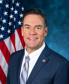
Surveyors Lookout is in Idaho’s 1st congressional district. Its representative, Russ Fulcher (R), votes on the laws that decide what happens to this land. Public-lands grade so far: F. See every public-lands vote →