Texas Flats
2Heads up2 fires, nearest 11 mi
- Right now
- Closed for the seasonOut of the season the agency publishes
- Sites
- 4All of them booked ahead
- Season
- May 1 – September 30Open May 1 through September 30
The place
the agency’s own description · what’s there · 6 notices
In the agency’s own words
Texas Flats Campground remains closed due to hazard trees. Texas Flats Campground is a horse-friendly group camp situated on the banks of McGilvery Creek. It is split into 4 sections named manzanita, red fir, white fir and cedar. Keep reading
Recreation
Nearby logging and forest roads can be used as equestrian trails. The Shadow of the Giants, a popular 1-mile hike through a grove of giant sequoias, is just a short drive northwest of the campground.
Facilities
Each campsite can accommodate between 20-30 people and has picnic tables and campfire rings. Vault toilets are provided, but campers need to bring drinking water. This campground does not have facilities or corrals for horses.
Natural Features
The Sierra National Forest, located on the western slope of the central Sierra Nevada, is known for its spectacular mountain scenery and abundant natural resources. The terrain includes rolling, oak-covered foothills, heavily forested middle elevation slopes and the starkly beautiful alpine landscape of the High Sierra. Texas Flat Campground is located in the Highway 41 Corridor of the Bass Lake Ranger District. This area is known for the Nelder Grove of giant sequoias.
Nearby Attractions
Yosemite National Park is a popular day trip. Visitors can also take a ride on the historic logging train at Yosemite Mountain Sugar Pine Railroad. The Sierra Vista Scenic Byway (Sky Ranch Road), an 83-mile drive past some of the highlights of Sierra National Forest, runs nearby.
What the agency tells you
Maximum vehicle length is 20 feet
Bring drinking water
This is bear country; store all food in bear-proof containers
Everything else this campground posts · 3
Fire Restrictions: Fire restrictions may be imposed at any time due to hot, dry weather conditions, at which time campfires and charcoal fires may not be allowed. For current fire conditions or weather closures contact the Sierra National Forest Headquarters, (559) 297-0706.
Don't Move Firewood: Protect California's forests from tree-killing pests by buying your firewood locally and burning it on-site. For more information visit firewood.ca.gov.
Click here for more information about Sierra National Forest
Tents and rigs
- Sites
- 4 · 4 group
- Hookups
- None
- Longest rig
- 20 ft
- Accessible sites
- None listed
- Campfires
- Allowed, barring fire bans
- Shade
- Every site
Facilities
- Toilets
- Vault Toilets
- “…has picnic tables and campfire rings. Vault toilets are provided, but campers need to bring drinking…”
- Drinking water
- None, bring your own
- “Vault toilets are provided, but campers need to bring drinking water.”
- Camp host
- On site
- recreation.gov lists “Host”
Around the campground
- On the water
- Lake, Creek
- Hiking
- Night sky · 749th darkest of 1,201 in CA
- Bortle 3
No reading yet, book on recreation.gov
Every site here is reservable, and the record lists none held back for anyone who drives up.
No availability snapshot inside the last 36 hours, so this page draws nothing rather than ageing a reading into fiction.
Watch for a cancellation
Full? Watch it.
One email when a night opens, plus More Than Just Parks dispatches. Unsubscribe any time.
We read recreation.gov once an hour, at 40 minutes past, and write the first time a site in your window is free for the nights you asked for.
Scanners that check every few minutes exist, and most of them charge. This one is free, it reads the same calendar, and it won’t always be first.
We make nothing when you book. The link goes straight to the government.
Every line of the receipt · 9
What you actually pay
Who keeps the booking fee
The agency’s own policy text says the reservation fee and the cancellation processing fee are “retained by the reservation service contractor”, and that a campground concessionaire will decline to refund them because “they did not receive these fees”. Recreation.gov is run under contract by Booz Allen Hamilton. What share of your booking fee the contractor keeps isn’t published in any federal dataset we can read, so we print no number for it. Our reporting on the contract →
How we know this receipt · 4
rules read Sep 9, 2026 · record Aug 23, 2026 · How we know all this
The sites
4 sites · which ones have room · the site map
The sites, ranked
from 4 mapped sitesAll 4 sites
| CEDAR | Group 3 - Cedar | group standard nonelectric | 20 ft | 142 ft | 868 ft |
| MANZANITA | Manzanita | group standard nonelectric | 20 ft | 167 ft | 1,021 ft |
| RED FIR | Group 1 - Red Fir | group standard nonelectric | 20 ft | 434 ft | 380 ft |
| WHITE FIR | Group 2 - White Fir | group standard nonelectric | 20 ft | 142 ft | 728 ft |
OpenStreetMap has no toilet mapped within 1 km of this campground, so no site here carries a toilet distance. That’s a gap in the map, not a finding about the campground.
Getting there
the map and the coordinate · the agency’s directions · the phone number
Where it is
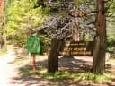 Kelty MeadowSierra National Forest · 1.0 mi
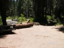 Soquel CampgroundSierra National Forest · 1.6 miFresno Dome CampgroundSierra National Forest · 2.1 miNelder Grove CampgroundSierra National Forest · 2.1 miGreys Mountain CampgroundSierra National Forest · 2.1 miBig Sandy CampgroundSierra National Forest · 3.6 mi
Take Highway 41 north through Oakhurst past Rd. 222 (aka Bass Lake turn off), to Road 632 (aka Sky Ranch Road).
Turn right, travel 7 miles, and turn right on FS6S40 towards Soquel Campground.
Travel for 1 mile, turn left on 6S08, cross the bridge and continue left through Greys Mt. Campground.
Travel for 1 mile, turn left on 6S38, and continue for 2 miles to Texas Flat Campground. (Distances approximate).
The weather
the next four days · the thirty-year normal
Next four days, and the thirty-year normal
Forecast
NWS forecast for Oakhurst, CA
Typical weather
Typical May night 37°F, day 63°F.
Coldest night of the open season: typical May night 37°F. Bring the bag rated for it.
Daily high and lowDays with 0.10 in or moreOutside the published season
A normal is the 1991-2020 average for the month, not a forecast: about half of all Julys are colder than the July line. The seven-day forecast above answers the other question.
The land, and who answers for it
what threatens it · who answers for it
Roadless country, and what’s coming for it
You’re camping on ground somebody wants. We track the threats and the comment deadlines.
Who answers for this land
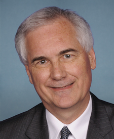
Texas Flats is in California’s 5th congressional district. Its representative, Tom McClintock (R), votes on the laws that decide what happens to this land. Public-lands grade so far: F. See every public-lands vote →