Trail River
- Right now
- Nobody has saidNo season, no closure, no bookings to read
- A night
- $23From, per site
- Sites
- 92All of them booked ahead
The place
the agency’s own description · what’s there · 4 notices
In the agency’s own words
Trail River Campground, set between the Trail River and Kenai Lake, provides lake, river and snow-capped mountain scenery among the hemlock and spruce forests of the Chugach National Forest. It lies within driving distance of two main tourism destinations; 24 miles north of Seward and 40 miles east of Cooper Landing, AK. Miles of hiking and biking trails weave throughout the area. Moose, brown and black bear, sheep and goats can be found across a large parts of the forest. Kenai Lake marks the headwaters of the Kenai River. The campground is situated on the Eastern Kenai Peninsula at elevation 450 feet. Keep reading
Recreation
The Day Use Site at Trail River Campground provides beach access to Kenai Lake. Many people enjoy fishing, collecting driftwood, skipping rocks and walking along the beach. The view of the mountains surrounding Kenai Lake is gorgeous. Snow is present in the high peaks and avalanche chutes until the end of August. Trout fishing can be very productive from the beach at Trail River Campground as well as at many nearby streams. The lake is home to Dolly Varden, rainbow trout and lake trout. Although trout fishing is open year-round in Kenai Lake, special restrictions apply within 1/4 mile of inlet streams. Kenai Lake is not open to salmon fishing. Anglers are required to have a State of Alaska Fishing license and obey all regulations. Within a one-mile radius of the campground entrance, are five trails: Falls Creek Trail, Crown Point Mine Road, Ptarmigan Creek Trail and Vagt Lake Trail. All of these trails run roughly east-west and provide access to the Iditarod National Historic Trail (INHT) which runs north-south. The INHT is an ongoing project to build a '"southern trek" connecting Seward (Mile 0 of the Iditarod Trail) to Eagle River (north of Anchorage). Currently, sections of this trail are still under construction, and several bridges are missing. However, links between Falls Creek Trail and Ptarmigan Lake Trail as well as between Vagt Lake Trail and Crown Point Mine Road make loop hikes possible. The Falls Creek OHV Trail is a half mile north of the entrance road. This steep trail provides good views of Kenai and Lower Trail Lakes and is deal for hikers and experienced OHV enthusiasts. A second option for motorized recreation is the Crown Point Mine Road. This trail is located one mile north of the campground entrance road at the end of Mine Road. This historic mining road leads above tree-line and provides great views. South of the entrance road is the Ptarmigan Creek Campground. This campground is also the location of Ptarmigan Creek Trail as well as a day use area with a fish-viewing platform where you can view spawning salmon in the late summer and fall. Ptarmigan Creek trail steadily gains elevation as it follows Ptarmigan Creek to Ptarmigan Lake. A round trip to the lake and back is seven miles. In the winter, the campground is closed and the campground's entrance road and loops are groomed for freestyle and Nordic skiing.
Facilities
The campground is divided into three loops. Spruce Tree loop has ample shade and stellar views of the mountains. Eagle Point Loop overlooks Kenai Lake and the River Terrace Loop is nearest to the river. The group campsite, which accommodates 70 guests, is part of Trail River Loop. The picnic shelter at the group site is a great place for large gatherings such as wedding receptions, retirement parties or birthdays. It has a beautiful, timber frame pavilion with a large central grill and covered picnic tables. The adjacent volleyball court, horseshoe pit and playground make it fun for all ages. There is also a large fire ring with seating, and plenty of parking. Amenities include vault toilets, trash collection and drinking water. The Day Use Area (mentioned above) includes lake shore access, picnic tables and vault toilets.
Natural Features
The Chugach National Forest covers the eastern half of the Kenai Peninsula and extends around Prince William Sound. It covers over 5 million acres and is characterized by jagged mountains, deep fjords, glacier-fed rivers, and dense forests. This rich natural area supports many miles of productive fishing streams as well as wildlife populations.
Nearby Attractions
Trail River Campground is located close to many tourist destinations. Within the Seward Ranger District, many world-class trailheads and day use areas await discovery. The newly-remodeled Seward Ranger District Information Office, is one mile south on Ranger Station Spur. There, friendly forest service employees can help you gather information, interpret the local ecology, purchase area maps, and offer advice about the Chugach National Forest. From this campground, possible day trips include wildlife viewing in Kenai Fjords National Park, rafting down the Kenai River, and a visit to Portage Glacier. Portage Glacier, is located in Portage Valley, a 14-mile isthmus that connects the Kenai Peninsula to mainland Alaska. Glacial remnants that can be seen today are Explorer, Middle, Byron, Burns and Shakespeare glaciers. Portage Valley is also home to the Begich Boggs Visitor Center, a world-class visitor center with a full-time interpretive staff and exhibits ready to inspire and explain the natural area. Contact Info For local information, please call (907) 522-8368 or call (907) 288-3178 for general information.
What the agency tells you
Be bear aware; keep all food out of sight in approved containers or locked inside your vehicle and remove all food from area after eating.
Limit 2 vehicles per site.
For more information on Chugach National Forest, click here
Everything else this campground posts · 1
Don't Move Firewood: Prevent the spread of tree-killing pests by purchasing firewood near your destination and burning it on-site. For more information visit dontmovefirewood.org.
Tents and rigs
- Sites
- 92 · 16 tent-only, 1 group, 1 cabin
- Hookups
- None
- Longest rig
- 88 ft
- Accessible sites
- None listed
Facilities
- Toilets
- Vault Toilets
- “…and plenty of parking. Amenities include vault toilets, trash collection and drinking water. The Day Use…”
- Drinking water
- Yes
- “…vault toilets, trash collection and drinking water. The Day Use Area (mentioned above) includes lake…”
- Playground
- Yes
Around the campground
- On the water
- Lake, River, Creek, Beach
- Boating
- Fishing
- Hiking
- Night sky · 227th darkest of 280 in AK
- Bortle 2
No reading yet, book on recreation.gov
Every site here is reservable, and the record lists none held back for anyone who drives up.
No availability snapshot inside the last 36 hours, so this page draws nothing rather than ageing a reading into fiction.
Watch for a cancellation
Full? Watch it.
One email when a night opens, plus More Than Just Parks dispatches. Unsubscribe any time.
We read recreation.gov once an hour, at 40 minutes past, and write the first time a site in your window is free for the nights you asked for.
Scanners that check every few minutes exist, and most of them charge. This one is free, it reads the same calendar, and it won’t always be first.
Tell me when the season opens
Watch for the season to open
One email when the season goes on sale, plus More Than Just Parks dispatches. Unsubscribe any time.
We check once an hour, at 40 minutes past, and write the first time the agency has that season on sale.
Scanners that check every few minutes exist, and most of them charge. This one is free, it reads the same calendar, and it won’t always be first.
We make nothing when you book. The link goes straight to the government.
Every line of the receipt · 14
What you actually pay
Derived by CAMPANAC: the agency’s published rate for this season, $23 a night, plus one $8 recreation.gov reservation fee for the booking. A weekend here means Friday and Saturday night, booked once. Optional charges (an extra vehicle, a second tent, a dump-station fee) are listed separately and aren’t in this total.
Who keeps the booking fee
The agency’s own policy text says the reservation fee and the cancellation processing fee are “retained by the reservation service contractor”, and that a campground concessionaire will decline to refund them because “they did not receive these fees”. Recreation.gov is run under contract by Booz Allen Hamilton. What share of your booking fee the contractor keeps isn’t published in any federal dataset we can read, so we print no number for it. Our reporting on the contract →
How we know this receipt · 5
rules read Sep 9, 2026 · rates Oct 1, 2026 · How we know all this
The sites
92 sites · which ones have room · the site map
The sites, ranked
from 54 mapped sites2 sites share one published coordinate and are left out of the rankings.
All 92 sites
The price is derived by CAMPANAC, not published per site: the per-night rate this campground publishes for each site’s own site type. 92 of the 92 sites listed carry one, and a site whose type has no published rate sits out of the price rather than being called free.
Measured shade is NLCD Tree Canopy Cover 2024 (USDA Forest Service / MRLC) read at the site’s own coordinate, 27% canopy or more, and only for the sites the agency gave no Shade value. It never changes the agency’s own shaded count beside it.
| Eagle Point | 062 | rv nonelectric | 78 ft | 138 ft | 435 ft | $23 |
| Eagle Point | 063 | rv nonelectric | 40 ft | 110 ft | 390 ft | $23 |
| Eagle Point | 064 | tent only nonelectric | 25 ft | $23 | ||
| Eagle Point | 065 | tent only nonelectric | 25 ft | $23 | ||
| Eagle Point | 066 | rv nonelectric | 38 ft | 110 ft | 461 ft | $23 |
| Eagle Point | 067 | rv nonelectric | 38 ft | $23 | ||
| Eagle Point | 068 | rv nonelectric | 38 ft | $23 | ||
| Eagle Point | 069 | rv nonelectric | 30 ft | $23 | ||
| Eagle Point | 070 | rv nonelectric | 38 ft | 147 ft | 99 ftKenai Lake | $23 |
| Eagle Point | 071 | rv nonelectric | 48 ft | $23 | ||
| Eagle Point | 072 | rv nonelectric | 34 ft | 131 ft | 181 ftKenai Lake | $23 |
| Eagle Point | 073 | rv nonelectric | 45 ft | $23 | ||
| Eagle Point | 074 | rv nonelectric | 48 ft | 58 ft | 275 ftKenai Lake | $23 |
| Eagle Point | 075 | rv nonelectric | 38 ft | 58 ft | 319 ftKenai Lake | $23 |
| Eagle Point | 076 | rv nonelectric | 44 ft | $23 | ||
| Eagle Point | 077 | rv nonelectric | 45 ft | 150 ft | 417 ftKenai Lake | $23 |
| Eagle Point | 078 | rv nonelectric | 72 ft | 81 ft | 538 ftKenai Lake | $23 |
| Eagle Point | 079 | rv nonelectric | 44 ft | 81 ft | 462 ftKenai Lake | $23 |
| Eagle Point | 080 | rv nonelectric | 88 ft | 78 ft | 492 ftKenai Lake | $23 |
| Eagle Point | 081 | rv nonelectric | 38 ft | $23 | ||
| Eagle Point | 082 | rv nonelectric | 36 ft | 78 ft | 452 ftKenai Lake | $23 |
| Eagle Point | 083 | rv nonelectric | 38 ft | $23 | ||
| Eagle Point | 084 | tent only nonelectric | 24 ft | $23 | ||
| Eagle Point | 085 | tent only nonelectric | 24 ft | $23 | ||
| Eagle Point | 086 | rv nonelectric | 40 ft | $23 | ||
| Eagle Point | 087 | tent only nonelectric | 24 ft | $23 | ||
| Eagle Point | 088 | tent only nonelectric | 24 ft | $23 | ||
| Eagle Point | 089 | tent only nonelectric | 24 ft | $23 | ||
| Eagle Point | 090 | tent only nonelectric | 24 ft | $23 | ||
| Eagle Point | 091 | rv nonelectric | 24 ft | 254 ft | 373 ftKenai Lake | $23 |
| Group Site | 000 Group | group shelter nonelectric | 45 ft | 276 ft | $200 | |
| River Terrace | 001 | rv nonelectric | 36 ft | 276 ft | $23 | |
| River Terrace | 002 | rv nonelectric | 78 ft | 128 ft | 260 ft | $23 |
| River Terrace | 003 | rv nonelectric | 39 ft | 172 ft | 414 ft | $23 |
| River Terrace | 004 | tent only nonelectric | 28 ft | $23 | ||
| River Terrace | 005 | tent only nonelectric | 30 ft | $23 | ||
| River Terrace | 006 | rv nonelectric | 40 ft | $23 | ||
| River Terrace | 007 | rv nonelectric | 44 ft | 127 ft | 607 ft | $23 |
| River Terrace | 008 | rv nonelectric | 50 ft | 127 ft | 501 ft | $23 |
| River Terrace | 009 | rv nonelectric | 40 ft | $23 | ||
| River Terrace | 010 | rv nonelectric | 34 ft | 164 ft | 713 ft | $23 |
| River Terrace | 011 | rv nonelectric | 60 ft | $23 | ||
| River Terrace | 012 | rv nonelectric | 34 ft | 126 ft | 841 ft | $23 |
| River Terrace | 013 | rv nonelectric | 54 ft | 126 ft | 758 ft | $23 |
| River Terrace | 014 | rv nonelectric | 75 ft | $23 | ||
| River Terrace | 015 | rv nonelectric | 39 ft | 143 ft | 618 ft | $23 |
| River Terrace | 016 | rv nonelectric | 40 ft | 178 ft | 445 ft | $23 |
| River Terrace | 017 | rv nonelectric | 40 ft | $23 | ||
| River Terrace | 018 | rv nonelectric | 32 ft | 121 ft | 321 ft | $23 |
| River Terrace | 019 | rv nonelectric | 75 ft | 110 ft | 288 ft | $23 |
| River Terrace | 020 | rv nonelectric | 42 ft | 109 ft | 192 ft | $23 |
| River Terrace | 021 | rv nonelectric | 31 ft | 119 ft | 346 ft | $23 |
| River Terrace | 022 | rv nonelectric | 36 ft | $23 | ||
| River Terrace | 023 | rv nonelectric | 74 ft | 109 ft | 229 ft | $23 |
| River Terrace | 024 | rv nonelectric | 31 ft | 106 ft | 154 ft | $23 |
| River Terrace | 025 | rv nonelectric | 31 ft | 106 ft | 260 ft | $23 |
| River Terrace | 026 | rv nonelectric | 50 ft | 82 ft | 177 ft | $23 |
| River Terrace | 027 | rv nonelectric | 35 ft | 82 ft | 101 ft | $23 |
| River Terrace | 028 | rv nonelectric | 53 ft | $23 | ||
| River Terrace | 029 | rv nonelectric | 36 ft | $23 | ||
| Spruce Wood | 030 | rv nonelectric | 34 ft | 79 ft | 489 ft | $23 |
| Spruce Wood | 031 | rv nonelectric | 34 ft | 79 ft | 475 ft | $23 |
| Spruce Wood | 032 | rv nonelectric | 34 ft | $23 | ||
| Spruce Wood | 033 | rv nonelectric | 42 ft | 88 ft | 701 ft | $23 |
| Spruce Wood | 034 | rv nonelectric | 38 ft | 103 ft | 610 ft | $23 |
| Spruce Wood | 035 | rv nonelectric | 30 ft | 88 ft | 630 ft | $23 |
| Spruce Wood | 036 | rv nonelectric | 40 ft | $23 | ||
| Spruce Wood | 037 | rv nonelectric | 38 ft | 122 ft | 698 ft | $23 |
| Spruce Wood | 038 | rv nonelectric | 48 ft | $23 | ||
| Spruce Wood | 039 | rv nonelectric | 38 ft | 122 ft | 770 ft | $23 |
| Spruce Wood | 040 | rv nonelectric | 48 ft | $23 | ||
| Spruce Wood | 041 | tent only nonelectric | 32 ft | $23 | ||
| Spruce Wood | 042 | rv nonelectric | 38 ft | 70 ft | 861 ft | $23 |
| Spruce Wood | 043 | rv nonelectric | 31 ft | 70 ft | 902 ft | $23 |
| Spruce Wood | 044 | rv nonelectric | 40 ft | 175 ft | 1,099 ft | $23 |
| Spruce Wood | 045 | rv nonelectric | 35 ft | 175 ft | 1,262 ft | $23 |
| Spruce Wood | 046 | rv nonelectric | 81 ft | $23 | ||
| Spruce Wood | 047 | rv nonelectric | 34 ft | $23 | ||
| Spruce Wood | 048 | rv nonelectric | 78 ft | 88 ft | 1,021 ft | $23 |
| Spruce Wood | 049 | rv nonelectric | 48 ft | 88 ft | 933 ft | $23 |
| Spruce Wood | 050 | tent only nonelectric | 46 ft | $23 | ||
| Spruce Wood | 051 | rv nonelectric | 40 ft | 106 ft | 955 ftKenai Lake | $23 |
| Spruce Wood | 052 | rv nonelectric | 34 ft | $23 | ||
| Spruce Wood | 053 | tent only nonelectric | 28 ft | $23 | ||
| Spruce Wood | 054 | tent only nonelectric | 28 ft | $23 | ||
| Spruce Wood | 055 | rv nonelectric | 28 ft | 116 ft | 831 ft | $23 |
| Spruce Wood | 056 | rv nonelectric | 60 ft | 112 ft | 765 ftKenai Lake | $23 |
| Spruce Wood | 057 | rv nonelectric | 38 ft | 112 ft | 792 ftKenai Lake | $23 |
| Spruce Wood | 058 | tent only nonelectric | 30 ft | 98 ft | 649 ftKenai Lake | $23 |
| Spruce Wood | 059 | rv nonelectric | 30 ft | 98 ft | 738 ftKenai Lake | $23 |
| Spruce Wood | 060 | rv nonelectric | 48 ft | 99 ft | 590 ftKenai Lake | $23 |
| Spruce Wood | 061 | tent only nonelectric | 26 ft | 105 ft | 649 ftKenai Lake | $23 |
25 of 92 listed
Getting there
the map and the coordinate · the agency’s directions
Where it is
 Trail River CabinChugach National Forest · 0.2 mi
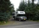 Ptarmigan CreekChugach National Forest · 0.9 mi
 Crescent Saddle CabinChugach National Forest · 4.7 miPrimrose CampgroundChugach National Forest · 5.2 mi
 Crescent Lake CabinChugach National Forest · 7.8 mi
 Lower Paradise Lake CabinChugach National Forest · 12 mi
From Anchorage, go south on Seward Highway approximately 100 miles to Crown Point. Turn at Milepost 24.2 on Trail River Road for 2 miles to campground.
The weather
the next four days · the thirty-year normal
Next four days, and the thirty-year normal
Forecast
NWS forecast for Crown Point, AK
Typical weather
Typical October night 31°F, day 41°F.
Coldest month of the year: typical January night 16°F, below freezing. Bring a bag rated colder than that, and expect ice in the water bottle.
Daily high and lowDays with 0.10 in or more
A normal is the 1991-2020 average for the month, not a forecast: about half of all Julys are colder than the July line. The seven-day forecast above answers the other question.
The land, and who answers for it
what threatens it · who answers for it
What threatens this place
You’re camping on ground somebody wants. We track the threats and the comment deadlines.
Who answers for this land

Trail River is in Alaska’s at-large congressional district. Its representative, Nick Begich (R), votes on the laws that decide what happens to this land. Public-lands grade so far: F. See every public-lands vote →