Troublesome Creek Campground
4Heads up4 fires, nearest 26 mi
This is how it should work.
- Right now
- Listed not openA database flag with no reason and no date
The place
the agency’s own description · what’s there
In the agency’s own words
Troublesome Creek Campground offers 25 sites nestled in a mixed conifer forest on the banks of the scenic North Fork Skykomish River and its tributary, Troublesome Creek. Water is abundant in this area, offering visitors easy access to fishing, kayaking, and swimming. There is also a mile long nature trail that follows the creek. Guests will be lulled to sleep by its subtle, but ever-present gurgle. This campground is ideal for escaping the hustle of everyday life to enjoy time with friends and family. Countless recreation opportunities await visitors with easy access to the Wild Sky and Henry M Jackson Wilderness areas.
Around the campground
- On the water
- River, Creek
Nothing to book, just show up
One of 1,623 federal campgrounds where the site still goes to whoever pulls in first. Get there before noon on a summer weekend.
recreation.gov publishes no availability for a campground you can’t reserve, so there’s no thirty-night reading to draw here. The season bar above is what the agency does publish.
Every line of the receipt · 4
What you actually pay
How we know this receipt · 4
record Aug 24, 2026 · How we know all this
Getting there
the map and the coordinate
Where it is
 Troublesome Creek CampgroundSnoqualmie National Forest · 1.8 mi
 Evergreen Mountain LookoutSnoqualmie National Forest · 6.0 mi
 Heybrook LookoutSnoqualmie National Forest · 9.7 mi
 Beckler River CampgroundSnoqualmie National Forest · 11 mi
 Money Creek CampgroundSnoqualmie National Forest · 11 mi
The weather
the next four days · the thirty-year normal
Next four days, and the thirty-year normal
Forecast
NWS forecast for Baring, WA
Typical weather
Typical October night 42°F, day 58°F.
Coldest month of the year: typical January night 32°F, below freezing. Bring a bag rated colder than that, and expect ice in the water bottle.
Daily high and lowDays with 0.10 in or more
A normal is the 1991-2020 average for the month, not a forecast: about half of all Augusts are colder than the August line. The seven-day forecast above answers the other question.
The land, and who answers for it
what threatens it · who answers for it
Roadless country, and what’s coming for it
You’re camping on ground somebody wants. We track the threats and the comment deadlines.
Who answers for this land
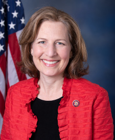
Troublesome Creek Campground is in Washington’s 8th congressional district. Its representative, Kim Schrier (D), votes on the laws that decide what happens to this land. Public-lands grade so far: A+. See every public-lands vote →