Tumwater Group Site
3Heads up3 fires, nearest 24 mi
This is how it should work.
- Right now
- Listed not openA database flag with no reason and no date
- Sites
- 1All of them walk-up
The place
the agency’s own description · what’s there · 3 notices
In the agency’s own words
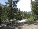
Tumwater Campground, located at the confluence of Chiwaukum Creek and the Nenatchee River in the Okanogan-Wenatchee National Forest, offers a serene setting for groups and large gatherings. Keep reading
Recreation
Tumwater Group Campground offers outdoor enthusiasts the opportunity to hike, fish, ski and enjoy a long list of outdoor recreational activities throughout the year. The confluence of Chiwaukum Creek and the Nenatchee River offers anglers a scenic backdrop as they cast their lines into the pools along the shore. Populations of trout and salmon find habitat along its banks. Skiing, snowmobiling, tubing and skijouring are popular winter activities for visitors to the Wenatchee Ranger District. Both motorized and non-motorized Sno-Parks in the area offer access to both groomed trails and natural settings for those wanting to explore the winter wonderland.
Facilities
Tumwater Group Campground has one large site that can accommodate up to 70 people and 40 vehicles. The site is equipped with picnic tables, campfire rings, drinking water, accessible flush toilets and electric hookups. The campground also has a covered shelter and picnic area, complete with a wood stove and fireplace.
Natural Features
Okanogan-Wenatchee National Forest offers stunning scenic views, with high, glaciated alpine peaks, valleys of old growth forest and rugged shrub-steppe country making up the diverse landscape. Elevations range from below 1,000 feet to more than 9,000 feet. Precipitation varies greatly throughout the area, ranging from approximately 140 inches along the Cascade Crest to only 10 inches along the eastern edge. Visitors can expect many days of warm, sunny weather in the summer, and winters with clear skies and plenty of snow. More than 700 lakes and mountain ponds dot the glacier-carved terrain of nearby Alpine Lake Wilderness. Tree-covered valleys give way to rocky ridges and rugged peaks along the crest of the Cascades. Many peaks and slopes are permanently cloaked in snowfields. From wet forests of Douglas fir, cedar, and an understory of salal and berries, to firs and mountain hemlock, the landscape opens up to expansive meadows matted with low growth and ends with dry forestland of ponderosa pine and grasses. The surrounding undeveloped wilderness, clean streams and diverse forests support an abundance of wildlife, including deer, porcupine, native fish and migratory birds.
Nearby Attractions
Visitors enjoy the Mt. Rainer National Park, where interpretive programs and exhibits offer education about the diverse landscape and history of the area. The spectacular Pacific Crest Trail (PCT), one of the world's premier National Scenic Trails, showcases some of North America's most fantastic scenery, winding its way its way from Mexico to Canada through California, Oregon and Washington, and is accessible near the campground.
What the agency tells you
First-come, first-served single sites are available
Click here for more information about Okanogan-Wenatchee National Forest
Don't Move Firewood: Please protect Pacific Northwest forests by preventing the spread of invasive species. Firewood can carry insects and diseases that can threaten the health of our western forests. You can make a difference by obtaining and burning your firewood near your camping destination. Visit Dontmovefirewood.org for further information.
Tents and rigs
- Sites
- 1 · 1 group
- Hookups
- 1 electric
- Longest rig
- 25 ft
- Paved pads
- All
- Accessible sites
- 1
- Shade
- Every site
Facilities
- Toilets
- Flush Toilets
- “…rings, drinking water, accessible flush toilets and electric hookups. The campground also has a…”
- Drinking water
- Yes
- “…with picnic tables, campfire rings, drinking water, accessible flush toilets and electric hookups. The…”
Around the campground
- On the water
- Lake, River, Creek, Meadow
- Biking
- Boating
- Hiking
- Swimming
- Wildlife viewing
- Night sky · 295th darkest of 400 in WA
- Bortle 3
- Fall color · reported 6 days ago, 14 km away
- Peak color
Nothing to book, just show up
One of 1,623 federal campgrounds where the site still goes to whoever pulls in first. Get there before noon on a summer weekend.
recreation.gov publishes no availability for a campground you can’t reserve, so there’s no thirty-night reading to draw here. The season bar above is what the agency does publish.
Every line of the receipt · 3
What you actually pay
How we know this receipt · 4
rules read Sep 9, 2026 · record Aug 23, 2026 · How we know all this
The sites
1 sites · the site map
All 1 sites
| AREA TUMWATER GROUP SITE | 001 | group standard electric | 25 ft | 15 amp | yes | 533 ft |
OpenStreetMap has no toilet mapped within 1 km of this campground, so no site here carries a toilet distance. That’s a gap in the map, not a finding about the campground.
Getting there
the map and the coordinate · the agency’s directions · the phone number
Where it is
 Johnny Creek CampgroundWenatchee National Forest · 6.8 mi
 Icicle Group CampgroundWenatchee National Forest · 7.3 mi
 Ida Creek CampgroundWenatchee National Forest · 7.4 miBridge Creek Group Site8.2 mi
 Nason Creek CampgroundWenatchee National Forest · 8.4 miChatter Creek Group SiteWenatchee National Forest · 8.7 mi
From the west, take Highway 2 east through Monroe and over Stevens' Pass. The Tumwater campground is approximately 20 miles east of the top of Stevens' pass, on the left side of the highway.
From the east, take Highway 2 west through Leavenworth. The campground is 10 miles west of Leavenworth on the right hand side of the highway.
The weather
the next four days · the thirty-year normal
Next four days, and the thirty-year normal
Forecast
NWS forecast for Leavenworth, WA
Typical weather
Typical October night 33°F, day 58°F.
Coldest month of the year: typical January night 21°F, below freezing. Bring a bag rated colder than that, and expect ice in the water bottle.
Daily high and lowDays with 0.10 in or more
A normal is the 1991-2020 average for the month, not a forecast: about half of all Julys are colder than the July line. The seven-day forecast above answers the other question.
The land, and who answers for it
who answers for it
Who answers for this land

Tumwater Group Site is in Washington’s 8th congressional district. Its representative, Kim Schrier (D), votes on the laws that decide what happens to this land. Public-lands grade so far: A. See every public-lands vote →