Turlo Campground
2Heads up2 fires, nearest 48 mi
- Right now
- Nobody has saidNo season, no closure, no bookings to read
- A night
- $32–$34Across the site types the agency prices
- Sites
- 18All of them booked ahead
The place
the agency’s own description · what’s there · 9 notices
In the agency’s own words
Turlo Campground is located just off the Mountain Loop Highway in the Mt.Baker-Snoqualmie National Forest. The campground is nestled in tall firs, cedars and hemlocks, adjacent to the south fork of the Stillaguamish River. The location offers individuals and families a tranquil camping experience with plenty of opportunities to fish, enjoy the river or relax at their campsite. Keep reading
Recreation
The Mt. Baker-Snoqualmie National Forest has 1,500 miles of trails, ranging from smooth paths through deep, quiet forests to challenging ascents up boulder-studded mountains. Hiking opportunities abound for every skill level. The Mt. Dickerman Trail, close to the campground, switchbacks steeply for 3 miles through a dark forest to an alpine meadow, which was replanted in 1915 after a major forest fire. From this point, the trail rises above the timberline to an alpine meadow alive with masses of wildflowers in July and August. The trail is generally in good condition, and spectacular views can be seen from all directions as the trail climbs to the 5,723 foot summit.
Facilities
Turlo Campground offers standard sites, accommodating both tent and RV camping. Picnic tables, and drinking water are also available, however there are no electrical hook-ups. Access to the Stillaguamish River is available from the campground.
Natural Features
Situated on the west side of the Cascades between the Canadian border and Mt. Rainier National Park, Mt. Baker-Snoqualmie National Forest is one of the most spectacular in the the country, showcasing glacier-covered peaks, wide mountain meadows and old-growth forests, rich in history and outdoor opportunities. On a clear day, visitors will see Mt. Baker, the most prominent feature of the Mt. Baker Wilderness Area. Rising to an elevation of 10,781 feet, the active volcano from which the forest takes its name, is perpetually snow-capped and mantled with an extensive network of creeping glaciers. Mt. Baker's summit, Grant Peak, is actually a 1,300-foot-deep mound of ice, which hides a massive volcanic crater. Old-growth forests line the wide, gently-flowing river, known for its salmon run. Salmon and other species including, chinook, coho, chum, pink, and sockeye salmon, steelhead trout, sea-run cutthroat, and bull trout, use the Stillaguamish and its tributaries for spawning. Contact Info For facility specific information, please call (530) 932-0242.
Nearby Attractions
Visit or stay in one of the historic lookouts in the area. Lookouts are tangible symbols of Forest Service heritage, perched on high peaks with unobstructed views where they have been used throughout the years to detect and control fires in remote wildlands. Take some time to visit nearby Mount Rainer National Park. Considered a wonderland, the park offers a fantasic glimpse into glaciers, subalpine ecology, and volcanic landscapes typical in the region. Discover the Verlot Public Service Center, near the South Fork Stillaguamish River. Built by the Civilian Conservation Corps from 1933 to 1942, Verlot`s handsome buildings reflect the architectural style and fine craftsmanship of that era and are listed on the National Register of Historic Places.
Charges & Cancellations
Once your reservation start date has begun, neither the Recreation.gov Contact Center nor the campground manager will be able to modify your reservation.
What the agency tells you
Prevent the spread of invasive species by inspecting and cleaning packs, equipment and tires before using lake or trails.
Extra Vehicles: One RV with tow vehicle per single site or one vehicle per single tent site. Two RVs with tow vehicle per double site or two vehicles per double tent site. Most sites can accommodate 1 extra vehicle that is not included with the reservation fee. A fee of $12/extra vehicle per night must be paid for upon arrival by cash or check only.
Fire Restrictions: Fire restrictions may be imposed at any time due to hot, dry weather conditions, at which time campfires and charcoal fires may not be allowed.
Everything else this campground posts · 6
Reserved Sites will be held until check out time (NOON) the day following your arrival date. Sites must be occupied by the checkout time of that following day to hold a reservation or the site may be forfeited and released to other guests.
Once your reservation start date has begun, neither the Recreation.gov Contact Center nor the campground manager will be able to modify your reservation.
Refunds: Refund requests made through www.recreation.gov will be charged a $10 processing fee. This fee is retained by the reservation service contractor along with the non-refundable reservation fee. All requests for the return of the non-refundable reservation fee and the cancellation fee will be declined by the campground concessionaire as they did not receive these fees (these are the fees retained by the reservation contractor, a different entity).
Don't Move Firewood: Please protect Pacific Northwest forests by preventing the spread of invasive species. Firewood can carry insects and diseases that can threaten the health of our western forests. You can make a difference by obtaining and burning your firewood near your camping destination. Visit Dontmovefirewood.org for further information.
The Mt. Baker-Snoqualmie National Forest has a Food Storage Order in effect. All food and refuse must be acceptably stored (in a hard sided vehicle or trailer, food storage locker, or certified bear resistant container) or acceptably possessed (attended to by a person who is physically present).
Click here for more information about Mt. Baker-Snoqualmie National Forest.
Tents and rigs
- Sites
- 18
- Hookups
- None
- Longest rig
- 40 ft
- Accessible sites
- 2
- Pets
- Allowed
- Campfires
- Allowed, barring fire bans
Facilities
- Drinking water
- Yes
- “…tent and RV camping. Picnic tables, and drinking water are also available, however there are no electrical…”
- Stay limit
- 14 nights
- recreation.gov facility rule maxStay
Around the campground
- On the water
- River, Meadow
- Night sky · 391st darkest of 400 in WA
- Bortle 4
No reading yet, book on recreation.gov
Every site here is reservable, and the record lists none held back for anyone who drives up.
No availability snapshot inside the last 36 hours, so this page draws nothing rather than ageing a reading into fiction.
Watch for a cancellation
Full? Watch it.
One email when a night opens, plus More Than Just Parks dispatches. Unsubscribe any time.
We read recreation.gov once an hour, at 40 minutes past, and write the first time a site in your window is free for the nights you asked for.
Scanners that check every few minutes exist, and most of them charge. This one is free, it reads the same calendar, and it won’t always be first.
Tell me when the season opens
Watch for the season to open
One email when the season goes on sale, plus More Than Just Parks dispatches. Unsubscribe any time.
We check once an hour, at 40 minutes past, and write the first time the agency has that season on sale.
Scanners that check every few minutes exist, and most of them charge. This one is free, it reads the same calendar, and it won’t always be first.
We make nothing when you book. The link goes straight to the government.
Every line of the receipt · 14
What you actually pay
“A fee of $12/extra vehicle per night must be paid for upon arrival by cash or check only.” · the U.S. Forest Service’s own agency notice
Derived by CAMPANAC: the agency’s published rates for this season, $32–$34 a night, plus one $8 recreation.gov reservation fee for the booking. A weekend here means Friday and Saturday night, booked once. Optional charges (an extra vehicle, a second tent, a dump-station fee) are listed separately and aren’t in this total.
“Once your reservation start date has begun, neither the Recreation.gov Contact Center nor the campground manager will be able to modify your reservation.” · this campground’s own terms
Who keeps the booking fee
The agency’s own policy text says the reservation fee and the cancellation processing fee are “retained by the reservation service contractor”, and that a campground concessionaire will decline to refund them because “they did not receive these fees”. Recreation.gov is run under contract by Booz Allen Hamilton. What share of your booking fee the contractor keeps isn’t published in any federal dataset we can read, so we print no number for it. Our reporting on the contract →
How we know this receipt · 7
rules read Sep 9, 2026 · rates Oct 1, 2026 · How we know all this
The sites
18 sites · which ones have room · the site map
The sites, ranked
from 18 mapped sitesAll 18 sites
Toilet distances are OpenStreetMap’s, measured for 18 of the 18 sites listed. A site with no reading is unknown, never far.
The price is derived by CAMPANAC, not published per site: the per-night rate this campground publishes for each site’s own site type. 18 of the 18 sites listed carry one, and a site whose type has no published rate sits out of the price rather than being called free.
Measured shade is NLCD Tree Canopy Cover 2024 (USDA Forest Service / MRLC) read at the site’s own coordinate, 27% canopy or more, and only for the sites the agency gave no Shade value. It never changes the agency’s own shaded count beside it.
| TURL | 002 | standard nonelectric | 35 ft | 38 ft | 146 ftTurlo Creek | 2,194 ft | $32–$34 | |
| TURL | 003 | standard nonelectric | 35 ft | yes | 29 ft | 133 ftTurlo Creek | 2,198 ft | $32–$34 |
| TURL | 004 | standard nonelectric | 35 ft | 52 ft | 105 ftTurlo Creek | 2,254 ft | $32–$34 | |
| TURL | 005 | standard nonelectric | 35 ft | yes | 26 ft | 63 ftTurlo Creek | 2,365 ft | $32–$34 |
| TURL | 006 | standard nonelectric | 35 ft | 57 ft | 55 ftTurlo Creek | 2,418 ft | $32–$34 | |
| TURL | 007 | standard nonelectric | 30 ft | 38 ft | 14 ftTurlo Creek | 2,473 ft | $32–$34 | |
| TURL | 008 | standard nonelectric | 35 ft | 38 ft | under 10 ftTurlo Creek | 2,505 ft | $32–$34 | |
| TURL | 009 | standard nonelectric | 35 ft | 35 ft | 46 ftTurlo Creek | 2,555 ft | $32–$34 | |
| TURL | 010 | standard nonelectric | 40 ft | 31 ft | 77 ftTurlo Creek | 2,570 ft | $32–$34 | |
| TURL | 011 | standard nonelectric | 35 ft | 31 ft | 71 ftTurlo Creek | 2,553 ft | $32–$34 | |
| TURL | 012 | standard nonelectric | 35 ft | 23 ft | 35 ftTurlo Creek | 2,501 ft | $32–$34 | |
| TURL | 013 | standard nonelectric | 35 ft | 23 ft | 17 ftTurlo Creek | 2,489 ft | $32–$34 | |
| TURL | 014 | standard nonelectric | 35 ft | 58 ft | under 10 ftTurlo Creek | 2,445 ft | $32–$34 | |
| TURL | 015 | standard nonelectric | 35 ft | 37 ft | under 10 ftTurlo Creek | 2,390 ft | $32–$34 | |
| TURL | 016 | standard nonelectric | 35 ft | 26 ft | 38 ftTurlo Creek | 2,375 ft | $32–$34 | |
| TURL | 017 | standard nonelectric | 35 ft | 45 ft | 21 ftTurlo Creek | 2,345 ft | $32–$34 | |
| TURL | 018 | standard nonelectric | 40 ft | 52 ft | 59 ftTurlo Creek | 2,280 ft | $32–$34 | |
| TURL | 019 | standard nonelectric | 35 ft | 29 ft | 107 ftTurlo Creek | 2,226 ft | $32–$34 |
Getting there
the map and the coordinate · the agency’s directions · the phone number
Where it is
 Tulalip Mill Site Group CampgroundMt. Baker National Forest · 0.4 mi
 Verlot CampgroundMt. Baker National Forest · 0.7 mi
 Gold Basin CampgroundMt. Baker National Forest · 2.7 mi
 Wiley Creek Group CampMt. Baker National Forest · 3.8 mi
 Esswine Group Camp4.6 mi
 Boardman Group CampMt. Baker National Forest · 5.6 mi
From Seattle, Washington: Go north on I-5 to Everett. Take exit 194 onto Hwy 2. Head north at Hwy 204, toward Lake Stevens. Turn north on Hwy 9, then east on Hwy 92 to Granite Falls.
The weather
the next four days · the thirty-year normal
Next four days, and the thirty-year normal
Forecast
NWS forecast for Verlot, WA
Typical weather
Typical October night 42°F, day 62°F.
Coldest month of the year: typical December night 34°F. Bring the bag rated for it.
Daily high and lowDays with 0.10 in or more
A normal is the 1991-2020 average for the month, not a forecast: about half of all Augusts are colder than the August line. The seven-day forecast above answers the other question.
The land, and who answers for it
what threatens it · who answers for it
Roadless country, and what’s coming for it
You’re camping on ground somebody wants. We track the threats and the comment deadlines.
Who answers for this land
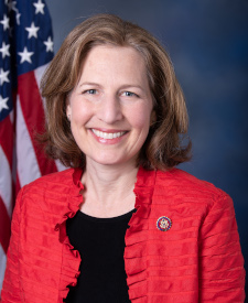
Turlo Campground is in Washington’s 8th congressional district. Its representative, Kim Schrier (D), votes on the laws that decide what happens to this land. Public-lands grade so far: A+. See every public-lands vote →