Virgin River Canyon Recreation Area
- Right now
- Taking bookingsSites offered on 30 of the next 30 nights read 15:22 UTC
- A night
- $8From, per site
- Sites
- 111109 on recreation.gov
The place
the agency’s own description · what’s there · 2 notices
In the agency’s own words
The Virgin River Canyon Recreation Area is located along Interstate 15 approximately 20 miles southwest of St. George, Utah and approximately 20 miles northeast of Mesquite, Nevada. It's accessed from the Cedar Pocket Exit (mile post 18). The overnight-use fee is $8 per site per night and the day-use fee is $2 per vehicle. Overnight use is limited to 14-night stays. The recreation area currently has 25 of the best sites only available through recreation.gov reservations. The remaining 83 sites are first come, first serve (FF) payable onsite by using the Scan and Pay feature on the recreation.gov app. Please come prepared by either making a reservation here before arrival OR having the recreation.gov app installed with login setup to pay onsite with the scan and pay option. Keep reading
Recreation
The Virgin River Canyon Recreation Area provides many recreational opportunities for hiking, wildlife viewing, water play, and more. It is surrounded by two designated wilderness areas. The Paiute Wilderness east of Interstate 15, and Beaver Dam Mountains Wilderness to the west. The Sullivan Canyon Trail starts within the recreation area and heads into the heart of the Paiute Wilderness. The campground and day-use areas also both have scenic trails leading to the Virgin River. The Virgin River is occasionally runnable to small whitewater boats during spring runoffs. Please check for information on the fish barriers and flow conditions prior to running. Additional hiking opportunities are available. A short drive on the Cedar Pocket Road (directly across the interstate from the campground) leads to the Cedar Pocket Wash Trailhead. This trail leads down a steep path to the narrows of the Cedar Pocket Wash and is a nice short stroll through a Joshua Tree forest. Several other trails can be accessed along this road or from hiking trails within the recreation area. A trails map is viewable on the site's restroom kiosks or can be downloaded as a PDF map or to the Avenza app . The Virgin River Gorge is also frequented by rock climbers and canyoneers. Additional information about recreation available in the area can be obtained by calling the visitor center at 435-688-3200.
Facilities
Campsite Amenities (108 overnight sites) - 14-night stay limit Paved access road Pull-through parking Drinking water Flush toilets (ADA compliant at middle restroom) Picnic table Grill and/or fire pit Vehicle or RV parking 8 sites that are ADA compliant 12 sites with shade shelters ** The campground has no electrical or waste dump hook ups. ** Day-Use Amenities - daylight hours only Paved access road Pull-through parking Drinking water Flush toilets Shade shelters ADA compliant sites Access to Sullivan Canyon Trail in the Paiute Wilderness Access to interpretative trail Trail access to the Virgin River Natural Features The Virgin River Gorge, where the Virgin River Canyon Recreation Area resides, was cut by the Virgin River. Though the Virgin River is relatively small, it is incredibly steep, dropping an average of 70 feet per mile - 10 times steeper than the Colorado River through the Grand Canyon. This steepness, caused by the uplift of the Colorado Plateau, has given the Virgin River the ability to cut through sandstone and limestone canyons. The gorge provides a stunning and colorful mountain desert setting. The gorge mimics, on a smaller scale, the colorful layers and striking depths of the Grand Canyon. In fact, many of the very same geologic formations are present in both areas. The gorge connects the southwestern rim of the Colorado Plateau and the northeastern part of the Mojave Desert. The climate of the gorge is typical of the Mojave Desert with hot summers and mild winters. This desert climate allows for some of the most northern Joshua Tree populations. The canyon is usually about 5 degrees Fahrenheit warmer than St George, Utah, however the canyon can occasionally amplify winds. Many species depend on the water of the Virgin River. The Virgin River directly supports hundreds of wildlife species including, woundfin, Virgin River chub, Virgin spinedace, flannelmouth sucker, desert sucker, speckled dace, and Southwestern Willow Flycatcher. Many of these species are endangered or are considered sensitive species within the State of Arizona and Utah. Contact Info This location is unstaffed. To speak with our main office for general information, please call: (435) 688-3200.
Nearby Attractions
Hiking Trails The most popular hike is a simple 0.1 mile hike down to the Virgin River via the River Trail . This is easily accessed from the lowest parking in the lower loop. The easiest trail is the 0.4 mile Canyon Overlook Trail . This trail begins at the fee kiosk. It is a paved, ADA trail leading to an overlook and interpretative compass display. The best hike is the Narrows hike. This is a steep, 1.4 mile hike leading through a Joshua Tree grove down to a limestone narrows punching through a geologic fold. The best starting point is a short drive up to the Cedar Pocket Wash Trailhead . A full of views hike is the Ridgeline Loop . This is a 1.1 mile loop starting at the I-15 trailhead. The trail follows the ridgeline up about 1000 ft above the start and loops back. For the more adventurous, Greyhaven Pinnacle is a exposed scramble up a limestone peak with wondrous views from the middle of the Virgin River Gorge. This 1.8 mile trail is accessed from I-15 Trailhead . A trails map is available as a PDF or for the Avenza app .
Charges & Cancellations
Cancellations*: *cancellation becomes a "late cancellation" at 12:01 am EST on the day before arrival. • $10.00 fee if reservation is changed/cancelled earlier than the day before arrival. • $10.00 plus first night's camping fee is charged if reservation is cancelled the day before or the day of the arrival, except when the reservation is only for 1 night (in which case only the first night's camping fee is charged). No Shows: customer does not arrive and/or does not cancel reservation by check out time (11 :00am) the day after the scheduled arrival date. $20.00 service fee charged and forfeit the first night's user fee • If requested before the late cancellation window: NRRS will handle • If requested during the late cancellation window (day before arrival, or day of arrival): Customer will be charged first night's use fee, and refunded rest • If requested after arrival, during or after departure from site: recreation.gov processes and field office has to approve
What the agency tells you
Cell Coverage The Recreation Area has spotty Verizon and T-Mobile cell phone coverage. There is no AT&T coverage. Due to the cell towers being remote and off grid, long outages can occur.
Supplemental Rules - You must not remain or camp within the Virgin River Canyon Recreation Area for more than 14 consecutive days in a 28-day period. After the 14th consecutive day, campers must move beyond a 30-mile radius from the boundary of the Virgin River Canyon Recreation Area. - Quiet Hours are from 10 pm to 7 am Arizona Time. No person shall operate noise-producing devices or by other means create noise enough to disturb other visitors during these hours. - Campfires allowed only in fire rings and grills. No campfires allowed during high winds. Follow the summer fire restriction orders that usually limit fire use to properly operated stoves. Fire restrictions will be posted around the entrance to the recreation area. - No shooting allowed within the recreation area. - Dogs, and other pets, must be on leashes. - No person shall dispose of any waste water, including that commonly called “grey water,” from a vehicle or container onto the ground or into a body of water. - Cutting firewood and damaging or removing vegetation is prohibited. - Leaving personal belongings unattended for more than 72 hours is prohibited.
Tents and rigs
- Sites
- 111 · 29 tent-only, 2 group, 2 cabin
- Hookups
- None
- Longest rig
- 130 ft
- Accessible sites
- 8
- Pets
- Allowed
- Campfires
- Allowed, barring fire bans
- Shade
- Every site
Facilities
- Toilets
- Flush Toilets
- “…road Pull-through parking Drinking water Flush toilets (ADA compliant at middle restroom) Picnic table…”
- Drinking water
- Yes
- “…Paved access road Pull-through parking Drinking water Flush toilets (ADA compliant at middle restroom)…”
Around the campground
- On the water
- River
- Hiking
- Picnicking
- Night sky · 187th darkest of 262 in AZ
- Bortle 4
4 of 54 site-nights open this Friday and Saturdayread 15:22 UTC
recreation.gov lists 109 of the 111 campsites the agency files here. The rest aren’t on its booking system, so a reservation won’t get you one.
OpenBooked
Watch for a cancellation
Full? Watch it.
One email when a night opens, plus More Than Just Parks dispatches. Unsubscribe any time.
We read recreation.gov once an hour, at 40 minutes past, and write the first time a site in your window is free for the nights you asked for.
Scanners that check every few minutes exist, and most of them charge. This one is free, it reads the same calendar, and it won’t always be first.
Tell me when the season opens
Watch for the season to open
One email when the season goes on sale, plus More Than Just Parks dispatches. Unsubscribe any time.
We check once an hour, at 40 minutes past, and write the first time the agency has that season on sale.
Scanners that check every few minutes exist, and most of them charge. This one is free, it reads the same calendar, and it won’t always be first.
We make nothing when you book. The link goes straight to the government.
Every line of the receipt · 19
What you actually pay
Derived by CAMPANAC: the agency’s published rate for this season, $8 a night, plus one $8 recreation.gov reservation fee for the booking. A weekend here means Friday and Saturday night, booked once. Optional charges (an extra vehicle, a second tent, a dump-station fee) are listed separately and aren’t in this total.
“Cancellations*: *cancellation becomes a "late cancellation" at 12:01 am EST on the day before arrival. • $10.00 fee if reservation is changed/cancelled earlier than the day before arrival. • $10.00 plus first night's camping fee is charged if reservation is cancelled the day before or the day of the arrival, except…” · this campground’s own no-show terms
Who keeps the booking fee
The agency’s own policy text says the reservation fee and the cancellation processing fee are “retained by the reservation service contractor”, and that a campground concessionaire will decline to refund them because “they did not receive these fees”. Recreation.gov is run under contract by Booz Allen Hamilton. What share of your booking fee the contractor keeps isn’t published in any federal dataset we can read, so we print no number for it. Our reporting on the contract →
How we know this receipt · 6
recreation.gov availability, read 15:22 UTC · rules read Oct 1, 2026 · rates Oct 1, 2026 · How we know all this
The sites
111 sites · which ones have room · the site map
The sites, ranked
from 81 mapped sitesAll 111 sites
Toilet distances are OpenStreetMap’s, measured for 111 of the 111 sites listed. A site with no reading is unknown, never far.
The price is derived by CAMPANAC, not published per site: the per-night rate this campground publishes for each site’s own site type. 111 of the 111 sites listed carry one, and a site whose type has no published rate sits out of the price rather than being called free.
| Lower Loop | 100 | rv nonelectric | 60 ft | 76 ft | 2,117 ft | 1,431 ft | $8 | |
| Lower Loop | 101 | rv nonelectric | 60 ft | 76 ft | 2,095 ft | 1,447 ft | $8 | |
| Lower Loop | 102 | rv nonelectric | 60 ft | 127 ft | 2,194 ft | 1,576 ft | $8 | |
| Lower Loop | 103 | group shelter nonelectric | 30 ft | yes | 115 ft | 2,245 ft | 1,564 ft | $8 |
| Lower Loop | 104 | type not stated | 30 ft | 2,262 ft | 1,573 ft | $8 | ||
| Lower Loop | 105 | type not stated | 30 ft | 2,269 ft | 1,571 ft | $8 | ||
| Lower Loop | 106 | type not stated | 30 ft | 2,268 ft | 1,562 ft | $8 | ||
| Lower Loop | 107 | type not stated | 30 ft | 2,281 ft | 1,512 ft | $8 | ||
| Lower Loop | 108 | type not stated | 30 ft | 2,285 ft | 1,508 ft | $8 | ||
| Lower Loop | 109 | type not stated | 30 ft | 2,282 ft | 1,496 ft | $8 | ||
| Lower Loop | 110 | type not stated | 30 ft | 2,267 ft | 1,478 ft | $8 | ||
| Lower Loop | 111 | rv nonelectric | 60 ft | 99 ft | 2,223 ft | 1,445 ft | $8 | |
| Lower Loop | 75 | rv nonelectric | 60 ft | 79 ft | 2,339 ft | 1,678 ft | $8 | |
| Lower Loop | 76 | rv nonelectric | 60 ft | 60 ft | 2,414 ft | 1,732 ft | $8 | |
| Lower Loop | 77 | rv nonelectric | 60 ft | 60 ft | 2,411 ft | 1,705 ft | $8 | |
| Lower Loop | 78 | rv nonelectric | 60 ft | 52 ft | 2,535 ft | 1,825 ft | $8 | |
| Lower Loop | 79 | rv nonelectric | 60 ft | 52 ft | 2,509 ft | 1,784 ft | $8 | |
| Lower Loop | 80 | type not stated | 30 ft | 2,586 ft | 1,857 ft | $8 | ||
| Lower Loop | 81 | type not stated | 30 ft | 2,582 ft | 1,868 ft | $8 | ||
| Lower Loop | 82 | type not stated | 30 ft | 2,567 ft | 1,865 ft | $8 | ||
| Lower Loop | 83 | type not stated | 30 ft | 2,558 ft | 1,855 ft | $8 | ||
| Lower Loop | 84 | type not stated | 30 ft | 2,534 ft | 1,838 ft | $8 | ||
| Lower Loop | 85 | tent only nonelectric | 30 ft | 38 ft | 2,520 ft | 1,832 ft | $8 | |
| Lower Loop | 86 | type not stated | 30 ft | 2,517 ft | 1,817 ft | $8 | ||
| Lower Loop | 87 | tent only nonelectric | 30 ft | 38 ft | 2,528 ft | 1,798 ft | $8 | |
| Lower Loop | 88 | rv nonelectric | 60 ft | 50 ft | 2,528 ft | 1,740 ft | $8 | |
| Lower Loop | 89 | rv nonelectric | 60 ft | 50 ft | 2,489 ft | 1,715 ft | $8 | |
| Lower Loop | 90 | rv nonelectric | 60 ft | 59 ft | 2,442 ft | 1,624 ft | $8 | |
| Lower Loop | 91 | rv nonelectric | 60 ft | 59 ft | 2,415 ft | 1,618 ft | $8 | |
| Lower Loop | 92 | rv nonelectric | 60 ft | 66 ft | 2,364 ft | 1,523 ft | $8 | |
| Lower Loop | 93 | group shelter nonelectric | 60 ft | yes | 66 ft | 2,318 ft | 1,498 ft | $8 |
| Lower Loop | 94 | rv nonelectric | 60 ft | 86 ft | 2,246 ft | 1,413 ft | $8 | |
| Lower Loop | 95 | rv nonelectric | 60 ft | 56 ft | 2,116 ft | 1,311 ft | $8 | |
| Lower Loop | 96 | rv nonelectric | 60 ft | yes | 56 ft | 2,129 ft | 1,347 ft | $8 |
| Lower Loop | 97 | rv nonelectric | 60 ft | yes | 81 ft | 2,037 ft | 1,280 ft | $8 |
| Lower Loop | 98 | rv nonelectric | 60 ft | 62 ft | 2,038 ft | 1,339 ft | $8 | |
| Lower Loop | 99 | rv nonelectric | 60 ft | 62 ft | 2,075 ft | 1,348 ft | $8 | |
| Upper Loop | 1 | type not stated | 30 ft | 1,093 ft | 207 ft | $8 | ||
| Upper Loop | 10 | type not stated | 30 ft | 1,096 ft | 135 ft | $8 | ||
| Upper Loop | 11 | type not stated | 30 ft | 1,091 ft | 136 ft | $8 | ||
| Upper Loop | 12 | tent only nonelectric | 30 ft | 60 ft | 1,076 ft | 129 ft | $8 | |
| Upper Loop | 13 | rv nonelectric | 60 ft | yes | 64 ft | 965 ft | 192 ft | $8 |
| Upper Loop | 14 | tent only nonelectric | 30 ft | 22 ft | 1,023 ft | 221 ft | $8 | |
| Upper Loop | 15 | tent only nonelectric | 30 ft | 21 ft | 1,031 ft | 243 ft | $8 | |
| Upper Loop | 16 | tent only nonelectric | 30 ft | 21 ft | 1,028 ft | 263 ft | $8 | |
| Upper Loop | 17 | tent only nonelectric | 30 ft | 22 ft | 1,014 ft | 279 ft | $8 | |
| Upper Loop | 18 | tent only nonelectric | 30 ft | 22 ft | 993 ft | 285 ft | $8 | |
| Upper Loop | 19 | rv nonelectric | 60 ft | 65 ft | 931 ft | 315 ft | $8 | |
| Upper Loop | 2 | type not stated | 30 ft | 1,117 ft | 213 ft | $8 | ||
| Upper Loop | 20 | rv nonelectric | 60 ft | 66 ft | 847 ft | 288 ft | $8 | |
| Upper Loop | 21 | type not stated | 30 ft | 863 ft | 332 ft | $8 | ||
| Upper Loop | 22 | tent only nonelectric | 30 ft | 20 ft | 844 ft | 348 ft | $8 | |
| Upper Loop | 23 | tent only nonelectric | 30 ft | 20 ft | 825 ft | 353 ft | $8 | |
| Upper Loop | 24 | rv nonelectric | 60 ft | 45 ft | 751 ft | 374 ft | $8 | |
| Upper Loop | 25 | rv nonelectric | 60 ft | 45 ft | 757 ft | 404 ft | $8 | |
| Upper Loop | 26 | tent only nonelectric | 30 ft | 60 ft | 683 ft | 429 ft | $8 | |
| Upper Loop | 27 | type not stated | 30 ft | 656 ft | 447 ft | $8 | ||
| Upper Loop | 28 | rv nonelectric | 60 ft | 55 ft | 648 ft | 487 ft | $8 | |
| Upper Loop | 29 | tent only nonelectric | 30 ft | 23 ft | 594 ft | 521 ft | $8 | |
| Upper Loop | 3 | tent only nonelectric | 30 ft | 29 ft | 1,131 ft | 209 ft | $8 | |
| Upper Loop | 30 | tent only nonelectric | 30 ft | 23 ft | 572 ft | 536 ft | $8 | |
| Upper Loop | 31 | type not stated | 30 ft | 557 ft | 541 ft | $8 | ||
| Upper Loop | 32 | type not stated | 30 ft | 555 ft | 532 ft | $8 | ||
| Upper Loop | 33 | rv nonelectric | 60 ft | 56 ft | 596 ft | 475 ft | $8 | |
| Upper Loop | 34 | rv nonelectric | 60 ft | 64 ft | 523 ft | 512 ft | $8 | |
| Upper Loop | 35 | tent only nonelectric | 30 ft | 21 ft | 577 ft | 464 ft | $8 | |
| Upper Loop | 36 | tent only nonelectric | 30 ft | 21 ft | 582 ft | 450 ft | $8 | |
| Upper Loop | 37 | tent only nonelectric | 30 ft | 23 ft | 573 ft | 438 ft | $8 | |
| Upper Loop | 38 | rv nonelectric | 60 ft | 67 ft | 515 ft | 402 ft | $8 | |
| Upper Loop | 39 | rv nonelectric | 60 ft | 49 ft | 541 ft | 285 ft | $8 | |
| Upper Loop | 4 | tent only nonelectric | 30 ft | 29 ft | 1,129 ft | 192 ft | $8 | |
| Upper Loop | 40 | rv nonelectric | 60 ft | 49 ft | 494 ft | 294 ft | $8 | |
| Upper Loop | 41 | type not stated | 30 ft | 439 ft | 193 ft | $8 | ||
| Upper Loop | 42 | tent only nonelectric | 30 ft | 21 ft | 422 ft | 189 ft | $8 | |
| Upper Loop | 43 | tent only nonelectric | 30 ft | 21 ft | 414 ft | 178 ft | $8 | |
| Upper Loop | 44 | tent only nonelectric | 30 ft | 23 ft | 416 ft | 158 ft | $8 | |
| Upper Loop | 45 | rv nonelectric | 60 ft | 57 ft | 404 ft | 128 ft | $8 | |
| Upper Loop | 46 | rv nonelectric | 60 ft | yes | 57 ft | 458 ft | 73 ft | $8 |
| Upper Loop | 47 | type not stated | 30 ft | 404 ft | 115 ft | $8 | ||
| Upper Loop | 48 | tent only nonelectric | 30 ft | 21 ft | 399 ft | 122 ft | $8 | |
| Upper Loop | 49 | tent only nonelectric | 30 ft | 21 ft | 407 ft | 120 ft | $8 | |
| Upper Loop | 5 | tent only nonelectric | 30 ft | 20 ft | 1,051 ft | 106 ft | $8 | |
| Upper Loop | 50 | tent only nonelectric | 30 ft | 22 ft | 423 ft | 111 ft | $8 | |
| Upper Loop | 51 | rv nonelectric | 60 ft | 77 ft | 499 ft | 72 ft | $8 | |
| Upper Loop | 52 | rv nonelectric | 60 ft | 106 ft | 553 ft | 164 ft | $8 | |
| Upper Loop | 53 | rv nonelectric | 60 ft | 56 ft | 657 ft | 187 ft | $8 | |
| Upper Loop | 54 | rv nonelectric | 60 ft | 56 ft | 648 ft | 148 ft | $8 | |
| Upper Loop | 55 | type not stated | 30 ft | 696 ft | 180 ft | $8 | ||
| Upper Loop | 56 | type not stated | 30 ft | 710 ft | 192 ft | $8 | ||
| Upper Loop | 57 | type not stated | 30 ft | 729 ft | 211 ft | $8 | ||
| Upper Loop | 58 | type not stated | 745 ft | 242 ft | $8 | |||
| Upper Loop | 59 | rv nonelectric | 60 ft | 102 ft | 789 ft | 271 ft | $8 | |
| Upper Loop | 6 | tent only nonelectric | 30 ft | 20 ft | 1,036 ft | 86 ft | $8 | |
| Upper Loop | 60 | rv nonelectric | 60 ft | 124 ft | 917 ft | 109 ft | $8 | |
| Upper Loop | 61 | rv nonelectric | 60 ft | 55 ft | 793 ft | 200 ft | $8 | |
| Upper Loop | 62 | rv nonelectric | 130 ft | 55 ft | 780 ft | 243 ft | $8 | |
| Upper Loop | 63 | rv nonelectric | 60 ft | 83 ft | 680 ft | 220 ft | $8 | |
| Upper Loop | 64 | rv nonelectric | 60 ft | 61 ft | 618 ft | 137 ft | $8 | |
| Upper Loop | 65 | rv nonelectric | 60 ft | 60 ft | 569 ft | 152 ft | $8 | |
| Upper Loop | 66 | tent only nonelectric | 30 ft | yes | 60 ft | 557 ft | 93 ft | $8 |
| Upper Loop | 67 | type not stated | 30 ft | 537 ft | 83 ft | $8 | ||
| Upper Loop | 68 | type not stated | 30 ft | 518 ft | 92 ft | $8 | ||
| Upper Loop | 69 | rv nonelectric | 60 ft | 56 ft | 904 ft | 125 ft | $8 | |
| Upper Loop | 7 | type not stated | 30 ft | 1,030 ft | 71 ft | $8 | ||
| Upper Loop | 70 | rv nonelectric | 60 ft | yes | 56 ft | 875 ft | 107 ft | $8 |
| Upper Loop | 71 | rv nonelectric | 60 ft | 48 ft | 792 ft | 217 ft | $8 | |
| Upper Loop | 72 | rv nonelectric | 60 ft | 48 ft | 765 ft | 219 ft | $8 | |
| Upper Loop | 73 | rv nonelectric | 60 ft | 52 ft | 684 ft | 328 ft | $8 | |
| Upper Loop | 74 | rv nonelectric | 60 ft | 52 ft | 655 ft | 335 ft | $8 | |
| Upper Loop | 8 | tent only nonelectric | 30 ft | 37 ft | 1,039 ft | 75 ft | $8 | |
| Upper Loop | 9 | tent only nonelectric | 30 ft | 56 ft | 1,090 ft | 125 ft | $8 |
25 of 111 listed
Getting there
the map and the coordinate · the agency’s directions · the phone number
Where it is
 Red Cliffs CampgroundRed Cliffs National Monument · 29 mi
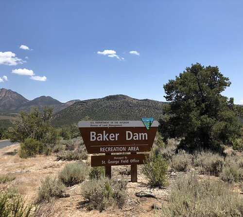 Baker Dam Recreation AreaSt. George Field Office · 31 mi
 Baker Dam CampgroundSt. George Field Office · 31 miDean Gardner CampgroundDixie National Forest · 34 miEffie Beckstrom West Group CampgroundDixie National Forest · 34 miEffie Beckstrom East Group CampgroundDixie National Forest · 34 mi
Virgin River Canyon Recreation Area is located along Interstate 15 approximately 20 miles southwest of St. George, Utah and approximately 20 miles northeast of Mesquite, Nevada. The recreation area is at the Cedar Pocket Exit (Mile Post 18).
The weather
the next four days · the thirty-year normal
Next four days, and the thirty-year normal
Forecast
NWS forecast for Littlefield, AZ
Typical weather
Typical October night 53°F, day 86°F.
Coldest month of the year: typical December night 32°F, below freezing. Bring a bag rated colder than that, and expect ice in the water bottle.
Daily high and lowDays with 0.10 in or more
A normal is the 1991-2020 average for the month, not a forecast: about half of all Julys are colder than the July line. The seven-day forecast above answers the other question.
The land, and who answers for it
who answers for it
Who answers for this land

Virgin River Canyon Recreation Area is in Arizona’s 9th congressional district. Its representative, Paul Gosar (R), votes on the laws that decide what happens to this land. Public-lands grade so far: F. See every public-lands vote →