Watercress
- Right now
- Closed for the seasonOut of the season the agency publishes
- A night
- $10–$20Across the site types the agency prices
- Sites
- 17All of them booked ahead
- Season
- May 1 – October 1Open May 1 through October 1
The place
the agency’s own description · what’s there · 9 notices
In the agency’s own words
Overview ***Watercress sustained substantial damage to the pavilions during the 2017 flood, they are not reservable at this time, however the boat ramp is still open for public use.*** Watercress Campground lies on the banks one of the forest’s greatest treasures; the Current River. Floats on the river provide views of southeastern Missouri that otherwise can't be seen. The area is home to a variety of birds and wildlife and recreation opportunities are plentiful in the surrounding area. Keep reading
Recreation
Boating and canoeing on the Current River, as well as on other nearby rivers, are popular activities. A boat ramp for both motorized and non-motorized boats is available on the east bank of the Current River. Anglers enjoy fishing for bass, walleye, sunfish and the occasional catfish. Big Spring, Missouri's largest spring, is just five miles from the campground. Hikers at Watercress area enjoy the Songbird Trail, a 1.2-mile loop that leads to Watercress Spring, passing remnants of Civil War-era earthwork that overlook the Current River.
Facilities
The campground offers 17 campsites for tent or RV camping and the sites are available on a first-come, first-served basis. Each site is equipped with a table and campfire ring. Vault toilets and drinking water are provided. Two group picnic shelters which can accommodate up to 75 people each are located alongside the river. Each is equipped with tables and grills. A seasonal trash collection dumpster is also available between April 1 and October 1 at the campground entrance.
Natural Features
Located within the town of Van Buren, the campground and day use area are adjacent to the Current River, which flows past scenic bluffs, springs, caves as it meanders through the Mark Twain National Forest toward Doniphan, MO.
Nearby Attractions
The campground is adjacent to the Ozark National Scenic Riverways, which is a series of protected rivers in the area managed by the National Park Service. More information about the National Park Service sites can be found here .
What the agency tells you
Overnight camping in campsites in the campground only. Campground open May 1-October 1.
Day Use Area open year-round
Boat Ramp open year-round
Everything else this campground posts · 6
Drinking water and flush toilets are not available during winter months; flush toilets are available May 1- October 1.
Accessible vault toilets are available year-round in Day Use Area
Picnic Shelters are available year-round for reservations
Click here for more information on the Mark Twain National Forest
Don't move firewood: To limit the spread of invasive tree-killing pests, firewood from outside the area is not permitted. Some states have quarantines and may confiscate your firewood. Please help protect our forests from invasive species by obtaining your firewood at or near your camping destination and burning it on-site. Visit dontmovefirewood.org for more information.
CURRENTLY ONLY THE BOAT RAMP AT WATERCRESS IS OPEN FOR PUBLIC USE DUE TO DAMAGE FROM 2017 FLOOD
Tents and rigs
- Sites
- 17
- Hookups
- None
- Longest rig
- 40 ft
- Accessible sites
- None listed
- Pets
- Allowed
- Campfires
- Allowed, barring fire bans
- Shade
- Every site
Facilities
- Toilets
- Vault Toilets
- “…equipped with a table and campfire ring. Vault toilets and drinking water are provided. Two group picnic…”
- Drinking water
- Yes
- “…and campfire ring. Vault toilets and drinking water are provided. Two group picnic shelters which can…”
- Boat ramp
- Yes
Around the campground
- On the water
- River
- Boating
- Fishing
- Hiking
- Picnicking
- Swimming
- Water sports
- Night sky · 47th darkest of 118 in MO
- Bortle 4
No reading yet, book on recreation.gov
Every site here is reservable, and the record lists none held back for anyone who drives up.
No availability snapshot inside the last 36 hours, so this page draws nothing rather than ageing a reading into fiction.
Watch for a cancellation
Full? Watch it.
One email when a night opens, plus More Than Just Parks dispatches. Unsubscribe any time.
We read recreation.gov once an hour, at 40 minutes past, and write the first time a site in your window is free for the nights you asked for.
Scanners that check every few minutes exist, and most of them charge. This one is free, it reads the same calendar, and it won’t always be first.
Tell me when the season opens
Watch for the season to open
One email when the season goes on sale, plus More Than Just Parks dispatches. Unsubscribe any time.
We check once an hour, at 40 minutes past, and write the first time the agency has that season on sale.
Scanners that check every few minutes exist, and most of them charge. This one is free, it reads the same calendar, and it won’t always be first.
We make nothing when you book. The link goes straight to the government.
Every line of the receipt · 14
What you actually pay
Derived by CAMPANAC: the agency’s published rates for this season, $10–$20 a night, plus one $8 recreation.gov reservation fee for the booking. A weekend here means Friday and Saturday night, booked once. Optional charges (an extra vehicle, a second tent, a dump-station fee) are listed separately and aren’t in this total.
Who keeps the booking fee
The agency’s own policy text says the reservation fee and the cancellation processing fee are “retained by the reservation service contractor”, and that a campground concessionaire will decline to refund them because “they did not receive these fees”. Recreation.gov is run under contract by Booz Allen Hamilton. What share of your booking fee the contractor keeps isn’t published in any federal dataset we can read, so we print no number for it. Our reporting on the contract →
How we know this receipt · 5
rules read Sep 9, 2026 · rates Oct 1, 2026 · How we know all this
The sites
19 records · which ones have room · the site map
The sites, ranked
from 17 mapped sitesAll 19 records
The price is derived by CAMPANAC, not published per site: the per-night rate this campground publishes for each site’s own site type. 17 of the 19 sites listed carry one, and a site whose type has no published rate sits out of the price rather than being called free.
| WATERCRESS | 01 | standard nonelectric | 40 ft | 90 ft | 102 ft | $10–$20 | |
| WATERCRESS | 02 | standard nonelectric | 40 ft | 104 ft | 194 ft | $10–$20 | |
| WATERCRESS | 03 | standard nonelectric | 40 ft | 90 ft | 96 ft | $10–$20 | |
| WATERCRESS | 04 | standard nonelectric | 40 ft | 86 ft | 221 ft | $10–$20 | |
| WATERCRESS | 05 | standard nonelectric | 40 ft | 103 ft | 119 ft | $10–$20 | |
| WATERCRESS | 06 | standard nonelectric | 40 ft | 86 ft | 240 ft | $10–$20 | |
| WATERCRESS | 07 | standard nonelectric | 40 ft | 106 ft | 161 ft | $10–$20 | |
| WATERCRESS | 08 | standard nonelectric | 40 ft | 101 ft | 178 ft | $10–$20 | |
| WATERCRESS | 09 | standard nonelectric | 40 ft | 101 ft | 188 ft | $10–$20 | |
| WATERCRESS | 10 | standard nonelectric | 40 ft | 99 ft | 133 ft | $10–$20 | |
| WATERCRESS | 11 | standard nonelectric | 40 ft | 78 ft | 124 ft | $10–$20 | |
| WATERCRESS | 12 | standard nonelectric | 40 ft | 78 ft | 184 ft | $10–$20 | |
| WATERCRESS | 13 | standard nonelectric | 40 ft | 107 ft | 77 ft | $10–$20 | |
| WATERCRESS | 14 | standard nonelectric | 40 ft | 87 ft | 130 ft | $10–$20 | |
| WATERCRESS | 15 | standard nonelectric | 40 ft | 87 ft | 153 ftCurrent River | $10–$20 | |
| WATERCRESS | 16 | standard nonelectric | 40 ft | 146 ft | 161 ftCurrent River | $10–$20 | |
| WATERCRESS | 17 | standard nonelectric | 40 ft | 196 ft | 178 ftCurrent River | $10–$20 | |
| WATERCRESS | Old Hickory Pavilion | day use | 36 ft | 20 amp | 95 ftCurrent River | $25 | |
| WATERCRESS | Sycamore Pavilion | day use | 36 ft | 20 amp | 139 ftCurrent River | $25 |
The agency files 2 more records here that aren’t sites for the night. It files them as day use. They’re in the table above, marked for what they are, and none of them is counted as a site.
OpenStreetMap has no toilet mapped within 1 km of this campground, so no site here carries a toilet distance. That’s a gap in the map, not a finding about the campground.
Getting there
the map and the coordinate · the agency’s directions
Where it is
 Big SpringOzark National Scenic Riverways · 3.4 mi
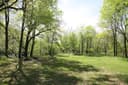 Big Tree CampgroundOzark National Scenic Riverways · 8.3 mi
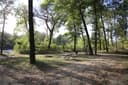 Clubhouse CampgroundOzark National Scenic Riverways · 8.7 mi
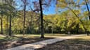 Log Yard CampgroundOzark National Scenic Riverways · 9.8 mi
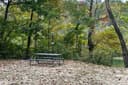 Cedar Spring CampgroundOzark National Scenic Riverways · 12 miGrubb Hollow CampgroundOzark National Scenic Riverways · 12 mi
From Highway 60, drive north on Main Street to the National Park Service sign on Watercress Road. Turn north and drive just past the Park Service building complex, then make a left to Watercress Recreation Area. The picnic shelters are on the left toward the north end of the day use area.
The weather
the next four days · the thirty-year normal
Next four days, and the thirty-year normal
Forecast
NWS forecast for Van Buren, MO
Typical weather
Typical October night 45°F, day 70°F.
Coldest night of the open season: typical October night 45°F. Bring the bag rated for it.
Daily high and lowDays with 0.10 in or moreOutside the published season
A normal is the 1991-2020 average for the month, not a forecast: about half of all Julys are colder than the July line. The seven-day forecast above answers the other question.
The land, and who answers for it
what threatens it · who answers for it
What threatens this place
You’re camping on ground somebody wants. We track the threats and the comment deadlines.
Who answers for this land

Watercress is in Missouri’s 8th congressional district. Its representative, Jason Smith (R), votes on the laws that decide what happens to this land. Public-lands grade so far: F. See every public-lands vote →