White Ledge Campground
- Right now
- Nobody has saidNo season, no closure, no bookings to read
- A night
- $30From, per site
- Sites
- 2717 on recreation.gov
The place
the agency’s own description · what’s there · 9 notices
In the agency’s own words
White Ledge Campground is conveniently located off State Route 16, 5 miles south of the town of Conway, New Hampshire. It is a relatively small facility and provides easy access to town amenities and activities as well as superb scenic driving, hiking, fishing and rock climbing. The White Mountains boast pristine forests, clear mountain streams and rivers and the tallest peaks in the Northeast. The forest encompasses nearly 800,000 acres in New Hampshire and western Maine, and is one of the most popular in the country. Keep reading
Recreation
Campers can access numerous hiking trails, rock climbing routes, scenic overlooks and wildlife viewing locations within a short drive. Local rivers and streams offer stocked or wild trout for anglers. Nearby Jigger Johnson Campground offers educational programs on Saturday nights. The White Mountains region hosts four alpine and five nordic ski areas, which provide year-round recreation opportunities such as skiing, hiking, mountain biking, outdoor concerts, interpretive trails, special events and regional and national skiing and snowboarding races. The area also contains 1,200 miles of hiking trails, including 160 miles of the famous Appalachian Trail. Learn more about recreation in the national forest.
Facilities
Campsites are organized into two loops. The facility is well shaded, and a grassy play area is available. Accessible restrooms and a hand pump for drinking water are provided. There are no showers or dump station on-site. Noise from the road may be noticeable.
Natural Features
The campground is tucked away in a mixed white pine and hardwood forest in the southern part of White Mountain National Forest. The forest is home to many species of northern wildlife, including moose, white-tailed deer and black bear. Almost 200 species of birds, including the rare Bicknell's Thrush, live in the forest. Contact Info For facility specific information, please call (802) 289-0970.
Nearby Attractions
The nearby towns of Conway and North Conway offer tours, shopping, restaurants and many other amenities. The Kancamagus Highway is a popular scenic byway perfect for a morning or afternoon drive on a clear day. Within an hour drive, campers can access the Presidential Range, which consists of the tallest mountains in the forest, including the 6,288-ft. Mount Washington, the highest peak north of the Smoky Mountains and east of the Mississippi River.
What the agency tells you
No switching sites upon arrival
Two pets per site
Be bear aware; keep all food out of site in approved containers or locked inside a hard-sided vehicle and remove all food from area after eating
Everything else this campground posts · 6
Please Note: Site fee includes one RV with tow vehicle, tent sites include two vehicles. If space allows a third vehicle would be an additional fee paid at time of check in if you did not pay for the Extra Vehicle Add On. Vehicles must fit on the parking spur at your site.
Reserved Sites will be held until check out time (NOON) the day following your arrival date. Sites must be occupied by the checkout time of that following day to hold a reservation or the site will be forfeited and released to other guests. Once your reservation start date has begun, neither the Recreation.gov Contact Center nor the campground manager will be able to modify your reservation.
Refunds: Refund requests made through www.recreation.gov will be charged a $10 processing fee. This fee is retained by the reservation service contractor along with the non-refundable reservation fee. All requests for the return of the non-refundable reservation fee and the cancellation fee will be declined by the campground concessionaire as they did not receive these fees (these are the fees retained by the reservation contractor, a different entity).
Visitors should be prepared for rugged trails and changing weather: Hike SafeHike Safe
Don't move firewood: To limit the spread of invasive tree-killing pests, firewood from outside the area is not permitted. Some states have quarantines and may confiscate your firewood. Please help protect our forests from invasive species by obtaining your firewood at or near your camping destination and burning it on-site. Visit dontmovefirewood.org for more information.
Click here for more information on White Mountain National Forest website
Tents and rigs
- Sites
- 27 · 6 tent-only
- Hookups
- None
- Longest rig
- 35 ft
- Accessible sites
- 11
- Pets
- Allowed
- Shade
- Every site
Facilities
- Showers
- None at this campground
- “There are no showers or dump station on-site.”
- Drinking water
- Yes
- “…is available. Accessible restrooms and a hand pump for drinking water are provided. There are no…”
- Dump station
- Yes
- Stay limit
- 14 nights
- recreation.gov facility rule maxStay
Around the campground
- On the water
- River, Creek
- Biking
- Fishing
- Hiking
- Picnicking
- Night sky · 24th darkest of 28 in NH
- Bortle 4
- Fall color · reported 13 days ago, 14 km away
- Past peak
No reading yet, book on recreation.gov
recreation.gov lists 17 of the 27 campsites the agency files here. The rest aren’t on its booking system, so a reservation won’t get you one.
No availability snapshot inside the last 36 hours, so this page draws nothing rather than ageing a reading into fiction.
Watch for a cancellation
Full? Watch it.
One email when a night opens, plus More Than Just Parks dispatches. Unsubscribe any time.
We read recreation.gov once an hour, at 40 minutes past, and write the first time a site in your window is free for the nights you asked for.
Scanners that check every few minutes exist, and most of them charge. This one is free, it reads the same calendar, and it won’t always be first.
Tell me when the season opens
Watch for the season to open
One email when the season goes on sale, plus More Than Just Parks dispatches. Unsubscribe any time.
We check once an hour, at 40 minutes past, and write the first time the agency has that season on sale.
Scanners that check every few minutes exist, and most of them charge. This one is free, it reads the same calendar, and it won’t always be first.
We make nothing when you book. The link goes straight to the government.
Every line of the receipt · 13
What you actually pay
Derived by CAMPANAC: the agency’s published rate for this season, $30 a night, plus one $8 recreation.gov reservation fee for the booking. A weekend here means Friday and Saturday night, booked once. Optional charges (an extra vehicle, a second tent, a dump-station fee) are listed separately and aren’t in this total.
Who keeps the booking fee
The agency’s own policy text says the reservation fee and the cancellation processing fee are “retained by the reservation service contractor”, and that a campground concessionaire will decline to refund them because “they did not receive these fees”. Recreation.gov is run under contract by Booz Allen Hamilton. What share of your booking fee the contractor keeps isn’t published in any federal dataset we can read, so we print no number for it. Our reporting on the contract →
How we know this receipt · 5
rules read Sep 9, 2026 · rates Sep 10, 2026 · How we know all this
The sites
29 records · which ones have room · the site map
The sites, ranked
from 13 mapped sitesAll 29 records
Toilet distances are OpenStreetMap’s, measured for 24 of the 29 sites listed. A site with no reading is unknown, never far.
The price is derived by CAMPANAC, not published per site: the per-night rate this campground publishes for each site’s own site type. 27 of the 29 sites listed carry one, and a site whose type has no published rate sits out of the price rather than being called free.
Measured shade is NLCD Tree Canopy Cover 2024 (USDA Forest Service / MRLC) read at the site’s own coordinate, 27% canopy or more, and only for the sites the agency gave no Shade value. It never changes the agency’s own shaded count beside it.
| MANAGEMENT SITES | 001 | type not stated | 721 ftChocorua River | 621 ft | $30 | |||
| MANAGEMENT SITES | 002 | type not stated | 698 ftChocorua River | 600 ft | $30 | |||
| MANAGEMENT SITES | 014 | type not stated | 682 ftChocorua River | 689 ft | $30 | |||
| MANAGEMENT SITES | 015 | type not stated | 639 ftChocorua River | 726 ft | $30 | |||
| MANAGEMENT SITES | 016 | type not stated | 592 ftChocorua River | 687 ft | $30 | |||
| MANAGEMENT SITES | 017 | type not stated | 640 ftChocorua River | 778 ft | $30 | |||
| MANAGEMENT SITES | 018 | type not stated | 581 ftChocorua River | 759 ft | $30 | |||
| MANAGEMENT SITES | 019 | type not stated | 605 ftChocorua River | 817 ft | $30 | |||
| MANAGEMENT SITES | 020 | type not stated | 684 ftChocorua River | 879 ft | $30 | |||
| MANAGEMENT SITES | 021 | type not stated | 721 ftChocorua River | 908 ft | $30 | |||
| MANAGEMENT SITES | 022 | type not stated | 770 ftChocorua River | 893 ft | $30 | |||
| MANAGEMENT SITES | XXX | unnamed record | 35 ft | yes | $30 | |||
| WHIT | 003 | standard nonelectric | 35 ft | yes | 19 ft | 688 ftChocorua River | 587 ft | $30 |
| WHIT | 004 | standard nonelectric | 25 ft | yes | 14 ft | 676 ftChocorua River | 570 ft | $30 |
| WHIT | 005 | standard nonelectric | 25 ft | yes | 14 ft | 663 ftChocorua River | 562 ft | $30 |
| WHIT | 006 | tent only nonelectric | 30 ft | 633 ftChocorua River | 559 ft | $30 | ||
| WHIT | 007 | tent only nonelectric | 32 ft | 604 ftChocorua River | 545 ft | $30 | ||
| WHIT | 008 | tent only nonelectric | 19 ft | 563 ftChocorua River | 586 ft | $30 | ||
| WHIT | 009 | tent only nonelectric | yes | 19 ft | 559 ftChocorua River | 605 ft | $30 | |
| WHIT | 010 | standard nonelectric | 30 ft | yes | 53 ft | 588 ftChocorua River | 649 ft | $30 |
| WHIT | 011 HOST | host pad | 25 ft | yes | $30 | |||
| WHIT | 012 | tent only nonelectric | 31 ft | 633 ftChocorua River | 673 ft | $30 | ||
| WHIT | 013 | tent only nonelectric | 31 ft | 662 ftChocorua River | 671 ft | $30 | ||
| WHIT | 023 | standard nonelectric | 25 ft | yes | 30 ft | 779 ftChocorua River | 803 ft | $30 |
| WHIT | 024 | standard nonelectric | 20 ft | yes | 48 ft | 821 ftChocorua River | 829 ft | $30 |
| WHIT | 025 | standard nonelectric | 30 ft | yes | 30 ft | 791 ftChocorua River | 776 ft | $30 |
| WHIT | 026 | standard nonelectric | 25 ft | yes | $30 | |||
| WHIT | 027 | standard nonelectric | 35 ft | yes | $30 | |||
| WHIT | 028 | standard nonelectric | 25 ft | yes | $30 |
The agency files 2 more records here that aren’t sites for the night: 1 it names a host pad and 1 it types MANAGEMENT rather than a campsite. They’re in the table above, marked for what they are, and none of them is counted as a site.
25 of 29 listed
Getting there
the map and the coordinate · the agency’s directions · the phone number
Where it is
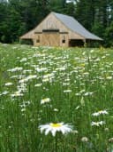 Russell-Colbath BarnWhite Mountain National Forest · 6.8 mi
 Radeke CabinWhite Mountain National Forest · 8.2 miPassaconaway CampgroundWhite Mountain National Forest · 8.4 mi
From Conway, New Hampshire, follow State Route 16 south for 5 miles. The campground is on the right.
The weather
the next four days · the thirty-year normal
Next four days, and the thirty-year normal
Forecast
NWS forecast for Conway, NH
Typical weather
Typical October night 34°F, day 57°F.
Coldest month of the year: typical January night 8°F, below freezing. Bring a bag rated colder than that, and expect ice in the water bottle.
Daily high and lowDays with 0.10 in or more
A normal is the 1991-2020 average for the month, not a forecast: about half of all Julys are colder than the July line. The seven-day forecast above answers the other question.
The land, and who answers for it
what threatens it · who answers for it
What threatens this place
You’re camping on ground somebody wants. We track the threats and the comment deadlines.
Who answers for this land

White Ledge Campground is in New Hampshire’s 2nd congressional district. Its representative, Maggie Goodlander (D), votes on the laws that decide what happens to this land. Public-lands grade so far: A+. See every public-lands vote →