Ya-Gub-Weh-tuh Campground
2Heads up2 fires, nearest 22 mi
This is how it should work.
- Right now
- Nobody has saidNo season, no closure, no bookings to read
The place
the agency’s own description · what’s there
In the agency’s own words
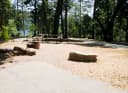
Gorgeous views of the Table Mountains surround this campsite and trailhead. Camping is available on a first come-first serve basis, reservations are not accepted for this campground of six campsites with picnic tables, fire pits, and vault toilet (a maximum of 8 people per site; double sites are also available). Campsites are accessible and reached via a primitive hardened path, located close to the paved parking area. Drinking water and garbage receptacles are available at this campground (electricity is not). Fee Schedule Day Use (per vehicle)………..$5 Annual Pass…………………..$25 Individual Campsite………….. Keep reading
$10 Double Campsite (2 tables)….$15 Equestrian Campsite…………$25 Group Campground*…………$175 Nuckahee Learning Center*…$300 Interpretive Programs………..$10 *The Group Campground and Nuckahee Learning Center require reservations. Please contact the Bakersfield Field Office for more information. Trails of the Gorge The Dumna and Kechayi Native Americans once called the Gorge home and are still active in the area, practicing their cultural traditions which include ceremonies on site. It is from their language that we derive the names of the trails contained within the Management Area. All trails are multi-use, shared by hikers, mountain bikers and equestrian users. Motorized use on trails is prohibited. Foot Bridge Trail Distance: 1 Mile to Foot Bridge Round Trip from Ya-Gub-Weh-Tuh parking: 2 Miles The Foot Bridge is one of the most sought-after sites here at the San Joaquin River Gorge. Please remember while the slope is gradual downhill to the Bridge, it is up-hill on the way back. Be sure to plan accordingly and bring plenty of water! Pa'san Ridge Trail Distance: 6 mile loop (begins across the Foot Bridge) Round Trip from Ya-Gub-Weh-Tuh parking: 8 Miles The Pa'san (pine nut) Ridge Trail is a six-mile loop trail. This trail takes one into the chaparral clothed uplands where they will encounter mountain lilac (ceanothus), manzanita, mountain mahogany, and many other shrubs and wildflowers. Wuh-ki'o Trail Distance: 4 miles Round Trip from Ya-Gub-Weh-Tuh parking: 11 Miles The Wuh-ki'o (Dumna/Kechayi word for San Joaquin River) Trail starts from the west side of the loop on the Pa'san Ridge Trail. About four miles long, it connects with Millerton Lake State Recreation Area on the Madera County side of the reservoir. The trail follows along the river and leads the traveler through oak woodlands with their mixture of foothill pines, shrubs and numerous wildflowers. San Joaquin River Trail Distance: 2 miles (to BLM boundary) Round Trip from Ya-Gub-Weh-Tuh parking: 4 Miles A portion of the San Joaquin River Trail (SJRT). Access to the trail is across the road from the Ya-Gub-Weh-Tuh parking and guides you into the Millerton Lake State Recreation Area. When complete the San Joaquin River Trail will eventually connect Highway 99 to the Pacific Crest Trail near the Devils Postpile National Monument. Portions of the trail cover prehistoric trade routes of the Mono Indians. River Access Trail Distance: 1/2 mile Round Trip from River Access Parking: 1 mile A short switchback trail leading down to the San Joaquin River's edge through the oak woodlands and grass understory. Day use parking is available at this trail head.
Facilities
- Toilets
- Vault Toilets
- “Camping is available on a first come-first serve basis, reservations are not accepted for this campground of six campsites with picnic tables, fire pits, and vault toilet (a maximum of 8 people per site; double sites are also available).”
Around the campground
- On the water
- Reservoir, Lake, River
- Biking
- Hiking
- Hunting
- Wildlife viewing
Nothing to book, just show up
One of 1,623 federal campgrounds where the site still goes to whoever pulls in first. Get there before noon on a summer weekend.
recreation.gov publishes no availability for a campground you can’t reserve, so there’s no thirty-night reading to draw here. The season bar above is what the agency does publish.
Every line of the receipt · 5
What you actually pay
How we know this receipt · 4
rules read Sep 7, 2026 · record Aug 23, 2026 · How we know all this
Getting there
the map and the coordinate · the phone number
Where it is


The weather
the next four days · the thirty-year normal
Next four days, and the thirty-year normal
Forecast
NWS forecast for Auberry, CA
Typical weather
Typical October night 50°F, day 80°F.
Coldest month of the year: typical December night 37°F. Bring the bag rated for it.
Daily high and lowDays with 0.10 in or more
A normal is the 1991-2020 average for the month, not a forecast: about half of all Julys are colder than the July line. The seven-day forecast above answers the other question.
The land, and who answers for it
who answers for it
Who answers for this land

Ya-Gub-Weh-tuh Campground is in California’s 20th congressional district. Its representative, Vince Fong (R), votes on the laws that decide what happens to this land. Public-lands grade so far: F. See every public-lands vote →