Bureau of Land Management · Public Domain · Montana
Butte Field Office
Here, 12% take walk-ups.
17Campgrounds
2Take walk-ups
$20–$25A night, across 5
216Sites, from 5
3,480–5,860 ftElevation
Where they are
17 of 17 mappedDrawing the map
© OpenFreeMap · OpenStreetMap · Esri hillshadeSource: RIDB · NPS · USFS EDW · BLM, unified by CAMPANAC · Oct 23, 2026
The campgrounds
17 campgrounds
 Log Gulch CampgroundReservablefrom $254 pull-through sites1 group site71 sitesrigs to 36 ft3,590 ftdrinking watertoilets
 Holter Lake CampgroundReservablefrom $2552 sitesrigs to 68 ft3,620 ftdrinking water
 Devil's Elbow CampgroundReservablefrom $2547 with a tent pad1 group site49 sitesrigs to 60 ft3,720 fthookupsdrinking watertoilets
 White Sandy CampgroundReservablefrom $251 group site27 sitesrigs to 50 ft3,690 fthookupsdrinking watertoilets
 Holter Dam CampgroundReservablefrom $2017 sitesrigs to 65 ft3,480 ftdrinking watertoiletsBeartooth Landing3,580 ftBryant Creek5,750 ftCarbella4,990 ftCrow Creek4,730 ftDeparture Point3,590 ftDickie Bridge5,730 ftDivide Bridge CampgroundFirst-come5,410 ftdrinking waterEast Bank5,740 ftGalena Gulch Rec Site5,080 ftSheep Camp5,050 ftSpokane Bay3,660 ftToll Mountain CampgroundFirst-come5,860 ft
Source: RIDB · NPS · USFS EDW · BLM, unified by CAMPANAC · Oct 23, 2026
This land
measured from the nearest campground in the unitRoadless
Roadless
Roadless
Roadless
Roadless
Roadless
Camping here is a stake in what happens to it. More Than Just Parks tracks the threats and the comment windows.
Roadless areas: USFS Inventoried Roadless Areas via MTJP Roadless Map · Jul 29, 2026
Source: MTJP Threatened Lands map · Oct 16, 2026
Heads up
Wildfire
Sand Creek fire · 24 mi from the nearest campground here · 35,520 acres · 83% contained
Wildfire
Mineral Hill fire · 42 mi from the nearest campground here · 0 acres
Source: NIFC/IRWIN via MTJP wildfire tracker · Oct 22, 2026
Who answers for this land
Butte Field Office’s campgrounds sit in 2 congressional districts. These members vote on the laws that decide what happens to this land.

Troy Downing (R)
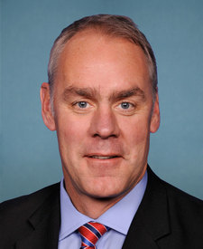
Ryan Zinke (R)
Source: campground records from RIDB, NPS, USFS EDW and BLM, unified by CAMPANAC, refreshed nightly