National Park Service · North Carolina
Cape Hatteras National Seashore
Here, none of the campgrounds take walk-ups.
4Campgrounds
$20–$28A night, across 4
715Sites
0–10 ftElevation
Where they are
4 of 4 mappedDrawing the map
© OpenFreeMap · OpenStreetMap · Esri hillshadeSource: RIDB · NPS · USFS EDW · BLM, unified by CAMPANAC · Oct 23, 2026
The campgrounds
4 campgrounds
 Cape Point CampgroundReservablefrom $20202 sitesrigs to 50 ft10 ftdrinking watertoilets
 Frisco CampgroundReservableClosedfrom $28128 sitesrigs to 49 ft10 ftdrinking watertoilets
 Ocracoke CampgroundReservablefrom $28140 sitesrigs to 48 ft0 ftdrinking watertoilets
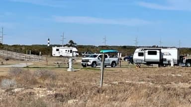 Oregon Inlet CampgroundReservablefrom $281 group site245 sitesrigs to 47 ft10 fthookupsdrinking watertoilets
Source: RIDB · NPS · USFS EDW · BLM, unified by CAMPANAC · Oct 23, 2026
This land
measured from the nearest campground in the unitCamping here is a stake in what happens to it. More Than Just Parks tracks the threats and the comment windows.
Source: MTJP Threatened Lands map · Oct 9, 2026
Heads up
Park Closure
Cape Point & Frisco campgrounds and several ORV ramps remain closed The Cape Point and Frisco campgrounds and several off-road vehicle routes are currently closed. Reopening will begin after conditions improve and post-storm assessments are complete.
Park Closure
Closure of Billy Mitchell Airport for Repaving Project The Billy Mitchell Airport (HSE) is closed to accommodate a runway pavement rehabilitation project. The project will provide full resurfacing of paved areas, new reflective paint, and new tie-downs and anchors, improving visitor safety and…
Park Closure
Project Safety Closure in Place Near Southernmost Groin in Buxton Public access is closed for 300 feet north and south of a groin repair project site in Buxton, as well as the adjacent ocean area to the east. Surfers, swimmers, and all other recreationists should stay at least 300 feet from the…
Source: National Park Service alerts API · Oct 24, 2026
Who answers for this land
Cape Hatteras National Seashore’s campgrounds sit in one congressional district. These members vote on the laws that decide what happens to this land.
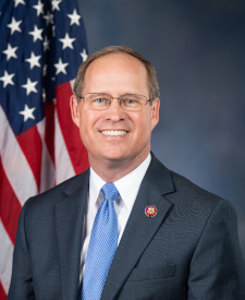
Greg Murphy (R)
Source: campground records from RIDB, NPS, USFS EDW and BLM, unified by CAMPANAC, refreshed nightly